Home
States
Colorado
Connecticut
Maine
Massachusetts
New Hampshire
New York
Rhode Island
Utah
Vermont
View All
Lists
NE 4,000 Footers
NE 100 Highest
NH 4,000 Footers
NH 100 Highest
NH 52 With A View
NH Belknap Range
NH Ossipee 10
Links
Trail Conditions
Trip Log
Sunrises
Sunsets
About
|
Locke's Hill
Gilford, NH
Trailheads, measurements, times, distances, and maps are all approximate and relative to the hike(s) as shown below.

Looking up the Lakeview Trail
Route: Lakeview Trail
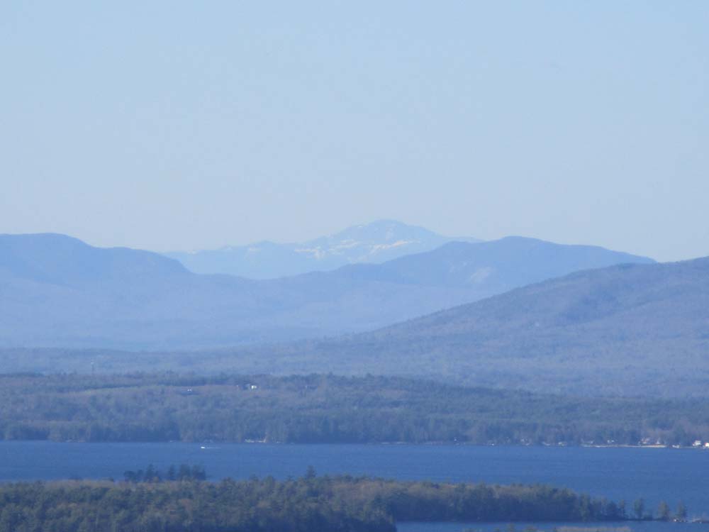
Trail was mostly dry. Still some snow visible on Mt. Washington from the near-summit vista.
| Hike Ratings |
|
Getting To Trailhead: |
Easy |
| Destination: |
Locke's Hill |
|
Length: |
Easy |
|
Steepness: |
Easy |
|
Navigation: |
Easy |
|
Views: |
Excellent |
|
Crowds: |
Moderate |
|
| Hike Stats |
|
Date Hiked: |
Tuesday, May 8, 2018 |
| Parking Elevation: |
630' |
| Destination: |
Locke's Hill |
| Trailhead Elevation: |
630' |
| Summit Elevation: |
1,057' |
| Vertical Gain: |
442' |
|
|
| Hike Vertical Gain: |
457' |
|

The Lakeview Trail trailhead near the Locke's Hill parking area
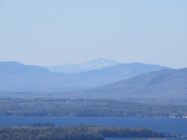
Looking at Mt. Washington from the upper Lakeview Trail vista
Directions to trailhead: From Route 11B, take Route 11 East for just under 2 miles. The Locke's Hill parking area entrance will be on the right with a sign. The Lakeside Trail trailhead is just before the parking lot, the Quarry Trail trailhead at the back of the parking lot.
Back to Locke's Hill Profile
|