Home
States
Colorado
Connecticut
Maine
Massachusetts
New Hampshire
New York
Rhode Island
Utah
Vermont
View All
Lists
NE 4,000 Footers
NE 100 Highest
NH 4,000 Footers
NH 100 Highest
NH 52 With A View
NH Belknap Range
NH Ossipee 10
Links
Trail Conditions
Trip Log
Sunrises
Sunsets
About
|
Mary's Mountain
Freedom, NH
Trailheads, measurements, times, distances, and maps are all approximate and relative to the hike(s) as shown below.
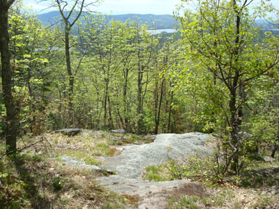
Looking down Mary's Mountain Trail
Route: Mary's Mountain Trail
While my original intent was to hike Stacy Mountain, I couldn't seem to locate a trailhead. Since I only had limited time until I had to head south for the day, I decided to check out Mary's Mountain.
Arriving at the Danforth Bay Campground, I wasn't quite sure where the trailhead was. There has apparently been a lot of work done at the campground in recent years, so the topographic and aerial imagery doesn't accurately show the roads or parking lots. I was just about ready to leave when I spotted the trailhead sign above the RV/day use parking lot. Since the bugs were out, I wasted no time in getting moving.
The trail is fairly gradual until it crosses a snowmobile trail about halfway up. Shortly after this, the woods open up and reveal a quasi meadow and some moderately steep ledges. The high point is bit past the first ledge, on a second ledge/small cliff.
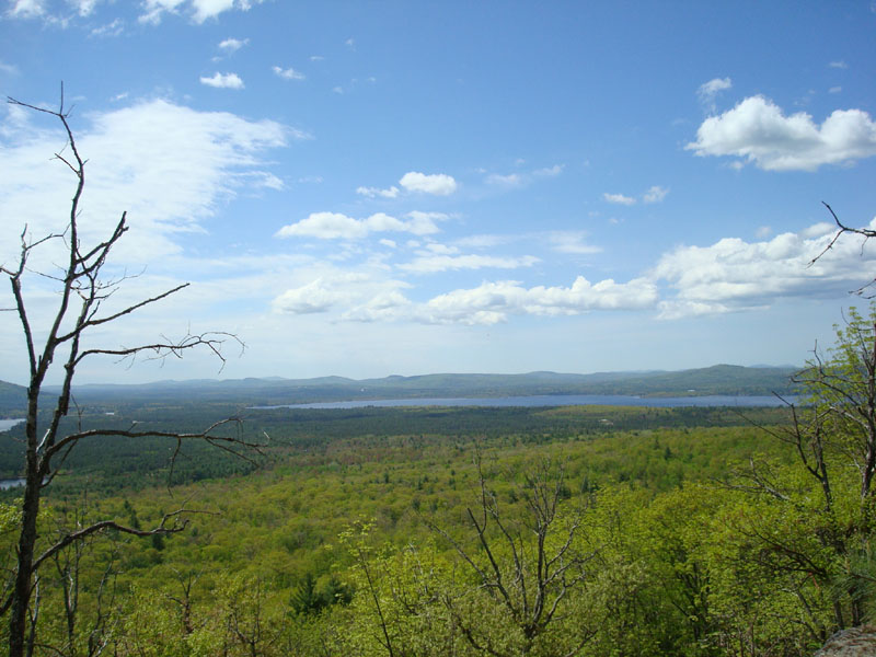
The views were good - looking east at Foss Mountain, south at Green Mountain, and southwest at Ossipee Lake. While I wanted to enjoy the sights and good weather, the black flies drove me away. Other than stopping a few times near the top to look at a flower I had never seen before (which I later identified to be a wild columbine), I headed straight down.
Not a bad little peak - good to know I have another short, easy hike nearby.
| Hike Ratings |
|
Getting To Trailhead: |
Easy |
| Destination: |
Mary's Mountain |
|
Length: |
Easy |
|
Steepness: |
Moderate |
|
Navigation: |
Easy |
|
Views: |
Excellent |
|
Crowds: |
Minimal |
|
| Hike Stats |
|
Date Hiked: |
Saturday, May 17, 2008 |
| Hike Commenced: |
10:28 AM |
| Parking Elevation: |
480' |
| Destination: |
Mary's Mountain |
| Ascent Commenced: |
10:29 AM |
| Summit Reached: |
10:43 AM |
| Time Elapsed: |
00:14 |
| Trailhead Elevation: |
495' |
| Summit Elevation: |
944' |
| Distance: |
.7 mile |
| Vertical Gain: |
469' |
|
|
| Hike Ended: |
11:04 AM |
| Hike Time Elapsed: |
00:36 |
| Hike Distance: |
1.4 miles |
| Hike Vertical Gain: |
489' |
|
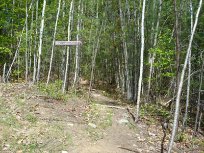
The Mary's Mountain Trail trailhead
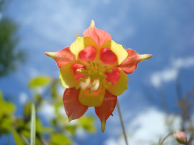
A wild columbine flower on the side of Mary's Mountain Trail

Looking at the southern portion of Ossipee Lake from the summit of Mary's Mountain
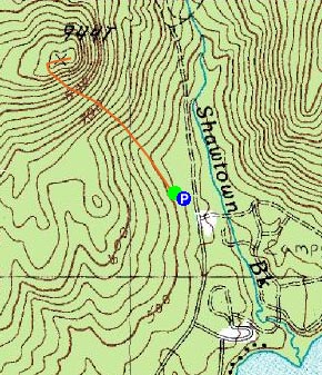

Directions to trailhead: Take Route 16 North from West Ossipee to Route 41 East. Take a right on Ossipee Lake Road. Head down this for a few minutes, then take a left onto Shawtown Road (Danforth Bay Campground sign). Go straight on this road, then take a left and park in the RV/day parking lot. The Mary's Mountain Trail trailhead is located just above the northwest corner of the parking lot.
Back to Mary's Mountain Profile
|