Home
States
Colorado
Connecticut
Maine
Massachusetts
New Hampshire
New York
Rhode Island
Utah
Vermont
View All
Lists
NE 4,000 Footers
NE 100 Highest
NH 4,000 Footers
NH 100 Highest
NH 52 With A View
NH Belknap Range
NH Ossipee 10
Links
Trail Conditions
Trip Log
Sunrises
Sunsets
About
|
Mary's Mountain
Freedom, NH
Trailheads, measurements, times, distances, and maps are all approximate and relative to the hike(s) as shown below.
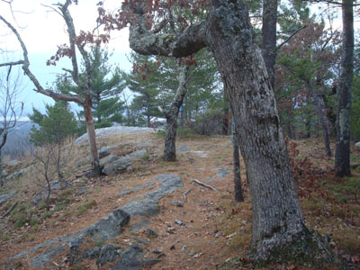
Looking down Mary's Mountain Trail
Route: Mary's Mountain Trail
Since it was an increasingly cloudy day, I decided to stay local for a quick afternoon hike.
After parking in the upper lot, I quickly set foot up the Mary's Mountain Trail. I was surprised to see some patches of ice at such a low elevation, though fortunately they were few and far between. I was also surprised to see some new metallic blazes on the summit ridge - perhaps I'll check into where that trail comes from.
Despite the increasing clouds, the views from the summit were nonetheless pretty good, with both Foss Mountain and Green Mountain easily seen.
The last non-snow hike of the year? We shall see.
| Hike Ratings |
|
Getting To Trailhead: |
Easy |
| Destination: |
Mary's Mountain |
|
Length: |
Easy |
|
Steepness: |
Moderate |
|
Navigation: |
Easy |
|
Views: |
Excellent |
|
Crowds: |
Minimal |
|
| Hike Stats |
|
Date Hiked: |
Monday, November 24, 2008 |
| Hike Commenced: |
3:29 PM |
| Parking Elevation: |
480' |
| Destination: |
Mary's Mountain |
| Ascent Commenced: |
3:29 PM |
| Summit Reached: |
3:45 PM |
| Time Elapsed: |
00:16 |
| Trailhead Elevation: |
495' |
| Summit Elevation: |
944' |
| Distance: |
.7 mile |
| Vertical Gain: |
469' |
|
|
| Hike Ended: |
4:05 PM |
| Hike Time Elapsed: |
00:36 |
| Hike Distance: |
1.4 miles |
| Hike Vertical Gain: |
489' |
|
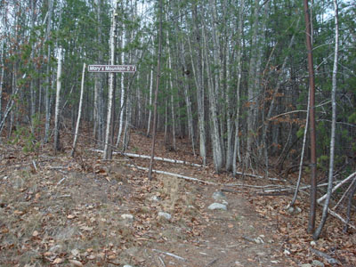
The Mary's Mountain Trail trailhead
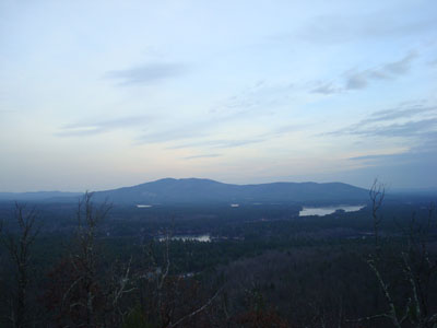
Looking at Green Mountain from the summit of Mary's Mountain
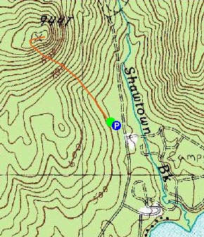

Directions to trailhead: Take Route 16 North from West Ossipee to Route 41 East. Take a right on Ossipee Lake Road. Head down this for a few minutes, then take a left onto Shawtown Road (Danforth Bay Campground sign). Go straight on this road, then take a left and park in the RV/day parking lot. The Mary's Mountain Trail trailhead is located just above the northwest corner of the parking lot.
Back to Mary's Mountain Profile
|

