Home
States
Colorado
Connecticut
Maine
Massachusetts
New Hampshire
New York
Rhode Island
Utah
Vermont
View All
Lists
NE 4,000 Footers
NE 100 Highest
NH 4,000 Footers
NH 100 Highest
NH 52 With A View
NH Belknap Range
NH Ossipee 10
Links
Trail Conditions
Trip Log
Sunrises
Sunsets
About
|
Middle Mountain
Conway, NH
Trailheads, measurements, times, distances, and maps are all approximate and relative to the hike(s) as shown below.
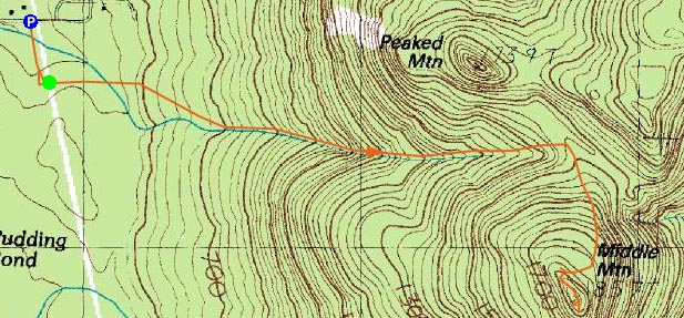
The Middle Mountain Trail
Route: Middle Mountain Trail, (Middle Mountain), Middle Mountain Trail
The forecast and the skies didn't look great, but I still decided to give a sunset hike at Middle Mountain a try.
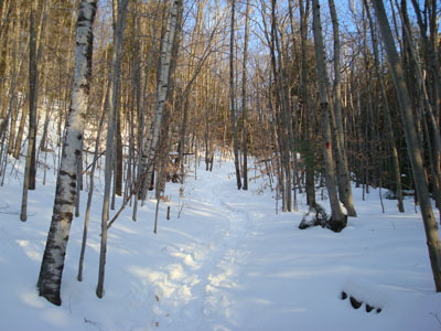
Arriving at the unplowed, but packed down parking area, I was soon on my way with my snowshoes. While they weren't necessary, I found the traction helpful.
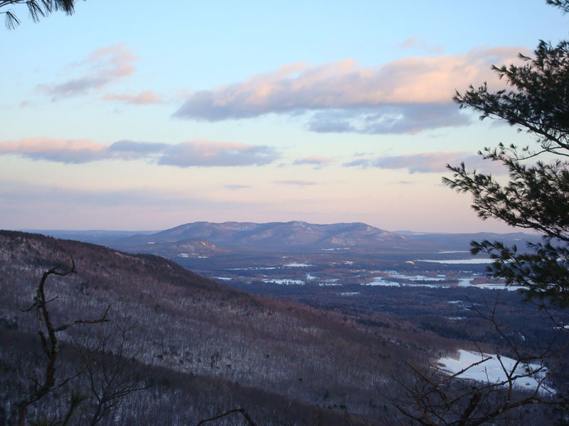
I arrived at the summit just in time to see the sunset in progress. While the temperature at the trailhead as about 20 degrees, it seemed a heck of a lot colder with the wind. The sunset was very nice considering the cloudy forecast.
The moonlight helped me to get back to the parking area without needing my headlamp. The temperature at this point was 15 degrees - brisk, but not too bad.
| Hike Ratings |
|
Getting To Trailhead: |
Easy |
| Destination: |
Middle Mountain |
|
Length: |
Moderate |
|
Steepness: |
Moderate |
|
Navigation: |
Easy |
|
Views: |
Excellent |
|
Crowds: |
Minimal |
|
| Hike Stats |
|
Date Hiked: |
Monday, January 21, 2008 |
| Hike Commenced: |
3:37 PM |
| Parking Elevation: |
535' |
| Destination: |
Middle Mountain |
| Ascent Commenced: |
3:41 PM |
| Summit Reached: |
4:27 PM |
| Time Elapsed: |
00:46 |
| Trailhead Elevation: |
545' |
| Summit Elevation: |
1,857' |
| Vertical Gain: |
1,342' |
|
|
| Hike Ended: |
5:38 PM |
| Hike Time Elapsed: |
02:01 |
| Hike Vertical Gain: |
1,402' |
|
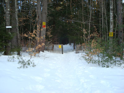
Middle Mountain Trail trailhead under the power lines

Looking southeast at Pleasant Mountain from Middle Mountain
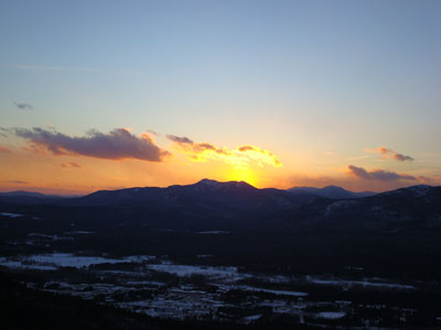
The sunset behind Middle Sister as seen from Middle Mountain
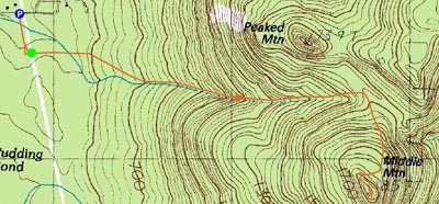

Directions to trailhead: From Routes 16/302 in North Conway, take Artist Falls Road past the railroad tracks. Take a right onto Thompson Road. A small Town of Conway/Pudding Pond Conservation Area signed parking lot will be on the right shortly thereafter.
Back to Middle Mountain Profile
|