Home
States
Colorado
Connecticut
Maine
Massachusetts
New Hampshire
New York
Rhode Island
Utah
Vermont
View All
Lists
NE 4,000 Footers
NE 100 Highest
NH 4,000 Footers
NH 100 Highest
NH 52 With A View
NH Belknap Range
NH Ossipee 10
Links
Trail Conditions
Trip Log
Sunrises
Sunsets
About
|
Millsfield Mountain
Millsfield, NH
Trailheads, measurements, times, distances, and maps are all approximate and relative to the hike(s) as shown below.
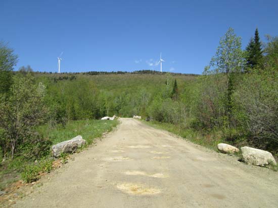
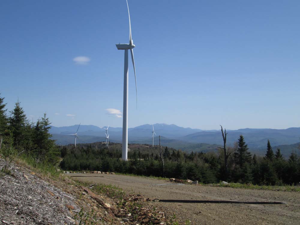
The tower access road
Sort of like walking next to an airport runway noisewise, and a bit creepy with massive shadows flying by.
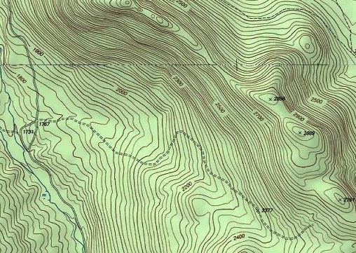
USGS shows the highpoint as 2,889, but tower 26 is now there, courtesy dynamite and concrete.
Apart from the line of massive wind turbines, far reaching views from the access road.
| Hike Ratings |
|
Getting To Trailhead: |
Easy |
| Destination: |
Millsfield Mountain |
|
Length: |
Moderate |
|
Steepness: |
Easy |
|
Navigation: |
Moderate |
|
Views: |
Excellent |
|
Crowds: |
Minimal |
|
| Hike Stats |
|
Date Hiked: |
Saturday, May 23, 2015 |
| Parking Elevation: |
1,767' |
| Destination: |
Millsfield Mountain |
| Time Elapsed: |
01:08 |
| Trailhead Elevation: |
1,767' |
| Summit Elevation: |
2,889' |
| Vertical Gain: |
1,142' |
|
|
| Hike Time Elapsed: |
01:24 |
| Hike Vertical Gain: |
1,162' |
|

Looking at the Presidentials from Millsfield Mountain

Back to Millsfield Mountain Profile
|