Home
States
Colorado
Connecticut
Maine
Massachusetts
New Hampshire
New York
Rhode Island
Utah
Vermont
View All
Lists
NE 4,000 Footers
NE 100 Highest
NH 4,000 Footers
NH 100 Highest
NH 52 With A View
NH Belknap Range
NH Ossipee 10
Links
Trail Conditions
Trip Log
Sunrises
Sunsets
About
|
Mittersill Peak, Cannon Mountain
Franconia, NH
Trailheads, measurements, times, distances, and maps are all approximate and relative to the hike(s) as shown below.
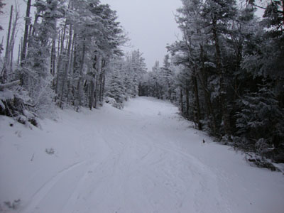
Looking up the Taft Trail on the way up Mittersill Peak
Route: Taft Cut Off, Taft Trail, (Mittersill), Taft Trail, spur trail, (Cannon Mountain), spur trail, Taft Trail, (Mittersill), Taft Trail, Taft Cut Off
Ah, the first day of winter. With limited daylight after the official start, Cannon seemed like a good choice. With the upper portion of the ski area closed, it seemed like a perfect time to snowshoe up Mittersill.
After six days in a row on the trails, as well as having cloudy skies overhead, I was dragging for much of the ascent. Topping out at Mittersill Peak, I could see the potential for a great sunset. Reaching the top of Cannon, the winds were brutal and the temperature similar. With limited visibility, I opted only to climb a few flights of stairs up the deck for a quick glance of the mediocre views.
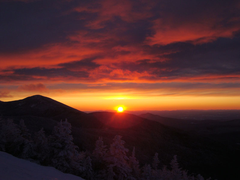
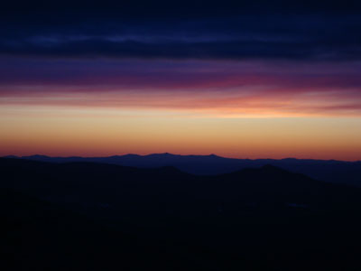
After dropping down a few hundred vertical feet (out of the clouds and winds), I found a good angle for the sunset. Sure enough, it was a a spectacular display, as the cloud layer lit up while the sun set roughly between Killington and Pico. Catching up with my group who had watched the display from Mittersill Peak, we were able to descend the trails without needing our headlamps.
| Hike Ratings |
|
Getting To Trailhead: |
Easy |
| Destination: |
Mittersill Peak |
|
Length: |
Moderate |
|
Steepness: |
Difficult |
|
Navigation: |
Moderate |
|
Views: |
Excellent |
|
Crowds: |
Minimal |
| Destination: |
Cannon Mountain |
|
Length: |
Moderate |
|
Steepness: |
Difficult |
|
Navigation: |
Easy |
|
Views: |
Moderate (due to weather) |
|
Crowds: |
Minimal |
|
| Hike Stats |
|
Date Hiked: |
Monday, December 21, 2009 |
| Hike Commenced: |
2:10 PM |
| Parking Elevation: |
1,860' |
| Destination: |
Mittersill Peak |
| Ascent Commenced: |
2:10 PM |
| Summit Reached: |
3:02 PM |
| Time Elapsed: |
00:52 |
| Trailhead Elevation: |
1,870' |
| Summit Elevation: |
3,617' |
| Vertical Gain: |
1,747' |
| Destination: |
Cannon Mountain |
| Ascent Commenced: |
3:05 PM |
| Summit Reached: |
3:27 PM |
| Time Elapsed: |
00:22 |
| Trailhead Elevation: |
3,617' |
| Summit Elevation: |
4,100' |
| Vertical Gain: |
605' |
|
|
| Hike Ended: |
5:14 PM |
| Hike Time Elapsed: |
03:04 |
| Hike Vertical Gain: |
2,449' |
|
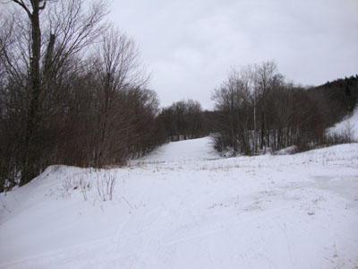
Looking up the old Mittersill ski area
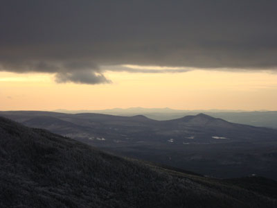
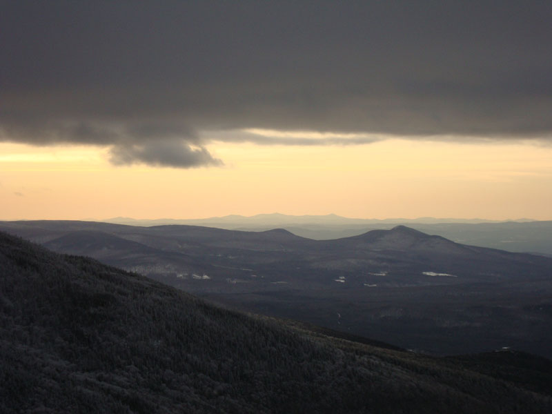
Looking Killington and Pico in the distance from Mittersill Peak
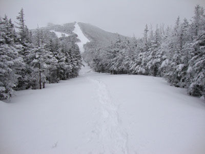
Looking up the Taft Trail on the way to Cannon Mountain
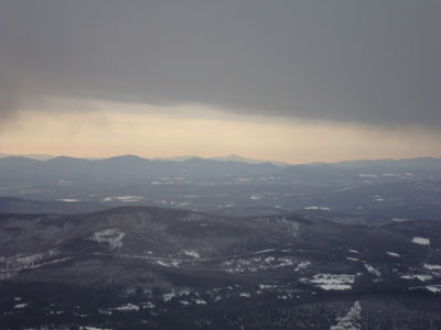
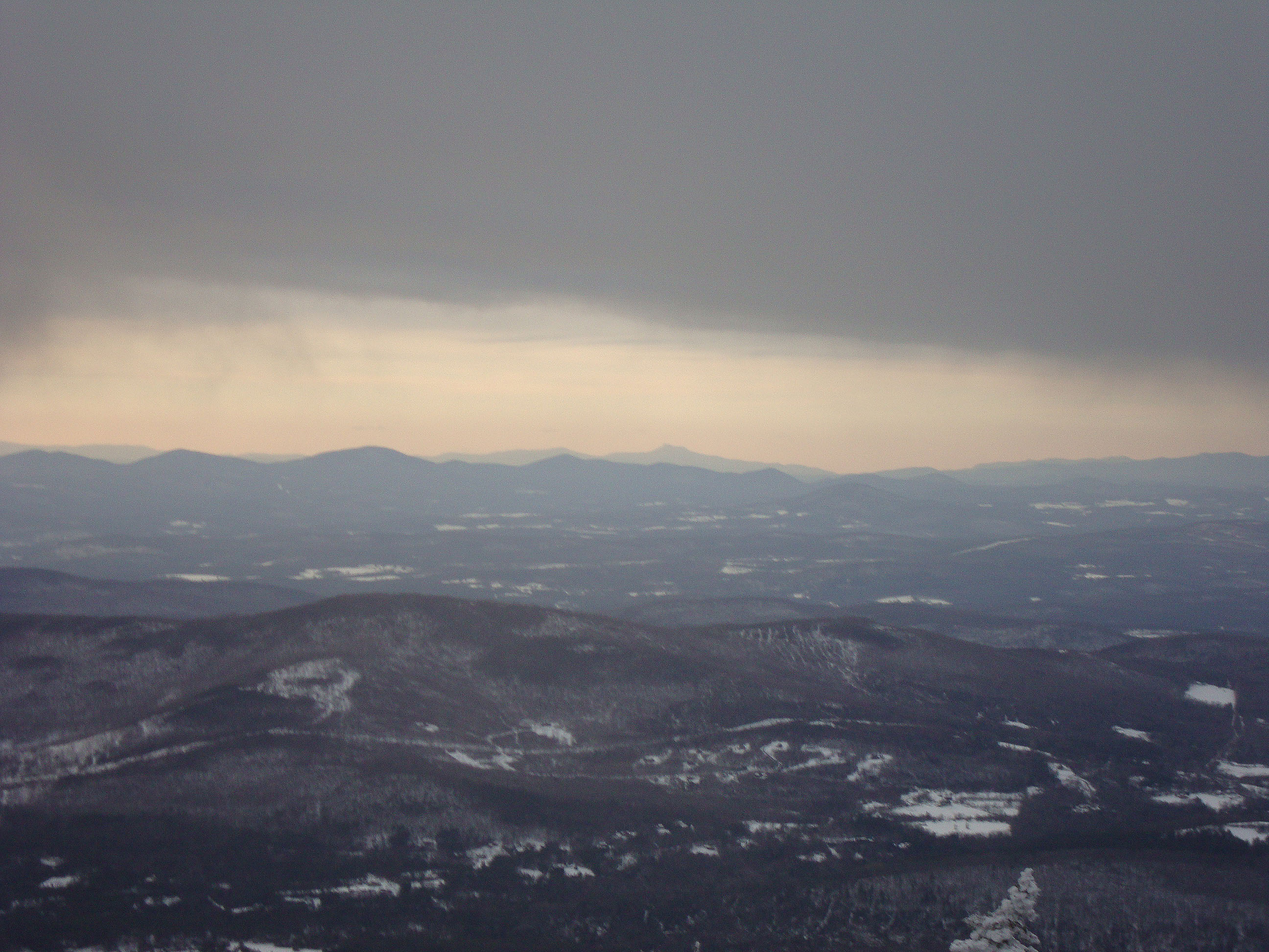
Camel's Hump as seen in the distance from the Cannon Mountain observation tower

The sunset as seen from near the summit of Cannon Mountain
Sunset colors as seen from Mittersill Peak
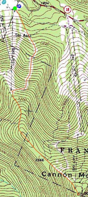

Directions to trailhead: Take I-93 North to the Cannon Mountain Peabody Slopes exit. Continue past the Cannon entrance, taking a left at the Mittersill sign. There are multiple parking areas on the left a fraction of a mile down this road. Looking uphill adjacent to the old double chairlift, the Taft Cut Off Trail is the furthest ski trail to the left (not to be confused with a dirt access road that branches out from the parking lot).
Back to Mittersill Peak Profile
Back to Cannon Mountain Profile
|