Home
States
Colorado
Connecticut
Maine
Massachusetts
New Hampshire
New York
Rhode Island
Utah
Vermont
View All
Lists
NE 4,000 Footers
NE 100 Highest
NH 4,000 Footers
NH 100 Highest
NH 52 With A View
NH Belknap Range
NH Ossipee 10
Links
Trail Conditions
Trip Log
Sunrises
Sunsets
About
|
Mittersill Peak, Cannon Mountain
Franconia, NH
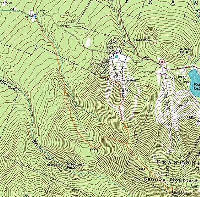
Trailheads, measurements, times, distances, and maps are all approximate and relative to the hike(s) as shown below.
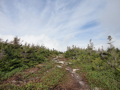
Looking down the Tucker Brook Trail on the way to Mittersill Peak
Route: Tucker Brook Trail, Taft Trail, (Mittersill), Taft Trail, spur trail, (Cannon Mountain), spur trail, Taft Trail, (Mittersill), Taft Trail, other ski trails, unnamed trail, bushwhack, Tucker Brook Trail
With a mediocre forecast, we decided to head up to Cannon. Since we wanted to mix it up a bit, we headed over to the Tucker Brook Trail.
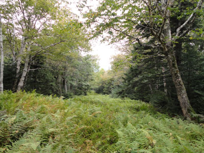
While the trail started off easily, there was a steep pitch within 20 minutes. Nonetheless, it was nice walking as we worked our way through the hardwood and mixed hardwood forest on a trail paved with ferns.
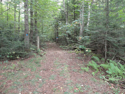
Climbing up to the steeps and switchbacks in the softwood forest, we eventually reached the Taft Trail. A bit ripped up from ongoing Mittersill construction, portions were muddy and dug down to ledge. Beyond Hardscrabble (after a brief porcupine encounter), though, was smooth (though wet with dew) sailing.
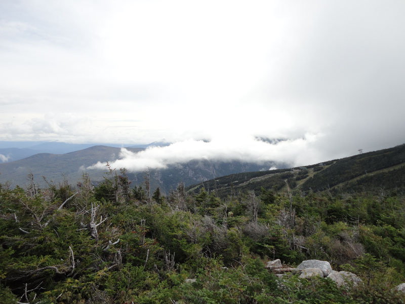
While we had views into the notch and toward Vermont from Mittersill Peak, incoming fog obscured Cannon. Thusly, we didn't linger on the cold, somewhat windy observation tower for too long.
After a quick break at the summit lodge (fresh french fries!), we headed back down. Unfortunately, nearing the Mittersill col, I realized I had left my poles outside the summit building. After a brisk climb back up to Cannon, I returned back to the col, poles in hand.
For the descent from Mittersill, we decided to check out the ski area construction. Below the Tucker Brook junction, the Taft Trail was very muddy due to recent regrading (and no haying/seeding). Reaching the top of the chairlift (under construction - footing forms in place), hay and seed made for smoother sailing until we were able to veer away from the recleared area and back into the old trails.
Upon reaching the bottom of Mittersill, we followed the uppermost road past a water tank and onto an unsigned trail. The trail angled uphill slightly, but was generally smooth sailing.
About ten minutes up this trail, we saw a tin sign for Bridesmaid Falls. Soon thereafter, we saw another one, and, within 16 minutes of the road, were standing at the bottom of the falls. While there was very little water flowing, it was a neat place nonetheless.
From there, we bushwhacked downhill briefly and soon were at the bottom of what turned out to be Plimpton Falls.
After that, we crossed the brook and worked our way through open woods back to the Tucker Brook Trail and back to the road.
| Hike Ratings |
|
Getting To Trailhead: |
Easy |
| Destination: |
Mittersill Peak |
|
Length: |
Moderate |
|
Steepness: |
Difficult |
|
Navigation: |
Moderate |
|
Views: |
Excellent |
|
Crowds: |
Minimal |
| Destination: |
Cannon Mountain |
|
Length: |
Moderate |
|
Steepness: |
Difficult |
|
Navigation: |
Easy |
|
Views: |
Minimal (due to weather) |
|
Crowds: |
Minimal |
|
| Hike Stats |
|
Date Hiked: |
Sunday, September 12, 2010 |
| Hike Commenced: |
8:12 AM |
| Parking Elevation: |
1,225' |
| Destination: |
Mittersill Peak |
| Ascent Commenced: |
8:12 AM |
| Summit Reached: |
9:57 AM |
| Time Elapsed: |
01:45 |
| Trailhead Elevation: |
1,230' |
| Summit Elevation: |
3,617' |
| Vertical Gain: |
2,387' |
| Destination: |
Cannon Mountain |
| Ascent Commenced: |
9:58 AM |
| Summit Reached: |
10:29 AM |
| Time Elapsed: |
00:31 |
| Trailhead Elevation: |
3,617' |
| Summit Elevation: |
4,100' |
| Vertical Gain: |
605' |
|
|
| Hike Ended: |
1:28 PM |
| Hike Time Elapsed: |
05:16 |
| Hike Vertical Gain: |
3,224' |
|
The bottom of the Tucker Brook Trail at the end of Tucker Brook Road
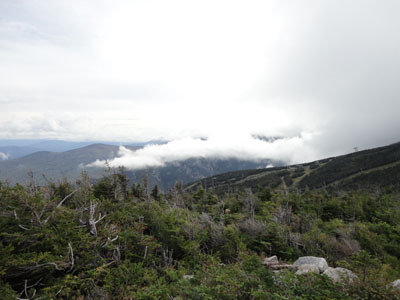
Looking at Franconia Notch from Mittersill Peak as fog rolls in
The Taft Trail on the way to Cannon Mountain
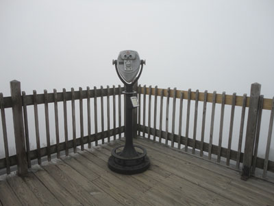
Probably not a good investment today
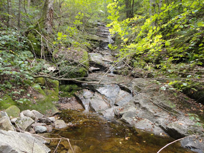
Plimpton Falls

Directions to trailhead: To get to the Tucker Brook Trail, take I-93 North to Route 18, then take Route 18 northwest past the Cannon Peabody Slopes and Mittersill entrances. A few minutes after, take a left off Route 18 onto Wells Road. A few minutes after, at a sharp right turn on Wells Road, take a left turn onto the dirt Tucker Brook Road (unsigned as of September 2010, except for a Dead End warning). There is a small parking area at the end of this road - the Tucker Brook Trail starts on the right (it does not cross the brook).
Back to Mittersill Peak Profile
Back to Cannon Mountain Profile
|