Home
States
Colorado
Connecticut
Maine
Massachusetts
New Hampshire
New York
Rhode Island
Utah
Vermont
View All
Lists
NE 4,000 Footers
NE 100 Highest
NH 4,000 Footers
NH 100 Highest
NH 52 With A View
NH Belknap Range
NH Ossipee 10
Links
Trail Conditions
Trip Log
Sunrises
Sunsets
About
|
Mittersill Peak, Cannon Mountain
Franconia, NH
Trailheads, measurements, times, distances, and maps are all approximate and relative to the hike(s) as shown below.
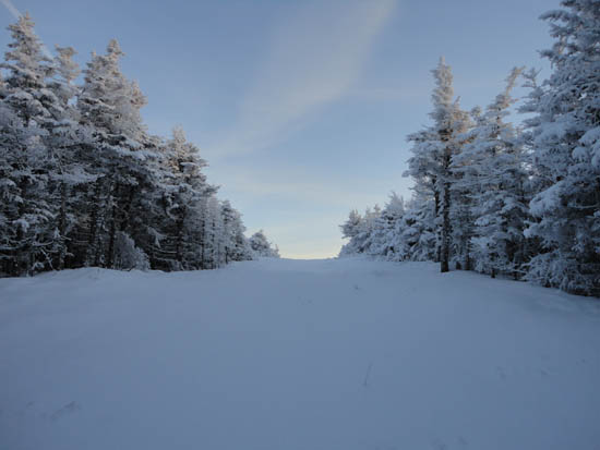
Looking up the Taft Trail near the top of Mittersill Peak
Route: Lift line, Taft Trail, (Mittersill), Taft Trail, spur trail, (Cannon Mountain), spur trail, Taft Trail, (Mittersill), Taft Trail, Lift fline
With the newly refurbished Mittersill area closed after only one day of operation, I decided to go for a quiet snowshoe up the once-backcountry ski trails.
Starting at Lot 2, I took my time going up the lift line, taking photos of the new lift (the most expensive two person chairlift in New England history) to contrast with the removed one. Reaching the summit of Mittersill, I could see a nice sunset was setting up to the west.
Continuing into the saddle and up the Taft Slalom Trail (closed), I soon reached the top of the ski area and spur trail to the summit.
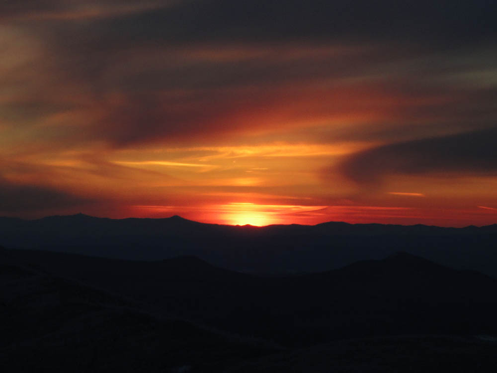
After taking off my snowshoes, I climbed up the steps to the observation deck and was just in time to see a nice sunset to the west. Amazingly, there was no wind.
Due to the general lack of snow, I took my time on the descent, donning my headlamp for the last half hour or so.
| Hike Ratings |
|
Getting To Trailhead: |
Easy |
| Destination: |
Mittersill Peak |
|
Length: |
Moderate |
|
Steepness: |
Difficult |
|
Navigation: |
Easy |
|
Views: |
Excellent |
|
Crowds: |
Minimal |
| Destination: |
Cannon Mountain |
|
Length: |
Moderate |
|
Steepness: |
Difficult |
|
Navigation: |
Easy |
|
Views: |
Excellent |
|
Crowds: |
Minimal |
|
| Hike Stats |
|
Date Hiked: |
Thursday, January 6, 2011 |
| Hike Commenced: |
3:15 PM |
| Parking Elevation: |
1,855' |
| Destination: |
Mittersill Peak |
| Ascent Commenced: |
3:17 PM |
| Summit Reached: |
4:03 PM |
| Time Elapsed: |
00:46 |
| Trailhead Elevation: |
1,870' |
| Summit Elevation: |
3,617' |
| Vertical Gain: |
1,747' |
| Destination: |
Cannon Mountain |
| Ascent Commenced: |
4:05 PM |
| Summit Reached: |
4:24 PM |
| Time Elapsed: |
00:19 |
| Trailhead Elevation: |
3,617' |
| Summit Elevation: |
4,100' |
| Vertical Gain: |
605' |
|
|
| Hike Ended: |
5:36 PM |
| Hike Time Elapsed: |
02:21 |
| Hike Vertical Gain: |
2,454' |
|
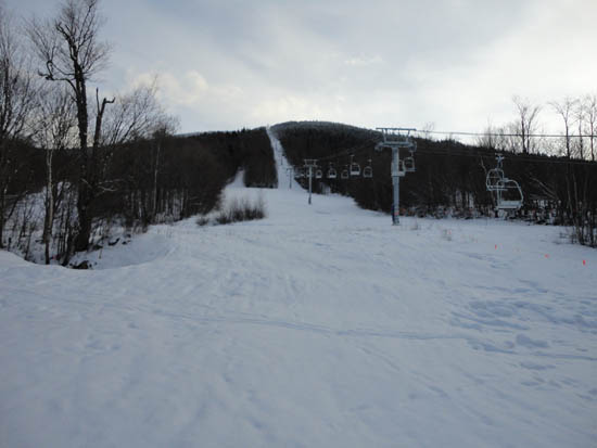
Looking up the bottom of the Mittersill lift line
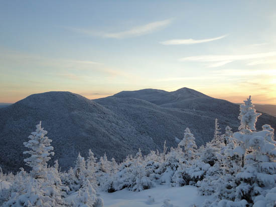
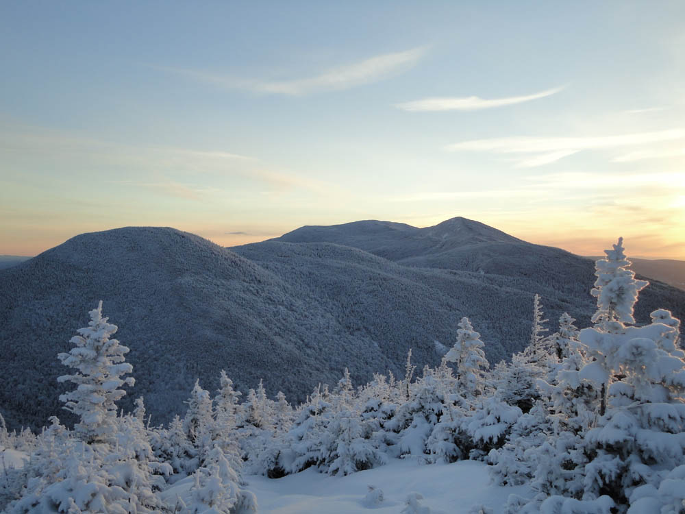
Northeast Cannonball and the Kinsmans as seen from Mittersill Peak
Looking up the Taft Trail on the way to Cannon Mountain

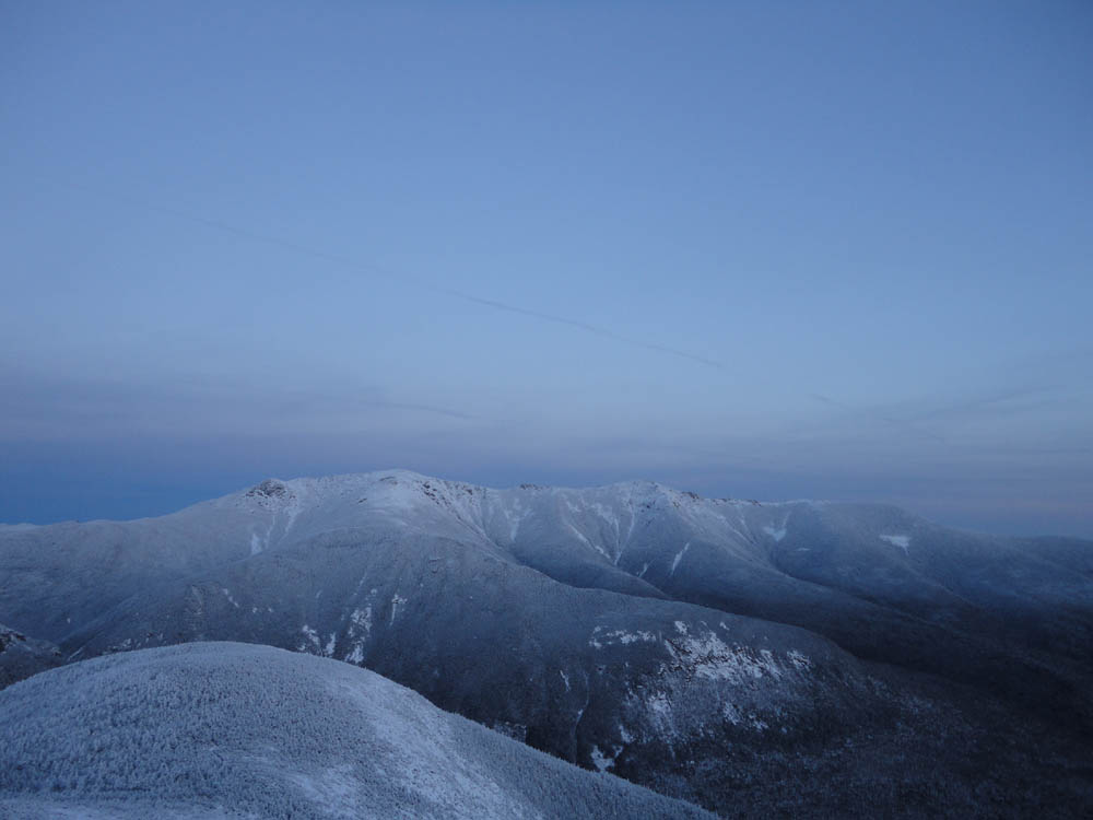
The Franconia Ridge as seen from the Cannon Mountain observation tower

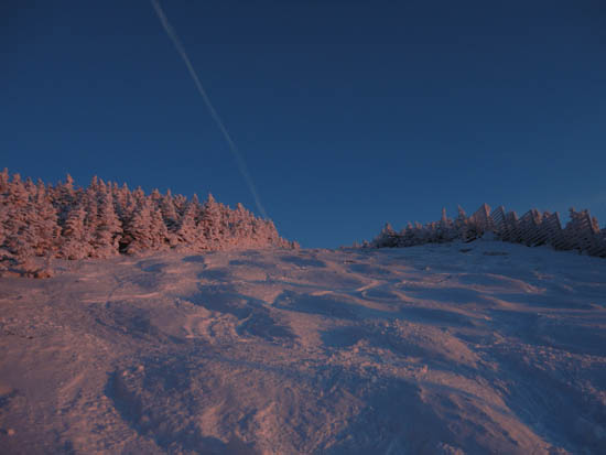
The sunset as seen from the Cannon Mountain observation tower
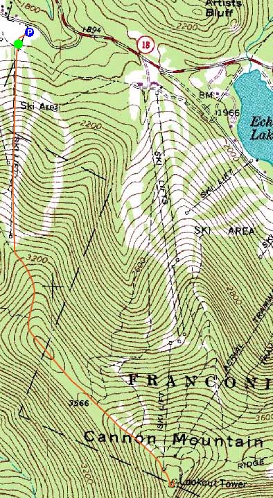

Directions to trailhead: Take I-93 North to the Cannon Mountain Peabody Slopes exit. Continue past the Cannon entrance, taking a left at the Mittersill sign. There are multiple parking areas on the left a fraction of a mile down this road. The Mittersill chairlift is located at the back of these lots.
Back to Mittersill Peak Profile
Back to Cannon Mountain Profile
|