Home
States
Colorado
Connecticut
Maine
Massachusetts
New Hampshire
New York
Rhode Island
Utah
Vermont
View All
Lists
NE 4,000 Footers
NE 100 Highest
NH 4,000 Footers
NH 100 Highest
NH 52 With A View
NH Belknap Range
NH Ossipee 10
Links
Trail Conditions
Trip Log
Sunrises
Sunsets
About
|
Mittersill Peak, Cannon Mountain
Franconia, NH
Trailheads, measurements, times, distances, and maps are all approximate and relative to the hike(s) as shown below.
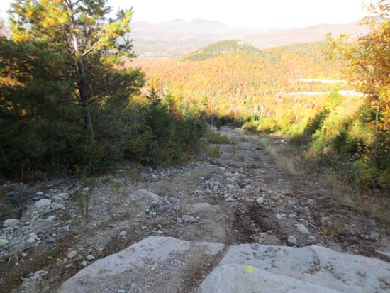
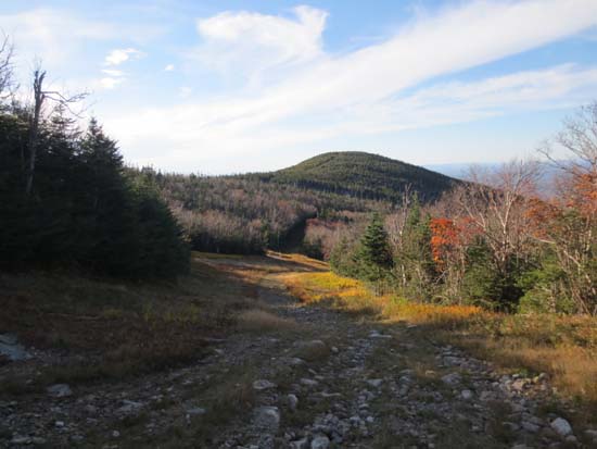
Looking up the Mittersill-Cannon Trail on the way to Mittersill Peak
Route: Mittersill-Cannon Trail, Short Trail
Mittersill-Cannon Trail is marked with rebar mounted blazes, blazed ledge, blazed trees, and a few blazed cairns. Trail was generally dry, with the exception of the very bottom and an area on the Ravine ski trail. Generally good footing (especially on a section of Mittersill trail that was not ripped up by the state a few years ago) with the exception of some actively eroding areas (due to machine usage). Also saw some mountain bike tire prints.
Top of the trail is very confusing, as there is a rope across it with a sign saying hiking is prohibited (even though there is a painted cairn within sight of it).
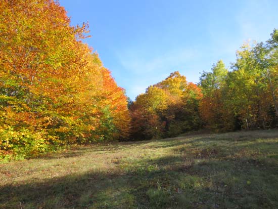
Fantastic foliage colors on the lower half of Mittersill.
| Hike Ratings |
|
Getting To Trailhead: |
Easy |
| Destination: |
Mittersill Peak |
|
Length: |
Moderate |
|
Steepness: |
Difficult |
|
Navigation: |
Easy |
|
Views: |
Excellent |
|
Crowds: |
Minimal |
| Destination: |
Cannon Mountain |
|
Length: |
Moderate |
|
Steepness: |
Difficult |
|
Navigation: |
Easy |
|
Views: |
Excellent |
|
Crowds: |
Heavy |
|
| Hike Stats |
|
Date Hiked: |
Thursday, October 3, 2013 |
| Parking Elevation: |
1,855' |
| Destination: |
Mittersill Peak |
| Time Elapsed: |
00:36 |
| Trailhead Elevation: |
1,870' |
| Summit Elevation: |
3,617' |
| Vertical Gain: |
1,747' |
| Destination: |
Cannon Mountain |
| Time Elapsed: |
00:16 |
| Trailhead Elevation: |
3,617' |
| Summit Elevation: |
4,100' |
| Vertical Gain: |
645' |
|
|
| Hike Time Elapsed: |
02:50 |
| Hike Vertical Gain: |
2,529' |
|
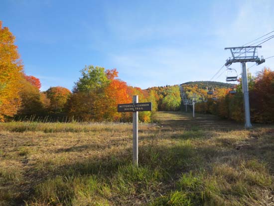
The Mittersill-Cannon Trail trailhead
Looking down the Mittersill-Cannon Trail

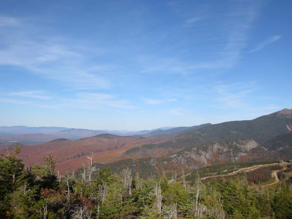
Looking at Scarface, Big Bickford, and Eagle Cliff from Mittersill Peak
Looking down the Mittersill-Cannon Trail on the way to Cannon Mountain
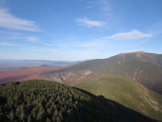
Big Bickford, Eagle Cliff, and Mt. Lafayette as seen from the Cannon Mountain observation tower
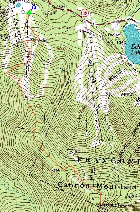

Directions to trailhead: Take I-93 North to the Cannon Mountain Peabody Slopes exit. Continue past the Cannon entrance, taking a left at the Mittersill sign. There are multiple parking areas on the left a fraction of a mile down this road. The Mittersill chairlift is located at the back of these lots. The Mittersill-Cannon Trail starts next to the chairlift.
Back to Mittersill Peak Profile
Back to Cannon Mountain Profile
|