Home
States
Colorado
Connecticut
Maine
Massachusetts
New Hampshire
New York
Rhode Island
Utah
Vermont
View All
Lists
NE 4,000 Footers
NE 100 Highest
NH 4,000 Footers
NH 100 Highest
NH 52 With A View
NH Belknap Range
NH Ossipee 10
Links
Trail Conditions
Trip Log
Sunrises
Sunsets
About
|
Mount Chocorua
Albany, NH
Trailheads, measurements, times, distances, and maps are all approximate and relative to the hike(s) as shown below.
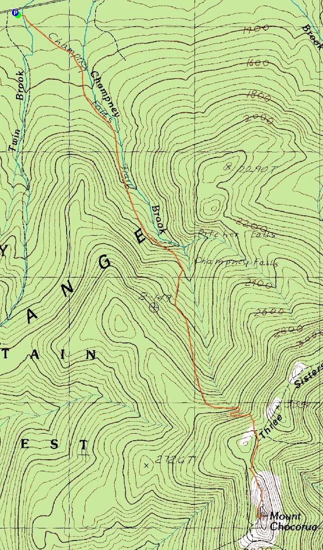
Looking toward the summit from the Piper Trail
Route: Champney Falls Trail, Piper Trail (Mt. Chocorua), Piper Trail, Champney Falls Trail
Since I hadn't done a substantial hike in awhile, I decided I'd get out of work half an hour early and head up to Chocorua to enjoy the 60 degree weather.
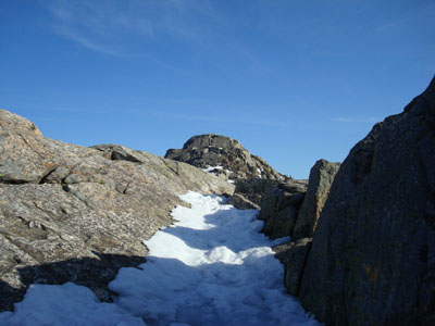
Upon setting off just a bit after 3, I was the only one in the Champney Falls parking lot. The trail was well packed in the middle snow monorail, however stepping off the side resulted in deep postholing. Nonetheless, I was able to keep my snowshoes on my pack.
While I had intended to go to Middle Sister if I had the time, passing the Champney Falls Cutoff Trail ended that notion - it didn't look particularly well traveled and would thus require snowshoes.
The area above treeline was somewhat interesting - due to the melting, it was hard to follow the trail in places, as there were old foot prints everywhere. I ended up following what looked to be the only prints from this day, which for the most part kept to the trail as I remember it. There were fortunately no significant patches of ice, so I was able to ascend without traction.
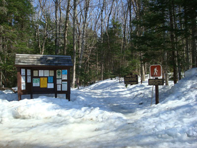
The views from the summit were great, the winds minimal, and the temperature pleasant.
While I was still tempted to venture over to Middle Sister on my way down, I decided to skip it, as I was hungry and the sun was starting to set.
| Hike Ratings |
|
Getting To Trailhead: |
Easy |
| Destination: |
Mount Chocorua |
|
Length: |
Moderate |
|
Steepness: |
Difficult |
|
Navigation: |
Easy |
|
Views: |
Excellent |
|
Crowds: |
Minimal |
|
| Hike Stats |
|
Date Hiked: |
Wednesday, April 16, 2008 |
| Hike Commenced: |
3:17 PM |
| Parking Elevation: |
1,260' |
| Destination: |
Mount Chocorua |
| Ascent Commenced: |
3:17 PM |
| Summit Reached: |
5:29 PM |
| Time Elapsed: |
02:12 |
| Trailhead Elevation: |
1,260' |
| Summit Elevation: |
3,474' |
| Distance: |
3.8 miles |
| Vertical Gain: |
2,314' |
|
|
| Hike Ended: |
7:37 PM |
| Hike Time Elapsed: |
04:20 |
| Hike Distance: |
7.6 miles |
| Hike Vertical Gain: |
2,414' |
|
The Champney Falls Trail trailhead
Looking at Mount Washington from the Mt. Chocorua summit
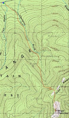

Directions to trailhead: Take Route 112 West past the visitor center on the right. The Champney Falls Trail pay parking lot and trailhead are around the next curve on the left.
Back to Mount Chocorua Profile
|