Home
States
Colorado
Connecticut
Maine
Massachusetts
New Hampshire
New York
Rhode Island
Utah
Vermont
View All
Lists
NE 4,000 Footers
NE 100 Highest
NH 4,000 Footers
NH 100 Highest
NH 52 With A View
NH Belknap Range
NH Ossipee 10
Links
Trail Conditions
Trip Log
Sunrises
Sunsets
About
|
Mt. Anderson, Mt. Lowell
Harts Location, NH, Livermore, NH
Trailheads, measurements, times, distances, and maps are all approximate and relative to the hike(s) as shown below.
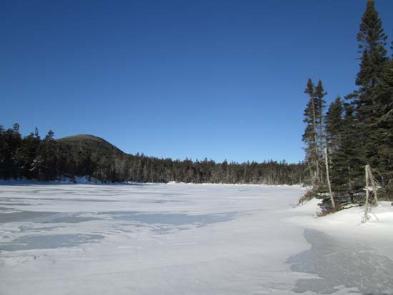
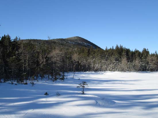
Looking across Nancy Pond at Mt. Anderson
Route: Notchland Trail, Nancy Brook Connector, Nancy Pond Trail, bushwhack, logging roads, Signal Ridge Trail, Sawyer River Road
Cold start, with temperatures in the double digits below zero. Obtained permission from Notchland Inn to use their private trail to access the Nancy Pond Trail. A little less vertical, but similar length. Not recently used, but now broken out. Snowpack down here was about a foot with a few inches of powder on top.
Once on the Nancy Pond Trail, we were able to take advantage of our previous tracks up to the abandoned Bemis trail turnoff. Above there, no use since around the ice storm, but relatively smooth sailing with a few inches of snow on top of the crust (increasing to maybe 6" of powder, on top of a few feet of snowpack).
We took advantage of Nancy Pond to cut off a little bit of the trail (blowdowns and obscure areas). Once at Little Norcross Pond, we cut across the pond, then waded through thick spruce for awhile.
Upon picking up the eastern ridge of Anderson, we had generally good going. With the exception of a few short spruce areas (usually in slight cols), the woods were generally open with current snowpack of about 3 feet. Grades weren't bad and we didn't even have to deal with any thickness to get to the summit.
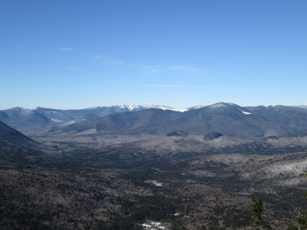
Fantastic clear views from the summit with its unique Pemi perspective.
We then retraced our tracks for a little bit, then slabbed toward the col, hitting some steep terrain and some pockets of spruce. Not nearly as bad as a direct line from the col to Anderson (my recollection of that was thick spruce and cliffbands).
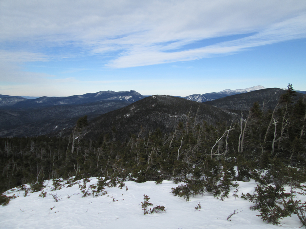
Slower going coming out of the col toward Lowell, pushing through lots of stick forest. Excellent views from the scrub area on Lowell as well, though the skies were starting to cloud a bit.
A bit tricky descending Lowell, as we hit lots of steeps and cliffbands on the south and east sides. We eventually hugged the west to get off the cone, then had okay woods for a little while on the ridge, then hit alternating junk and pockets of open (with plenty of moose sign). We start to favor the Duck Pond drainage a bit, while trying to not drop too far into it. Eventually hit good woods later on the old logging roads (the last one, which eventually crosses Signal Ridge Trail, is borderline useless due to being spruce filled, whilst either side of it is open woods).
Signal Ridge Trail from there out was well packed and good snowshoeing. Sawyer River Road was of course well packed down by snowmobiles (though we encountered none after 4:30).
| Hike Ratings |
|
Getting To Trailhead: |
Moderate |
| Destination: |
Mt. Anderson |
|
Length: |
Moderate |
|
Steepness: |
Difficult |
|
Navigation: |
Difficult |
|
Views: |
Excellent |
|
Crowds: |
Minimal |
| Destination: |
Mt. Lowell |
|
Length: |
Difficult |
|
Steepness: |
Very Difficult |
|
Navigation: |
Difficult |
|
Views: |
Excellent |
|
Crowds: |
Minimal |
|
| Hike Stats |
|
Date Hiked: |
Saturday, January 17, 2015 |
| Parking Elevation: |
1,010' |
| Destination: |
Mt. Anderson |
| Time Elapsed: |
03:47 |
| Trailhead Elevation: |
1,020' |
| Summit Elevation: |
3,740' |
| Vertical Gain: |
2,920' |
| Destination: |
Mt. Lowell |
| Time Elapsed: |
01:51 |
| Trailhead Elevation: |
3,740' |
| Summit Elevation: |
3,740' |
| Vertical Gain: |
480' |
|
|
| Hike Time Elapsed: |
10:03 |
| Hike Vertical Gain: |
3,550' |
|
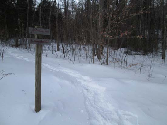
The Notchland Trail trailhead
Looking across Little Norcross Pond at Mt. Anderson prior to starting a bushwhack

Looking at the Bonds and Franconias from Mt. Anderson
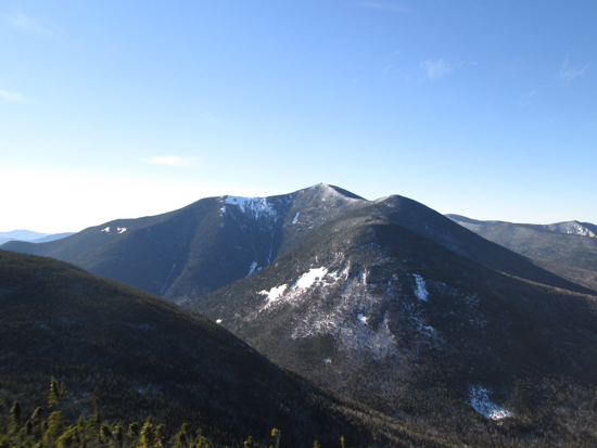
Looking at Mt. Carrigain from Mt. Anderson
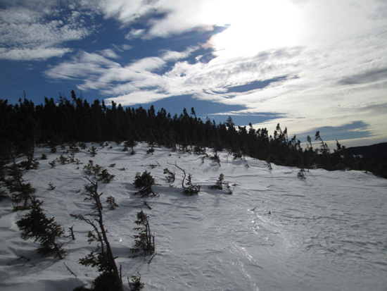
Ascending the scrub zone on Mt. Lowell

Looking at the Willey Range, Mt. Anderson, Mt. Nancy, and Mt. Washington from near the summit of Mt. Lowell

Directions to trailhead:
Back to Mt. Anderson Profile
Back to Mt. Lowell Profile
|