Home
States
Colorado
Connecticut
Maine
Massachusetts
New Hampshire
New York
Rhode Island
Utah
Vermont
View All
Lists
NE 4,000 Footers
NE 100 Highest
NH 4,000 Footers
NH 100 Highest
NH 52 With A View
NH Belknap Range
NH Ossipee 10
Links
Trail Conditions
Trip Log
Sunrises
Sunsets
About
|
Mt. Anna, Mt. Mack, Mt. Klem
Gilmanton, NH, Gilford, NH
Trailheads, measurements, times, distances, and maps are all approximate and relative to the hike(s) as shown below.
Looking up the Anna-Old Stage Road Link
Route: Old Stage Road, Anna-Old Stage Road Link, (Mt. Anna), Mack-Anna Trail, (Mt. Mack), Klem-Mack Loop, Mt. Klem Spur, (Mt. Klem), Mt. Klem Spur, Klem-Mack Loop, Red Trail, Round Pond Road
Trails were generally dry with some areas of avoidable mud and puddles.
All trails listed are pretty well blazed, with blaze colors matching the current belknaprangetrails.org map.
Anna-Old Stage Road Link trailhead on Old Stage Road doesn't have a sign, but is pretty obvious from the road (just east of a bridge; blue blazes visible if you head a few feet up the trail). Anna-Old Stage Road Link (blue blazed trail) provides the only views near Mt. Anna (a ledge a few minutes below the summit with good views south).
Nice loop with generally decent footing, clocking in at about 8.3 miles.
| Hike Ratings |
|
Getting To Trailhead: |
Easy |
| Destination: |
Mt. Anna |
|
Length: |
Moderate |
|
Steepness: |
Moderate |
|
Navigation: |
Moderate |
|
Views: |
Excellent |
|
Crowds: |
Minimal |
| Destination: |
Mt. Mack |
|
Length: |
Moderate |
|
Steepness: |
Difficult |
|
Navigation: |
Moderate |
|
Views: |
Excellent |
|
Crowds: |
Minimal |
| Destination: |
Mt. Klem |
|
Length: |
Moderate |
|
Steepness: |
Difficult |
|
Navigation: |
Moderate |
|
Views: |
Excellent |
|
Crowds: |
Minimal |
|
| Hike Stats |
|
Date Hiked: |
Wednesday, June 24, 2015 |
| Parking Elevation: |
740' |
| Destination: |
Mt. Anna |
| Time Elapsed: |
00:45 |
| Trailhead Elevation: |
740' |
| Summit Elevation: |
1,670' |
| Vertical Gain: |
1,030' |
| Destination: |
Mt. Mack |
| Time Elapsed: |
00:26 |
| Trailhead Elevation: |
1,670' |
| Summit Elevation: |
1,945' |
| Vertical Gain: |
395' |
| Destination: |
Mt. Klem |
| Time Elapsed: |
00:13 |
| Trailhead Elevation: |
1,945' |
| Summit Elevation: |
2,001' |
| Distance: |
0.8 mile |
| Vertical Gain: |
266' |
|
|
| Hike Time Elapsed: |
02:21 |
| Distance: |
8.3 miles |
| Hike Vertical Gain: |
1,801' |
|
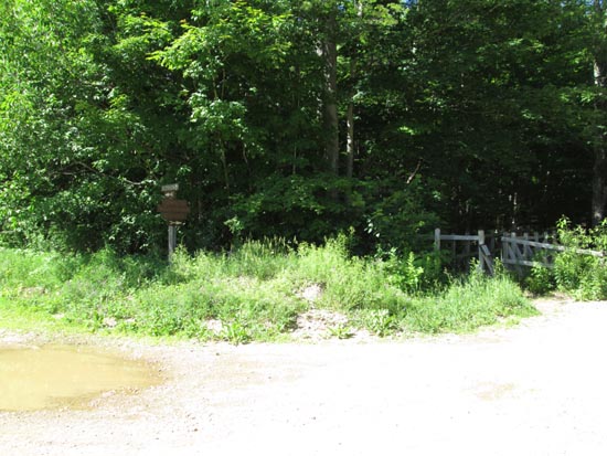
The Old Stage Road trailhead at Camp Bell
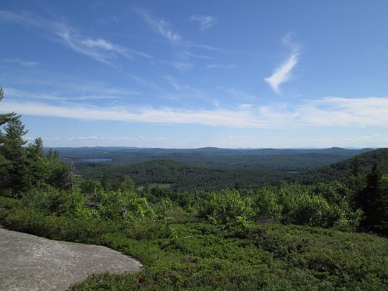
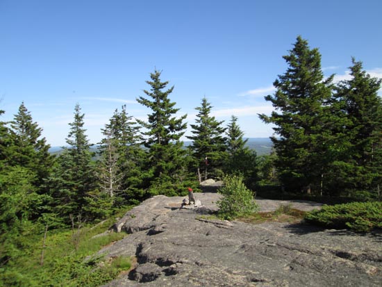
Looking south from the Mt. Anna viewpoint on the Anna-Old Stage Road Link
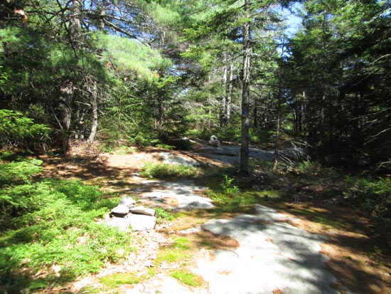
Looking down the Mack-Anna Trail
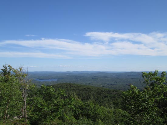
Looking south from near the summit of Mt. Mack
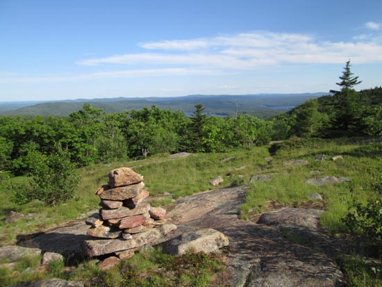
The trail between Mt. Mack and Mt. Klem
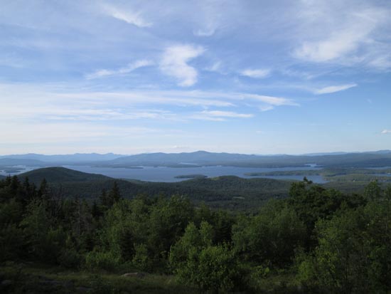
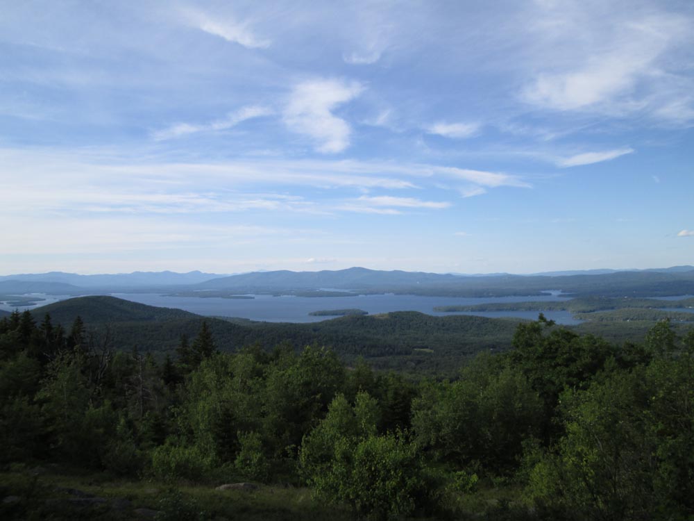
Looking at Lake Winnipesaukee from near the Mt. Klem summit
Directions to trailhead: From Route 107, take Route 140 east into Gilmanton. Take a left onto Crystal Lake Road, bearing left to stay on it (when Mountain Road goes straight). After passing Crystal Lake, the road turns into Guinea Ridge Road. Take a right next to some cabins onto Manning Lake Road (this is inaccurately labelled as Camp Leo Road and Moulton Road on some maps...the current road sign says Manning Lake Road). There is a small parking area on the left just before reaching the area with the camp buildings. The Red-Blue Trail (Old Stage Road) starts at the bridge just beyond the main building, in the form of a dirt road. When camp is in session, visitors should sign in at the main building.
Back to Mt. Anna Profile
Back to Mt. Mack Profile
Back to Mt. Klem Profile
|