Home
States
Colorado
Connecticut
Maine
Massachusetts
New Hampshire
New York
Rhode Island
Utah
Vermont
View All
Lists
NE 4,000 Footers
NE 100 Highest
NH 4,000 Footers
NH 100 Highest
NH 52 With A View
NH Belknap Range
NH Ossipee 10
Links
Trail Conditions
Trip Log
Sunrises
Sunsets
About
|
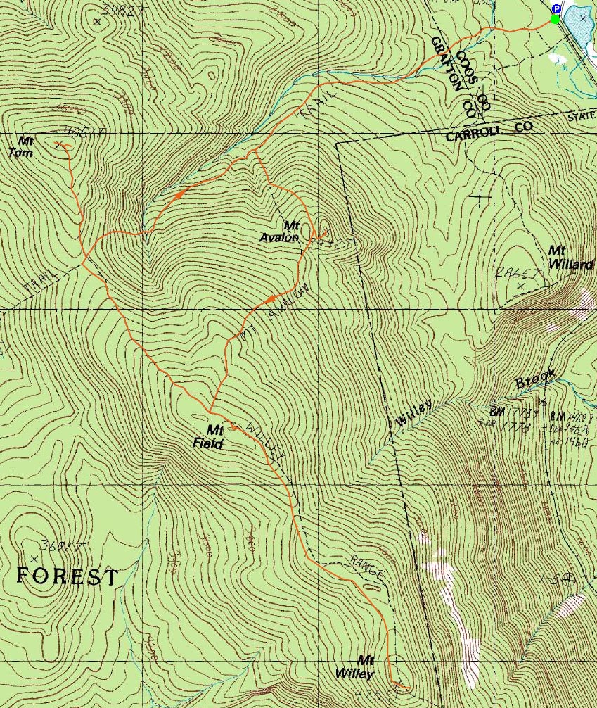
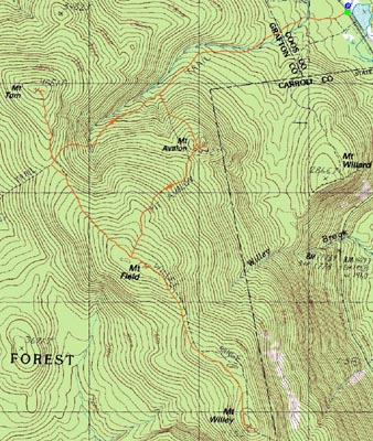
Mt. Avalon, Mt. Field, Mt. Willey, Mt. Tom
Carroll, NH, Bethlehem, NH
Trailheads, measurements, times, distances, and maps are all approximate and relative to the hike(s) as shown below.
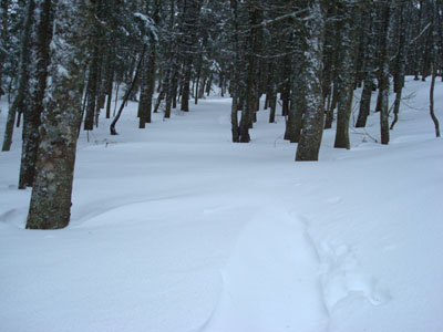
Windblown snow disguises the Avalon Trail near Mt. Avalon
Route: Avalon Trail, (spur trail to summit), (Mt. Avalon), (spur trail from summit), Avalon Trail, Willey Range Trail, (Mt. Field), Willey Range Trail, (Mt. Willey), Willey Range Trail, (Mt. Field), Willey Range Trail, A-Z Trail, Mt. Tom Spur Trail, (Mt. Tom), Mt. Tom Spur Trail, A-Z Trail, Avalon Trail
My original plan was to get up wicked early and watch the sunrise from Mt. Avalon. I did the first part, but after hearing the heavy winds outside, I decided to wait a bit and ascend in the light.
Arriving at the small parking lot next to the train station, I put on my snowshoes and was on my way. The first water crossing, which can be the hardest in my experience, was completely covered in snow. The second one wasn't covered completely, but there was enough snow that I could keep on my snowshoes.
Soon, I was at the Avalon Trail and A-Z Trail junction. The A-Z Trail looked well packed, whereas the the Avalon Trail looked like it hadn't seen anyone thus far this morning. Nonetheless, I wanted to get the bulk of the vertical done early, so I continued on the Avalon Trail.
As the trail became steeper, the footing became much more difficult, as the snow was very smoothly packed down from butt sliders. As the trail flattened out, it disappeared in a few places, due to the recent powder and wind. Thank you, snowshoes!
Soon enough, I was at the Avalon spur intersection. As I arrived at the top of Mt. Avalon, I could only see Crawford Notch. After snapping a few photos, I noticed the clouds were lifting. Soon enough, I could see the top of Webster Cliff and some of the mountains to the southeast. I considered waiting around for the clouds to lift higher, but I wanted to git r done.
Back on the Avalon Trail, I continued up to Mt. Field. As I arrived at the Willey Range Trail, I could see I was up in the clouds. Once again, there would be no view on Mt. Field. Yet.
My next stop was Mt. Willey. The Willey Range Trail drops somewhat steeply off Mt. Field, before getting a bit rolly (at one point, the snowshoe prints split, so with the up and downs, I began to worry I was going the wrong way).
Soon, I was seeing a bit of blue sky poking through the clouds. As I climbed, I began to recognize the topography and trees - sure enough, I rounded the corner and was at the summit of Mt. Willey. The views from both outlooks (the on-trail view toward Carrigain and the short spur trail looked down toward Route 302) were superb - the day wasn't wasted!
Determined to see something from Mt. Field, I took a few photos and was quickly on my way back.
Arriving back on Mt. Field, I followed the very short spur trail to a nice view point - and indeed saw a view from Mt. Field! The Presidentials were still in the clouds, but a lot of the surrounding area was becoming visible.
Back on the Willey Range Trail, I looked out at Mt. Tom and saw that it was in the clear. This was enough to convince me to head over.
The Willey Range Trail isn't overly steep from Mt. Field to the A-Z Trail. The Mt. Tom Spur Trail, however, does steepen up a bit toward the top. Since I had been going relatively non-stop (save for a few brief photo and snack breaks), the scrambles and short steeps were enough to tell me I was starting to get fatigued!
Arriving at the summit blowdown field, I saw a sweeping view from Mt. Field to the Twins. The summit was completely socked in during my previous two ascents, so this was quite a treat.
After looking at the views, I followed some tracks to the east - and saw another awesome view (this one of the southern Presidentials and Mt. Field). Not a bad summit when you can actually something!
The descent down the A-Z Trail was a little bit messy, as the trail was a hodgepodge of butt slides and post holes. I was also surprised that it was somewhat busy - a combination of day trip traffic as well as overnighters heading to Zealand.
| Hike Ratings |
|
Getting To Trailhead: |
Easy |
| Destination: |
Mt. Avalon |
|
Length: |
Moderate |
|
Steepness: |
Difficult |
|
Navigation: |
Easy |
|
Views: |
Excellent |
|
Crowds: |
Minimal |
| Destination: |
Mt. Field |
|
Length: |
Moderate |
|
Steepness: |
Difficult |
|
Navigation: |
Easy |
|
Views: |
Minimal due to weather |
|
Crowds: |
Minimal |
| Destination: |
Mt. Willey |
|
Length: |
Moderate |
|
Steepness: |
Difficult |
|
Navigation: |
Moderate |
|
Views: |
Excellent |
|
Crowds: |
Minimal |
| Destination: |
Mt. Field |
|
Length: |
Moderate |
|
Steepness: |
Difficult |
|
Navigation: |
Easy |
|
Views: |
Excellent |
|
Crowds: |
Minimal |
| Destination: |
Mt. Tom |
|
Length: |
Moderate |
|
Steepness: |
Difficult |
|
Navigation: |
Easy |
|
Views: |
Excellent |
|
Crowds: |
Minimal |
|
| Hike Stats |
|
Date Hiked: |
Sunday, December 30, 2007 |
| Hike Commenced: |
7:38 AM |
| Parking Elevation: |
1,900' |
| Destination: |
Mt. Avalon |
| Ascent Commenced: |
7:40 AM |
| Summit Reached: |
8:43 AM |
| Time Elapsed: |
01:03 |
| Trailhead Elevation: |
1,900' |
| Summit Elevation: |
3,442' |
| Distance: |
1.8 miles |
| Vertical Gain: |
1,567' |
| Destination: |
Mt. Field |
| Ascent Commenced: |
8:51 AM |
| Summit Reached: |
9:35 AM |
| Time Elapsed: |
00:44 |
| Trailhead Elevation: |
3,442' |
| Summit Elevation: |
4,340' |
| Distance: |
.9 mile |
| Vertical Gain: |
995' |
| Destination: |
Mt. Willey |
| Ascent Commenced: |
9:35 AM |
| Summit Reached: |
10:19 AM |
| Time Elapsed: |
00:44 |
| Trailhead Elevation: |
4,340' |
| Summit Elevation: |
4,285' |
| Distance: |
1.4 miles |
| Vertical Gain: |
465' |
| Destination: |
Mt. Field |
| Ascent Commenced: |
10:23 AM |
| Summit Reached: |
11:05 AM |
| Time Elapsed: |
00:42 |
| Trailhead Elevation: |
4,285' |
| Summit Elevation: |
4,340' |
| Distance: |
1.4 miles |
| Vertical Gain: |
520' |
| Destination: |
Mt. Tom |
| Ascent Commenced: |
11:10 AM |
| Summit Reached: |
11:50 AM |
| Time Elapsed: |
00:40 |
| Trailhead Elevation: |
4,340' |
| Summit Elevation: |
4,051' |
| Distance: |
1.5 miles |
| Vertical Gain: |
411' |
|
|
| Hike Ended: |
1:12 PM |
| Hike Time Elapsed: |
05:24 |
| Hike Distance: |
9.9 miles |
| Hike Vertical Gain: |
4,128' |
|
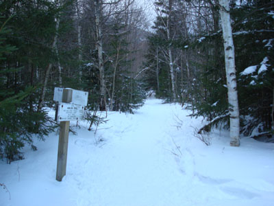
The Avalon Trail trailhead next to the train station
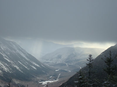
Looking under rising clouds toward Webster Cliff and Route 302 from Mt. Avalon
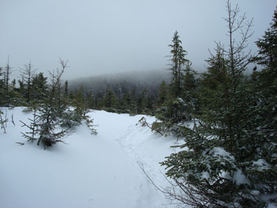
The Avalon Trail to Mt. Field
Looking toward the Mt. Washington Hotel from the Mt. Field view point

The Willey Range Trail near the Mt. Willey summit

Looking at Mt. Webster from the Mt. Willey eastern view point

Looking down the Mt. Tom Spur Trail

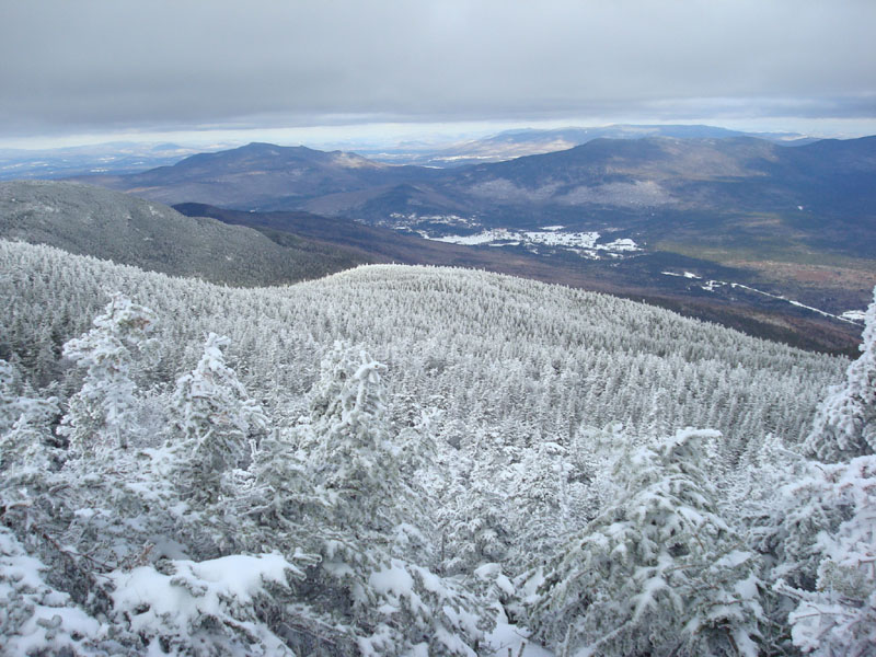
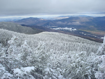
Looking some of the Pemi 4,000 footers from the Mt. Tom summit

Directions to trailhead: Take Route 302 west from Bartlett, NH. In the winter, at least, there is parking next to the railroad station. Trailhead is across the tracks.
Back to Mt. Avalon Profile
Back to Mt. Field Profile
Back to Mt. Willey Profile
Back to Mt. Tom Profile
|