Home
States
Colorado
Connecticut
Maine
Massachusetts
New Hampshire
New York
Rhode Island
Utah
Vermont
View All
Lists
NE 4,000 Footers
NE 100 Highest
NH 4,000 Footers
NH 100 Highest
NH 52 With A View
NH Belknap Range
NH Ossipee 10
Links
Trail Conditions
Trip Log
Sunrises
Sunsets
About
|
Mt. Avalon, Mt. Field, Mt. Tom
Carroll, NH, Bethlehem, NH
Trailheads, measurements, times, distances, and maps are all approximate and relative to the hike(s) as shown below.
Looking up the Cascade Loop on the way to Mt. Avalon
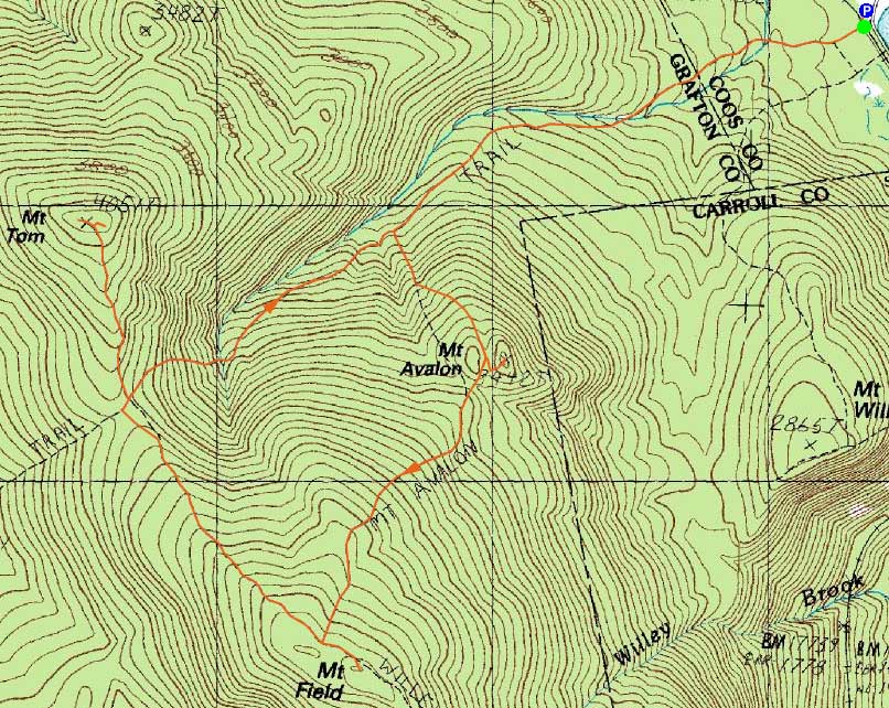
Route: Avalon Trail, Cascade Loop, Avalon Trail, (spur trail to summit), (Mt. Avalon), (spur trail from summit), Avalon Trail, Willey Range Trail, (Mt. Field), Willey Range Trail, (Mt. Willey), Willey Range Trail, (Mt. Field), Willey Range Trail, A-Z Trail, Mt. Tom Spur Trail, (Mt. Tom), Mt. Tom Spur Trail, A-Z Trail, Avalon Trail
While I was planning to head to Mt. Waumbek for a cloudy afternoon hike, I noticed things around Crawford Notch appeared to be better than forecasted. Thus, I decided to give Avalon, Field, and Tom a try.
Mixing things up a bit, I decided to check out the cascades along the Cascade Loop trail. While both cascades were nice, I think I preferred the Pearl over the Beecher. The loop trail itself had generally decent footing, though it was muddy in places.
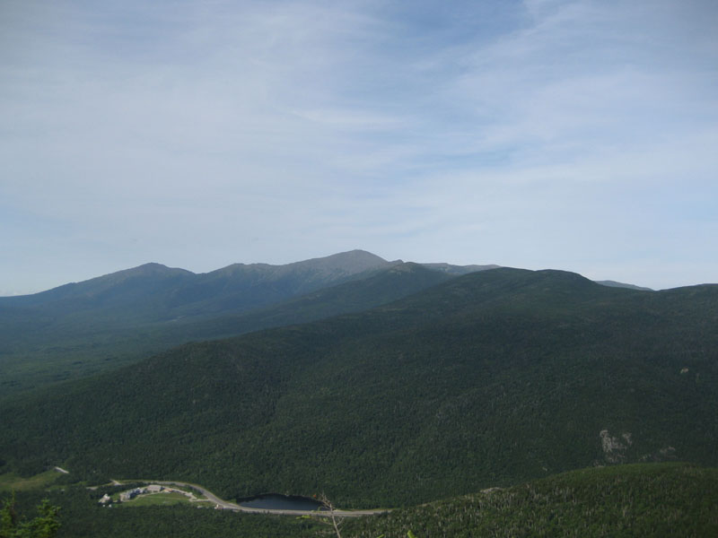
Heading up to Avalon, I was greeted with excellent views - even some blue sky over the Presidentails!
The next segment of the Avalon Trail was muddy, prior to the steeps on the side of Mt. Field. The views from the Mt. Field vistas (the side trail and the on trail viewpoints) were pretty good.
On my way to Tom, I stopped to remove a set of blowdowns (a well defined herdpath had already developed!) on the Willey Range Trail. Eventually reaching Mt. Tom, I has treated to the best views of the day - South Twin, Bond, Scar Ridge, Carrigain, and the Presidentials were all easily seen from the two viewpoints.
I ended up back at the train station just prior to sunset. Despite the gloomy forecast, a nice afternoon!
| Hike Ratings |
|
Getting To Trailhead: |
Easy |
| Destination: |
Mt. Avalon |
|
Length: |
Moderate |
|
Steepness: |
Difficult |
|
Navigation: |
Easy |
|
Views: |
Excellent |
|
Crowds: |
Moderate |
| Destination: |
Mt. Field |
|
Length: |
Moderate |
|
Steepness: |
Difficult |
|
Navigation: |
Easy |
|
Views: |
Excellent |
|
Crowds: |
Minimal |
| Destination: |
Mt. Tom |
|
Length: |
Moderate |
|
Steepness: |
Difficult |
|
Navigation: |
Easy |
|
Views: |
Excellent |
|
Crowds: |
Minimal |
|
| Hike Stats |
|
Date Hiked: |
Wednesday, August 5, 2009 |
| Parking Elevation: |
1,900' |
| Destination: |
Mt. Avalon |
| Time Elapsed: |
00:50 |
| Trailhead Elevation: |
1,900' |
| Summit Elevation: |
3,442' |
| Vertical Gain: |
1,617' |
| Destination: |
Mt. Field |
| Time Elapsed: |
00:34 |
| Trailhead Elevation: |
3,442' |
| Summit Elevation: |
4,340' |
| Distance: |
.9 mile |
| Vertical Gain: |
995' |
| Destination: |
Mt. Tom |
| Time Elapsed: |
00:42 |
| Trailhead Elevation: |
4,340' |
| Summit Elevation: |
4,051' |
| Distance: |
1.5 miles |
| Vertical Gain: |
411' |
|
|
| Hike Time Elapsed: |
03:37 |
| Hike Vertical Gain: |
3,193' |
|
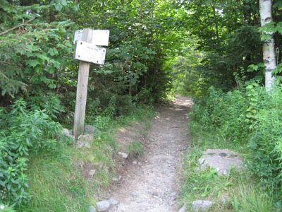
The Avalon Trail trailhead next to the train station
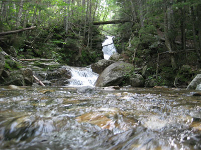
The Pearl Cascade
The Presidentials as seen from Mt. Avalon
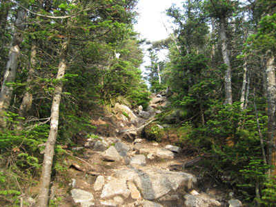
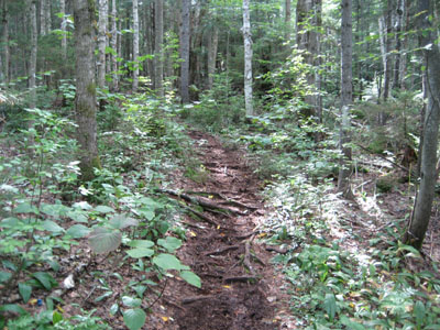
The Willey Range Trail near Mt. Field
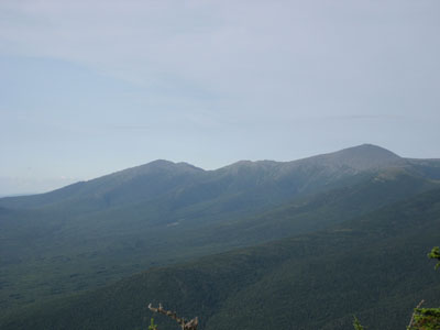
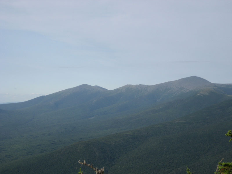
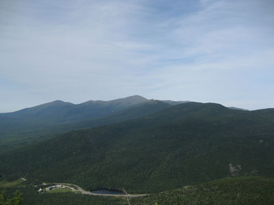
Mt. Jefferson, Mt. Reagan, and Mt. Washington as seen from near the summit of Mt. Field

The Willey Range Trail on the way to Mt. Tom

Mt. Washington as seen from near the summit of Mt. Tom
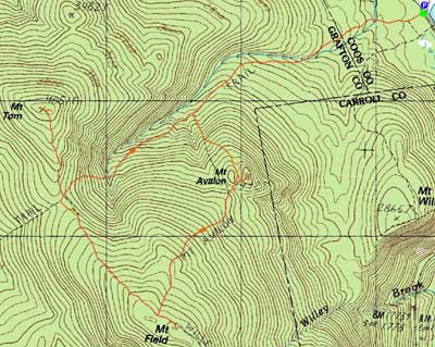

Directions to trailhead: Take Route 302 west from Bartlett, NH. There is day parking next to the railroad station. Trailhead is across the tracks.
Back to Mt. Avalon Profile
Back to Mt. Field Profile
Back to Mt. Tom Profile
|