Home
States
Colorado
Connecticut
Maine
Massachusetts
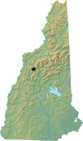
New Hampshire
New York
Rhode Island
Utah
Vermont
View All
Lists
NE 4,000 Footers
NE 100 Highest
NH 4,000 Footers
NH 100 Highest
NH 52 With A View
NH Belknap Range
NH Ossipee 10
Links
Trail Conditions
Trip Log
Sunrises
Sunsets
About
|
Mt. Blue
Benton, NH
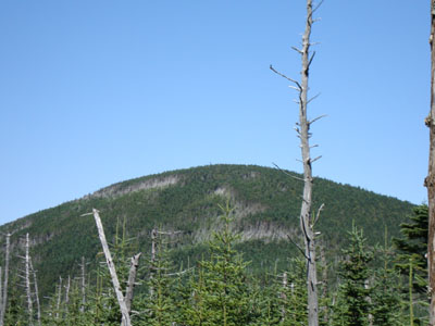
Mt. Blue as seen from the side of Mt. Jim
 Summary Summary
Located northeast of Mt. Moosilauke, the trail-less Mt. Blue some partial viewpoints from near its summit. Prior to the installation of the Cannon Mountain Tramway, Mt. Blue was a finalist for the lift location.
Summit Elevation
4,529 feet
Summit Facilities
None.
Trip Reports:
Click on the date for photos, timestamps, and maps.
| Date of Hike |
Trail(s) |
Length |
Steepness |
Vertical |
|
| August 30, 2009 |
Asquam Ridge Trail, more |
Moderate |
Difficult |
3,066' |
|
More Information
Mt. Blue - New England's Cancelled Ski Areas
Dartmouth Outing Club's Mount Moosilauke page
MtMoosilauke.com
|
