Home
States
Colorado
Connecticut
Maine
Massachusetts
New Hampshire
New York
Rhode Island
Utah
Vermont
View All
Lists
NE 4,000 Footers
NE 100 Highest
NH 4,000 Footers
NH 100 Highest
NH 52 With A View
NH Belknap Range
NH Ossipee 10
Links
Trail Conditions
Trip Log
Sunrises
Sunsets
About
|
Mt. Blue
Stratford, NH
Trailheads, measurements, times, distances, and maps are all approximate and relative to the hike(s) as shown below.
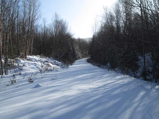
Ascending the logging road adjacent to Cone Brook
Route: Logging roads, herd paths
Mt. Blue, near North Stratford, south of Colebrook.
Cool day, starting at -1F not including the windchill (warmed up to 0F upon return).
The road from the gate (circa point 1,445') had some tire tracks, snowmobile tracks, and cat tracks on it and maybe 3" of snow. We hopped onto a side road just before Cone Brook, where snow depth quickly increased to 6-8" (except in a windy landing), then up to 1-1.5 feet. The landing on the ridge (circa 3,100') was blown down to dirt, then snow depth resumed, 1-2 feet deep all the way up the overgrown logging roads to the highpoint. We wore our snowshoes all day. The grades are gradual enough and the roads/paths open enough that I think some could ski/skin this with relative ease.
| Hike Ratings |
|
Getting To Trailhead: |
Easy |
| Destination: |
Mt. Blue |
|
Length: |
Moderate |
|
Steepness: |
Moderate |
|
Navigation: |
Difficult |
|
Views: |
Moderate |
|
Crowds: |
Minimal |
|
| Hike Stats |
|
Date Hiked: |
Sunday, January 26, 2014 |
| Parking Elevation: |
1,700' |
| Destination: |
Mt. Blue |
| Time Elapsed: |
02:17 |
| Trailhead Elevation: |
1,700' |
| Summit Elevation: |
3,763' |
| Vertical Gain: |
2,103' |
|
|
| Hike Time Elapsed: |
03:53 |
| Hike Vertical Gain: |
2,153' |
|
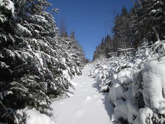
Ascending the logging road above Cone Brook
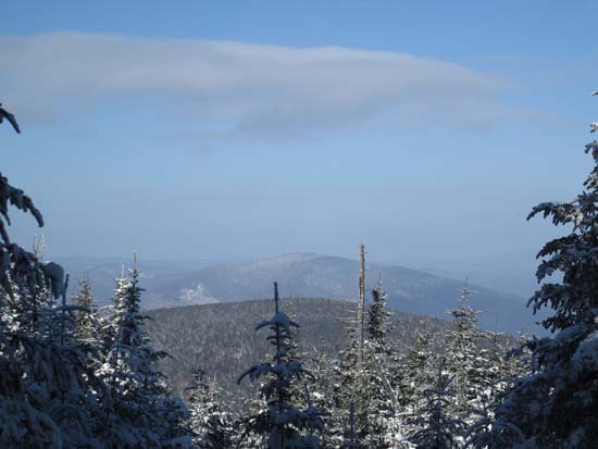
Views to the north from near the summit of Mt. Blue
Directions to trailhead: To get to the western side of Cleveland Notch, take US 3 north from North Stratford, then take a right onto Washburn Road. At around 1,350 feet in elevation, bear left (road may not be plowed after this point), then park near a gate. The gated road continues to Cleveland Notch.
Back to Mt. Blue Profile
|

