Home
States
Colorado
Connecticut
Maine
Massachusetts
New Hampshire
New York
Rhode Island
Utah
Vermont
View All
Lists
NE 4,000 Footers
NE 100 Highest
NH 4,000 Footers
NH 100 Highest
NH 52 With A View
NH Belknap Range
NH Ossipee 10
Links
Trail Conditions
Trip Log
Sunrises
Sunsets
About
|
Mt. Cabot
Lancaster, NH, Kilkenny, NH
Trailheads, measurements, times, distances, and maps are all approximate and relative to the hike(s) as shown below.
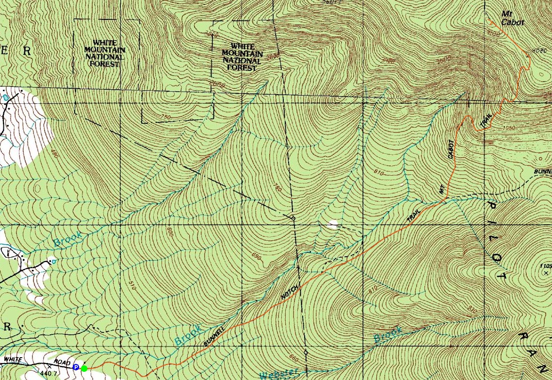
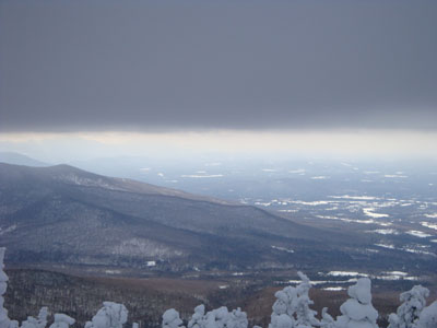
Looking down the Mt. Cabot Trail
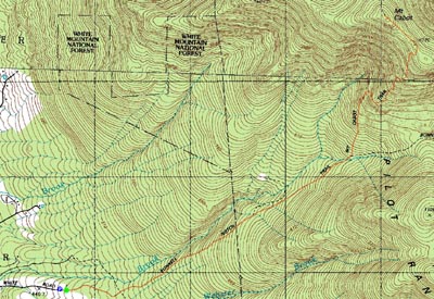
Route: Mt. Cabot Trail, Kilkenny Ridge Trail, bushwhack, (Mt. Cabot), Kilkenny Ridge Trail, Mt. Cabot Trail
After a long yet somewhat fruitless hike to Bondcliff, I was ready to do something a bit more tame. Adding to my desire for tameness was a combination of two other factors - subzero temperatures and a rather sore foot. Thus, Mt. Cabot seemed like a decent possibility.
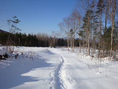
After parking in a snowbank along a field below the trailhead, I made my way up to the gate. The foot pain was already ample enough that I was considering turning back after 50 feet of hiking. Having driven a decent number of miles to get here, though, I decided to at least continue on a bit and hope for the best.
The first part of the trail was basically a road through various fields and logging cuts. My guess is that without snow on the ground, this might be an ugly sight. The scenery to the back, however, is top notch (a similar feel the beginning of the Iron Mountain Trail), thus neutralizing the surroundings.
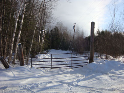
After passing straight through a four-way intersection, the trail gradually dipped into the woods. Still in pain, I had by this point adapted my stride into a limp. Beyond the water crossing, the pitch started to pick up - thus changing the impact/weighting on my feet. No longer in pain, I was able to continue up the drifted Kilkenny Ridge Trail, eventually arriving at the Cabot Cabin.
Just below the cabin, as well as above it, things were heavily drifted. While I was able to follow the trail for awhile above it, I eventually decided to do a direct bushwhack to the height of land. Arriving at the larger summit sign, I continued past it to the true summit.
After reaching the summit, I headed over to the blowdown vista for some views (quickly clouding up, but Cannon Mountain was nonetheless still visible), then back to the Kilkenny Ridge Trail, which I was able to follow in reverse back to the cabin.
Once at the cabin, I headed inside and swapped my base layer shirt and added some additional winter gear for the descent. Not exactly an attractive interior, things were rather dark as the windows were caked in rime.
Back on the trail, I was able to enjoy a fairly pain free descent until I reached the flats. From there, once again, things were a bit sore (though not nearly as bad as during the initial part of the ascent). Time to shut things down for awhile and see if the stupid thing recovers on its own!
| Hike Ratings |
|
Getting To Trailhead: |
Moderate |
| Destination: |
Mt. Cabot |
|
Length: |
Moderate |
|
Steepness: |
Moderate |
|
Navigation: |
Moderate |
|
Views: |
Excellent |
|
Crowds: |
Minimal |
|
| Hike Stats |
|
Date Hiked: |
Sunday, January 25, 2009 |
| Hike Commenced: |
9:29 AM |
| Parking Elevation: |
1,490' |
| Destination: |
Mt. Cabot |
| Ascent Commenced: |
9:30 AM |
| Summit Reached: |
11:59 AM |
| Time Elapsed: |
02:29 |
| Trailhead Elevation: |
1,510' |
| Summit Elevation: |
4,170' |
| Distance: |
3.9 miles |
| Vertical Gain: |
2,760' |
|
|
| Hike Ended: |
2:07 PM |
| Hike Time Elapsed: |
04:38 |
| Hike Distance: |
7.8 miles |
| Hike Vertical Gain: |
2,880' |
|
The Mt. Cabot Trail trailhead on Arthur White Road
Looking up the Kilkenny Ridge Trail
The view from the blowdown vista near the Mt. Cabot summit

Directions to trailhead: Take US 2 West through Jefferson. After passing through downtown, take a right onto North Road. A few minutes down this road, when it curves to the left, take a right onto Gore Road. Not too long after a sharp left turn (Gore Road becomes Garland Road), take a right onto Pleasant Valley Road. Soon thereafter, take a right onto Arthur White Road. The trailhead, marked by a gate, is at the top of this road (left and right are both private drives). Please respect private property by obeying all signs and not blocking any roads, gates, or driveways.
Back to Mt. Cabot Profile
|