Home
States
Colorado
Connecticut
Maine
Massachusetts
New Hampshire
New York
Rhode Island
Utah
Vermont
View All
Lists
NE 4,000 Footers
NE 100 Highest
NH 4,000 Footers
NH 100 Highest
NH 52 With A View
NH Belknap Range
NH Ossipee 10
Links
Trail Conditions
Trip Log
Sunrises
Sunsets
About
|
Mt. Cabot
Lancaster, NH, Kilkenny, NH
Trailheads, measurements, times, distances, and maps are all approximate and relative to the hike(s) as shown below.
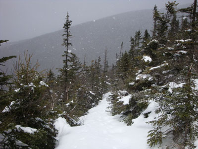
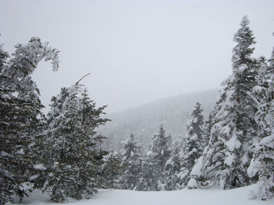
Looking down the Kilkenny Ridge Trail
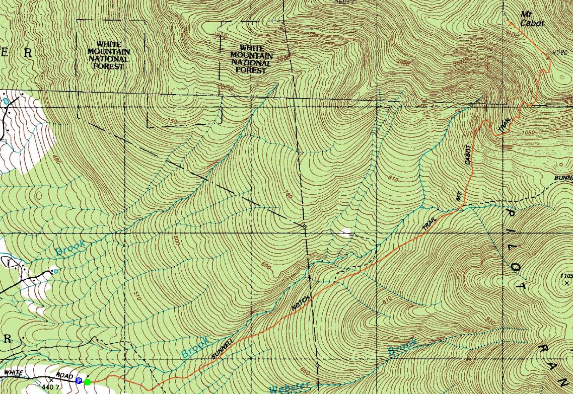
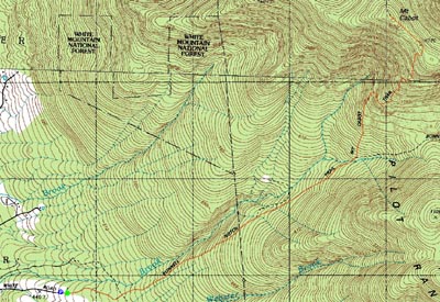
Route: Mt. Cabot Trail, Kilkenny Ridge Trail, bushwhack, (Mt. Cabot), Kilkenny Ridge Trail, Mt. Cabot Trail
My plan, with a nice weather forecast, was to hike Mt. Moriah. Upon waking up to a changed forecast, and then upon seeing the Carter Range in and out of the clouds, I decided to continue north and hike Mt. Cabot.
Arriving at the trailhead, temperatures were below freezing, the wind was whipping, and snow was falling. Great fun.
Conditions were such that I was able to bareboot from the trailhead to the summit. The first few hundred vertical feet of the trail was snow free, followed by patches of snow, ice, and mud, and then wall to wall snow. Fortunately, the top water crossing was easily done on a downed log.
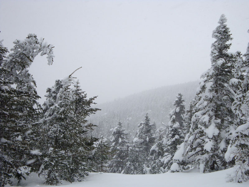
Once on the Kilkenny Ridge Trail, it was mid-winter hiking - cold winds and 1-3" of new snow. Not surprisingly, there weren't any views from the summit due to the storm.
As I descended, small peaks of sunshine broke through. Other than pausing briefly to grab some photos of a bull moose, I went nonestop back to the base, reaching the trailhead only to see the mountain had broken out of the storm.
| Hike Ratings |
|
Getting To Trailhead: |
Moderate |
| Destination: |
Mt. Cabot |
|
Length: |
Moderate |
|
Steepness: |
Moderate |
|
Navigation: |
Moderate |
|
Views: |
Minimal (due to weather) |
|
Crowds: |
Minimal |
|
| Hike Stats |
|
Date Hiked: |
Sunday, April 12, 2009 |
| Hike Commenced: |
9:32 AM |
| Parking Elevation: |
1,490' |
| Destination: |
Mt. Cabot |
| Ascent Commenced: |
9:33 AM |
| Summit Reached: |
11:31 AM |
| Time Elapsed: |
01:58 |
| Trailhead Elevation: |
1,510' |
| Summit Elevation: |
4,170' |
| Distance: |
3.9 miles |
| Vertical Gain: |
2,760' |
|
|
| Hike Ended: |
1:23 PM |
| Hike Time Elapsed: |
03:51 |
| Hike Distance: |
7.8 miles |
| Hike Vertical Gain: |
2,880' |
|
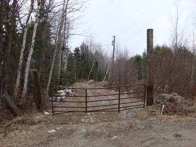
The Mt. Cabot Trail trailhead on Arthur White Road
The view from the former fire tower location near the Mt. Cabot summit
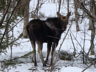
A bull moose looking for spring

Directions to trailhead: Take US 2 West through Jefferson. After passing through downtown, take a right onto North Road. A few minutes down this road, when it curves to the left, take a right onto Gore Road. Not too long after a sharp left turn (Gore Road becomes Garland Road), take a right onto Pleasant Valley Road. Soon thereafter, take a right onto Arthur White Road. The trailhead, marked by a gate, is at the top of this road (left and right are both private drives). Please respect private property by obeying all signs and not blocking any roads, gates, or driveways.
Back to Mt. Cabot Profile
|