Home
States
Colorado
Connecticut
Maine
Massachusetts
New Hampshire
New York
Rhode Island
Utah
Vermont
View All
Lists
NE 4,000 Footers
NE 100 Highest
NH 4,000 Footers
NH 100 Highest
NH 52 With A View
NH Belknap Range
NH Ossipee 10
Links
Trail Conditions
Trip Log
Sunrises
Sunsets
About
|
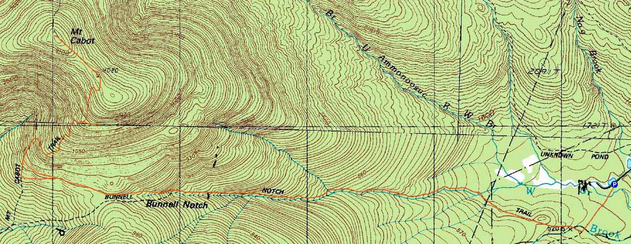
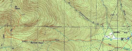
Mt. Cabot
Lancaster, NH, Kilkenny, NH
Trailheads, measurements, times, distances, and maps are all approximate and relative to the hike(s) as shown below.
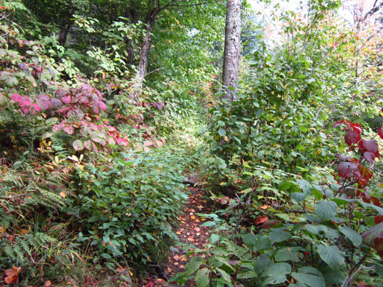
Looking up the Bunnell Notch Trail
Route: York Pond Trail, Bunnell Notch Trail, Kilkenny Ridge Trail, (Mt. Cabot), Kilkenny Ridge Trail, bushwhack, Kilkenny Ridge Trail, Bunnell Notch Trail, York Pond Trail
Starting on the York Pond and Bunnell Notch Trails, there were some nice early fall foliage colors in the trees and hobblebush. Brisk temperatures and cloud skies resulted in a steady walking pace. Above Bunnell Notch, winds and colder temperatures resulted in some sleet and snow flurries - the first winter hike of the summer.
After reaching the highpoint, we doubled back to the Cabot Cabin and waited out the fog and snow for a bit. Once the sun burned through and the rime started falling out of the trees, we headed a bit down the Kilkenny Ridge Trail, then bushwhacked out to the massive talus fields.
While the fog was slow to lift on nearby peaks, we were able to eventually see the Mahoosucs, Carters, lower slopes of the Presidentials, and the Green Mountains from the excellent vista.
| Hike Ratings |
|
Getting To Trailhead: |
Easy |
| Destination: |
Mt. Cabot |
|
Length: |
Moderate |
|
Steepness: |
Moderate |
|
Navigation: |
Easy |
|
Views: |
Excellent |
|
Crowds: |
Minimal |
|
| Hike Stats |
|
Date Hiked: |
Friday, September 16, 2011 |
| Parking Elevation: |
1,670' |
| Destination: |
Mt. Cabot |
| Time Elapsed: |
02:02 |
| Trailhead Elevation: |
1,670' |
| Summit Elevation: |
4,170' |
| Vertical Gain: |
2,800' |
|
|
| Hike Time Elapsed: |
06:04 |
| Hike Vertical Gain: |
3,100' |
|
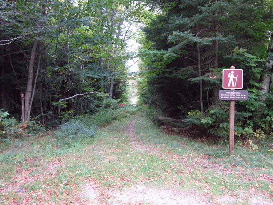
The York Pond Trail trailhead
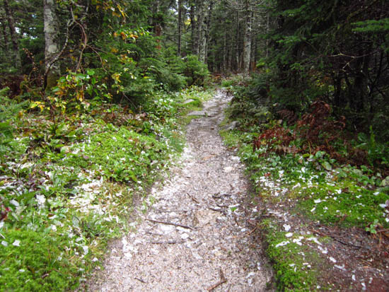
Rime ice on the Kilkenny Ridge Trail
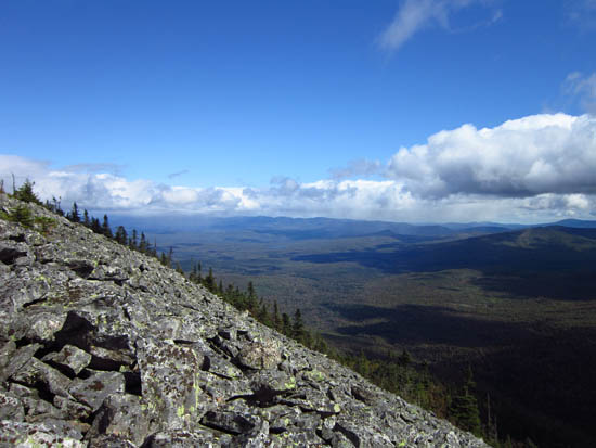
Looking east from the Cabot talus field

Directions to trailhead: Take Route 16 to Berlin, then take Route 110 west. York Pond Road will eventually be on the left. Continue through the Fish Hatchery (do be aware that the gates are only open during the day, usually 8 AM - 4 PM). The York Pond Trail trailhead and small parking area will eventually be on the left, shortly after passing the Unknown Pond Trail parking area on the right.
Back to Mt. Cabot Profile
|