Home
States
Colorado
Connecticut
Maine
Massachusetts
New Hampshire
New York
Rhode Island
Utah
Vermont
View All
Lists
NE 4,000 Footers
NE 100 Highest
NH 4,000 Footers
NH 100 Highest
NH 52 With A View
NH Belknap Range
NH Ossipee 10
Links
Trail Conditions
Trip Log
Sunrises
Sunsets
About
|
Mt. Cabot
Lancaster, NH, Kilkenny, NH
Trailheads, measurements, times, distances, and maps are all approximate and relative to the hike(s) as shown below.
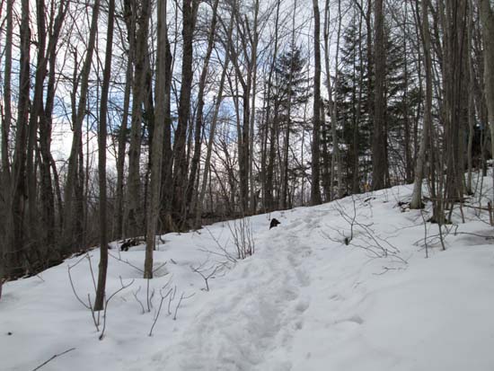
Looking up the Bunnell Notch Trail
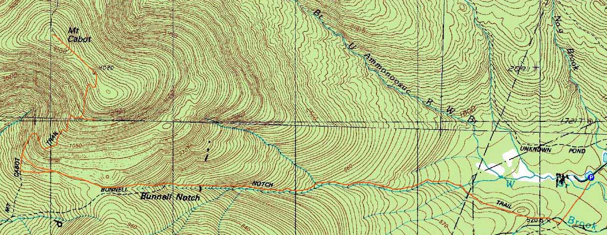
Route: York Pond Trail, Bunnell Notch Trail, Kilkenny Ridge Trail, (Mt. Cabot), Kilkenny Ridge Trail, bushwhack, Kilkenny Ridge Trail, Bunnell Notch Trail, York Pond Trail
Cold temperatures with wind, spring temperatures, clouds, sun, snow flurries...typical April day on Cabot?
Snowpack was firm to start. Logging road portion of Bunnell Notch Trail has a monorail in the middle, but the sides are starting to melt down to dirt. Snowpack increases as trail turns to go into the woods. Monorail in the woods up to the notch took a bit of a beating in the afternoon and was narrow to begin with. I barebooted this section morning and afternoon with careful steps in the middle that avoided postholing.
Snowpack increases above Mt. Cabot Trail junction. In the morning, I barebooted all the way to the cabin, as the snowpack had set up and was quick firm. Others opted for light traction. In the afternoon, I snowshoed this section without issue. Monorail is sticking up, but a bit wider as one climbs.
Above the cabin to the summit, we snowshoed roundtrip. The trail is not as well defined and various monorails come and go. Snowpack was relatively firm in the morning, but I would suggest bringing snowshoes if attempting this section in the near future, as losing the monorail or ending up here with the snowpack is soft would result in really uncomfortable, slow postholing. Easily 3 feet of snowpack up here still.
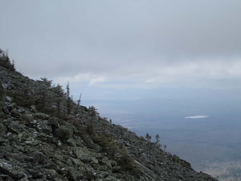
On the descent, we left the trail maybe 7 minutes below the cabin and bushwhacked east to the scree fields. Our snowshoe tracks should be visible tomorrow, so if you've ever wondered about these, this is a good time to go. The scree fields are snow free and, if you walk to the center (they're easily a quarter mile long), the views are spectacular, ranging from the Mahoosucs to the Presidentials to the Green Mountains. Passing fog minimized our views today, but we still were able to see the Mahoosucs and Moriahs on occasion. A spectacular place to eat lunch.
Overall, the snowpack is becoming patchy at the base, maybe 6-12" with significant bare spots in the notch (monorail is taller), and deeper as one approaches and passes Bunnell Rock.
No recent tracks heading toward North Terrace, down Mt. Cabot Trail, or toward The Bulge.
| Hike Ratings |
|
Getting To Trailhead: |
Easy |
| Destination: |
Mt. Cabot |
|
Length: |
Moderate |
|
Steepness: |
Moderate |
|
Navigation: |
Easy |
|
Views: |
Minimal (due to weather) |
|
Crowds: |
Minimal |
|
| Hike Stats |
|
Date Hiked: |
Saturday, April 19, 2014 |
| Parking Elevation: |
1,670' |
| Destination: |
Mt. Cabot |
| Time Elapsed: |
03:15 |
| Trailhead Elevation: |
1,670' |
| Summit Elevation: |
4,170' |
| Vertical Gain: |
2,800' |
|
|
| Hike Time Elapsed: |
07:09 |
| Hike Vertical Gain: |
3,100' |
|
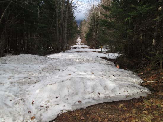
The York Pond Trail trailhead
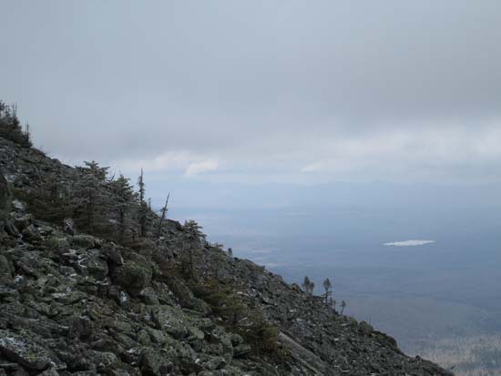
Looking east from the Cabot talus field
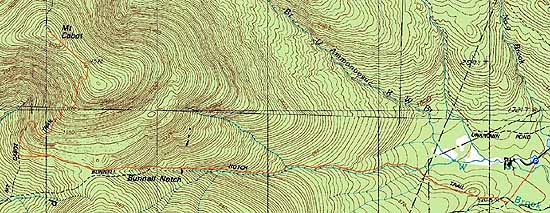

Directions to trailhead: Take Route 16 to Berlin, then take Route 110 west. York Pond Road will eventually be on the left. Continue through the Fish Hatchery (do be aware that the gates are only open during the day, usually 8 AM - 4 PM). The York Pond Trail trailhead and small parking area will eventually be on the left, shortly after passing the Unknown Pond Trail parking area on the right.
Back to Mt. Cabot Profile
|