Home
States
Colorado
Connecticut
Maine
Massachusetts
New Hampshire
New York
Rhode Island
Utah
Vermont
View All
Lists
NE 4,000 Footers
NE 100 Highest
NH 4,000 Footers
NH 100 Highest
NH 52 With A View
NH Belknap Range
NH Ossipee 10
Links
Trail Conditions
Trip Log
Sunrises
Sunsets
About
|
Mt. Cabot
Lancaster, NH, Kilkenny, NH
Trailheads, measurements, times, distances, and maps are all approximate and relative to the hike(s) as shown below.

Looking up the Kilkenny Ridge Trail
Route: York Pond Trail, Bunnell Notch Trail, Kilkenny Ridge Trail, (Mt. Cabot), Kilkenny Ridge Trail, bushwhack, Kilkenny Ridge Trail, Bunnell Notch Trail, York Pond Trail
Trail was a nice packed snowshoe track up to the cabin, however parasitic postholers were reaping havoc late this morning. I can't imagine what it looked like this afternoon when the temperatures climbed above freezing. Some without snowshoes seemed oblivious to how much snow there is, where the sun was moving to, how warm it was getting, and how deep they would be postholing in those conditions on the way down. Others had no idea that the path from the cabin to the summit was not well broken out and was not kosher with the trail (have fun postholing into a buried spruce tree). Others didn't care at all, saying "I don't need snowshoes." Well, thanks for trashing the trail for everyone else (perhaps you also pee on the toilet seat, not caring about the next user). But, there was some karma, seeing how much extra effort they were putting in spinning their wheels with their Microspikes, as opposed to those gliding along smoothly on snowshoes.
The majority of the ascent has about 3 to 4 feet of snowpack. On the ridge, the snowpack is probably 5 to 7 feet, judging by the treetop views and that the "summit" sign had to be dug out.
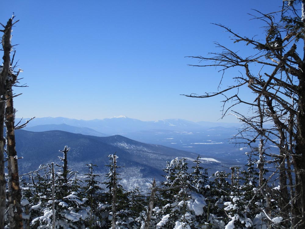
Beautiful spring like weather - mild temperatures, not a cloud in the sky. Birch glades were particularly, contrasting with the deep blue.
| Hike Ratings |
|
Getting To Trailhead: |
Easy |
| Destination: |
Mt. Cabot |
|
Length: |
Moderate |
|
Steepness: |
Moderate |
|
Navigation: |
Moderate |
|
Views: |
Excellent |
|
Crowds: |
Moderate |
|
| Hike Stats |
|
Date Hiked: |
Saturday, March 9, 2019 |
| Parking Elevation: |
1,670' |
| Destination: |
Mt. Cabot |
| Time Elapsed: |
02:04 |
| Trailhead Elevation: |
1,670' |
| Summit Elevation: |
4,170' |
| Vertical Gain: |
2,780' |
|
|
| Hike Time Elapsed: |
03:56 |
| Hike Vertical Gain: |
3,060' |
|

The York Pond Trail trailhead

Looking at Mt. Lafayette from near the summit of Mt. Lafayette
Directions to trailhead: Take Route 16 to Berlin, then take Route 110 west. York Pond Road will eventually be on the left. Continue through the Fish Hatchery (do be aware that the gates are only open during the day, usually 8 AM - 4 PM). The York Pond Trail trailhead and small parking area will eventually be on the left, shortly after passing the Unknown Pond Trail parking area on the right.
Back to Mt. Cabot Profile
|