Home
States
Colorado
Connecticut
Maine
Massachusetts
New Hampshire
New York
Rhode Island
Utah
Vermont
View All
Lists
NE 4,000 Footers
NE 100 Highest
NH 4,000 Footers
NH 100 Highest
NH 52 With A View
NH Belknap Range
NH Ossipee 10
Links
Trail Conditions
Trip Log
Sunrises
Sunsets
About
|
Mt. Carrigain
Livermore, NH
Trailheads, measurements, times, distances, and maps are all approximate and relative to the hike(s) as shown below.
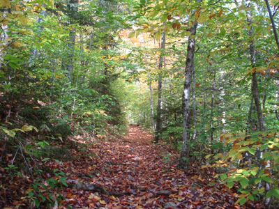
Fall on the Signal Ridge Trail
Route: Signal Ridge Trail
While I had wanted to hike Mt. Carrigain again for awhile, I didn't get an opportunity with a good forecast until this day. Of course, as I headed up, I could see the summit was in a cloud.
I quickly set off from the trailhead, rapidly remembering how the footing on significant parts of the Signal Ridge Trail is poor. The first set of brook crossings was no problem, however as I later reached the second set, I couldn't see much in way of stepping stones - in fact, they were submerged under an inch or two of water. Grabbing a stick, I balanced my way across, finding out that my newish waterproof hiking boots were in fact waterproof, unlike my previous pair of waterproof hiking boots.
The foliage down low was quite colorful - though probably not peak, it was still rather scenic. While I remembered the actual ascent to be tiring and long, it didn't seem quite as bad this time around. Hoping the summit would be clear by the time I neared it, I could see from the top of Signal Ridge that it was still obscured by clouds.
As I crossed the ridge and started the last piece of ascent (left at the quasi intersection of unmarked trails), I suddenly saw white stuff. Not even one full week into October and I was hiking in snow.
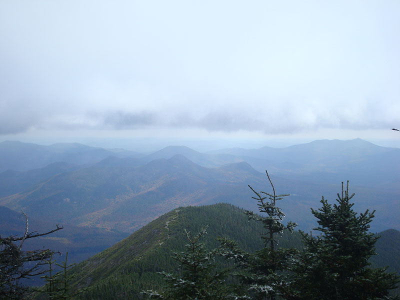
It was snowing very lightly on the summit with strong, bitterly cold winds. After climbing the tower to see nothing but cloud, I retreated down the trail a bit for lunch. Looking through the trees, I could soon see the horizon appearing. Hustling back up to the summit, I had a few minutes of halfway decent (though still very obscured) views to the east and west.
Back over on Signal Ridge, the views were a bit better - the valley between the Captain, Vose Spur, and Signal Ridge looked quite colorful.
While I had hoped for a great fall day, it wasn't quite that while I was up on the mountain. Nonetheless, it was still nice to be out on the trails.
| Hike Ratings |
|
Getting To Trailhead: |
Easy |
| Destination: |
Mt. Carrigain |
|
Length: |
Difficult |
|
Steepness: |
Difficult |
|
Navigation: |
Moderate |
|
Views: |
Excellent |
|
Crowds: |
Heavy |
|
| Hike Stats |
|
Date Hiked: |
Saturday, October 4, 2008 |
| Hike Commenced: |
9:17 AM |
| Parking Elevation: |
1,370' |
| Destination: |
Mt. Carrigain |
| Ascent Commenced: |
9:18 AM |
| Summit Reached: |
11:31 PM |
| Time Elapsed: |
02:13 |
| Trailhead Elevation: |
1,370' |
| Summit Elevation: |
4,700' |
| Distance: |
5 miles |
| Vertical Gain: |
3,430' |
|
|
| Hike Ended: |
2:37 PM |
| Hike Time Elapsed: |
05:20 |
| Hike Vertical Gain: |
3,640' |
|
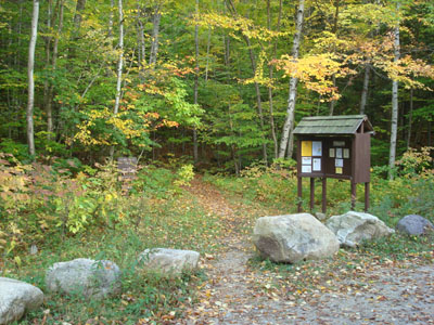
Signal Ridge Trail trailhead on Sawyer River Road
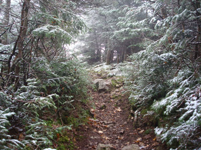
Early winter near the top of the Signal Ridge Trail
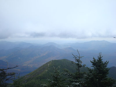
Looking to the east from the Mt. Carrigain summit lookout tower

Directions to trailhead: Take Route 302 West from Bartlett to Sawyer River Road. WMNF fee parking lot is a few minutes up the dirt road on the left. Trailhead is across the road.
Back to Mt. Carrigain Profile
|