Home
States
Colorado
Connecticut
Maine
Massachusetts
New Hampshire
New York
Rhode Island
Utah
Vermont
View All
Lists
NE 4,000 Footers
NE 100 Highest
NH 4,000 Footers
NH 100 Highest
NH 52 With A View
NH Belknap Range
NH Ossipee 10
Links
Trail Conditions
Trip Log
Sunrises
Sunsets
About
|
Mt. Carrigain
Livermore, NH
Trailheads, measurements, times, distances, and maps are all approximate and relative to the hike(s) as shown below.
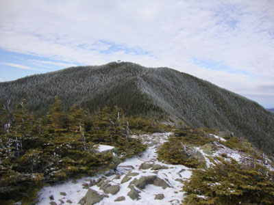
Looking up the Signal Ridge Trail
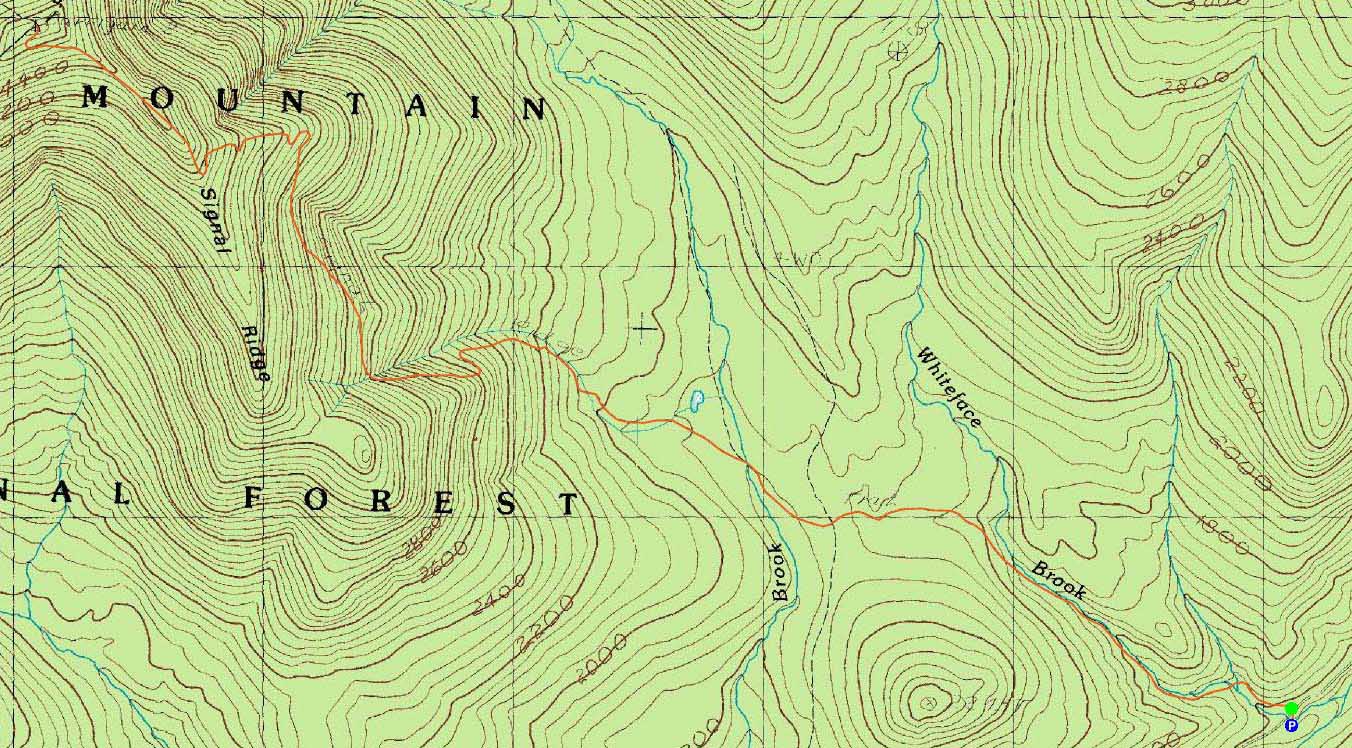
Route: Signal Ridge Trail
The forecast looked perfect for Carrigain - Sawyer River Road was still open, the winds were forecasted to be a bit much in the Presidentials, and the morning was supposed to be sunny. As such, quite a few other folks had the same idea.
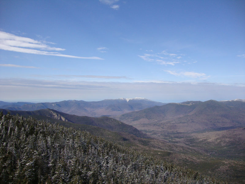
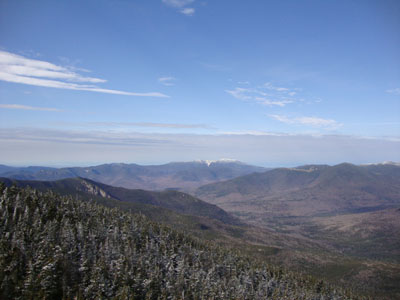
The water crossings were a bit tricky, as there was some ice on the non-submerged rocks. Reaching the steeps, the consistent snow started - never more than an inch. Arriving on Signal Ridge, the Presidentials were lit up in white. Clouds were moving in, as forecasted, so the lighting was unfortunately not going to stay that way.
The summit wasn't overly cold, though there was a little bit of wind up on the fire tower. The clouds had moved in just enough to take away the magnificent
Presidential lighting. Since it was such a nice day, and because I wanted to see the peaks in better lighting, and because I wanted to work on getting my colder weather acclimation, I hung out on the summit for a good 45 minutes - though I ran out of patience in waiting for the light to reach the Presidentials again, the Franconias light up nicely as a large clould moved on.
The snow line had moved up slightly in a few hours, as the more mild daytime temperatures had moved in. A nice day for Carrigain.
| Hike Ratings |
|
Getting To Trailhead: |
Easy |
| Destination: |
Mt. Carrigain |
|
Length: |
Difficult |
|
Steepness: |
Difficult |
|
Navigation: |
Moderate |
|
Views: |
Excellent |
|
Crowds: |
Heavy |
|
| Hike Stats |
|
Date Hiked: |
Saturday, November 7, 2009 |
| Hike Commenced: |
8:25 AM |
| Parking Elevation: |
1,370' |
| Destination: |
Mt. Carrigain |
| Ascent Commenced: |
8:26 AM |
| Summit Reached: |
10:34 PM |
| Time Elapsed: |
02:12 |
| Trailhead Elevation: |
1,370' |
| Summit Elevation: |
4,700' |
| Distance: |
5 miles |
| Vertical Gain: |
3,430' |
|
|
| Hike Ended: |
1:34 PM |
| Hike Time Elapsed: |
05:09 |
| Hike Distance: |
10 miles |
| Hike Vertical Gain: |
3,540' |
|
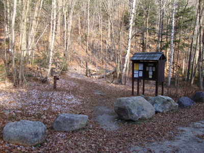
Signal Ridge Trail trailhead on Sawyer River Road
Looking the Franconia Ridge from the Mt. Carrigain summit lookout tower

Directions to trailhead: Take Route 302 West from Bartlett to Sawyer River Road. WMNF fee parking lot is a few minutes up the dirt road on the left. Trailhead is across the road.
Back to Mt. Carrigain Profile
|