Home
States
Colorado
Connecticut
Maine
Massachusetts
New Hampshire
New York
Rhode Island
Utah
Vermont
View All
Lists
NE 4,000 Footers
NE 100 Highest
NH 4,000 Footers
NH 100 Highest
NH 52 With A View
NH Belknap Range
NH Ossipee 10
Links
Trail Conditions
Trip Log
Sunrises
Sunsets
About
|
Mt. Carrigain
Livermore, NH
Trailheads, measurements, times, distances, and maps are all approximate and relative to the hike(s) as shown below.
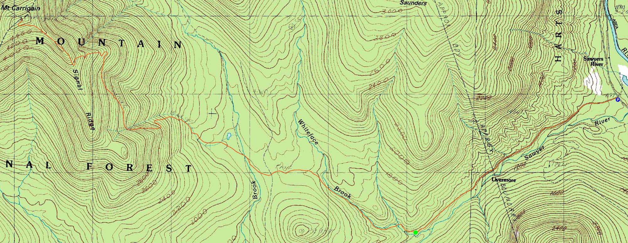
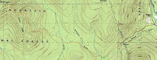
The Signal Ridge Trail
Route: Sawyer River Road, Signal Ridge Trail, bushwhack, (Mt. Carrigain), Signal Ridge Trail, Sawyer River Road, herdpath
With nice weather but somewhat high winds, we headed to Carrigain. Starting on the closed Sawyer River Road, we decided to practice pulling a sled for the roadwalk. While it didn't seem to be much of a time or energy saver for the ascent, it was nice to descend the road without having packs on our backs.
Starting on the Signal Ridge Trail, snow coverage was minimal in the lower elevations. The first set of crossings was ice bridged (not overly solid), while the second crossing was wide open (as usual).
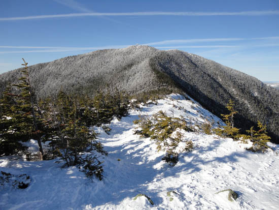
Eventually reaching the switchbacks with direct sunlight, our progress was slowed due to snow sticking on our snowshoes. Nonetheless, we eventually reached Signal Ridge, from where we had strong views.
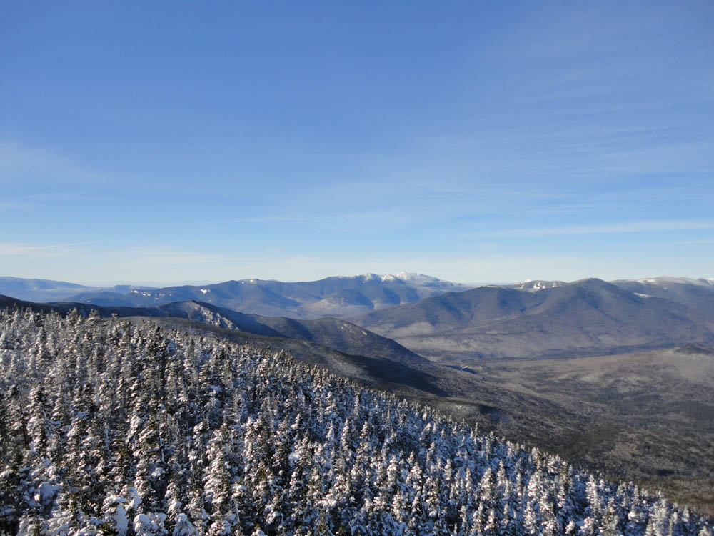
Continuing up to the summit and fire tower, there were excellent views in all directions, ranging to perhaps 100 miles.
After an extended lunch break in seasonally mild temperatures, we made our way back down to the base in the springlike trail conditions.
| Hike Ratings |
|
Getting To Trailhead: |
Difficult |
| Destination: |
Mt. Carrigain |
|
Length: |
Difficult |
|
Steepness: |
Difficult |
|
Navigation: |
Easy |
|
Views: |
Excellent |
|
Crowds: |
Minimal |
|
| Hike Stats |
|
Date Hiked: |
Thursday, December 30, 2010 |
| Hike Commenced: |
8:09 AM |
| Parking Elevation: |
900' |
| Destination: |
Mt. Carrigain |
| Ascent Commenced: |
9:04 AM |
| Summit Reached: |
12:37 PM |
| Time Elapsed: |
03:33 |
| Trailhead Elevation: |
1,370' |
| Summit Elevation: |
4,700' |
| Vertical Gain: |
3,440' |
|
|
| Hike Ended: |
4:42 PM |
| Hike Time Elapsed: |
08:33 |
| Hike Vertical Gain: |
4,040' |
|
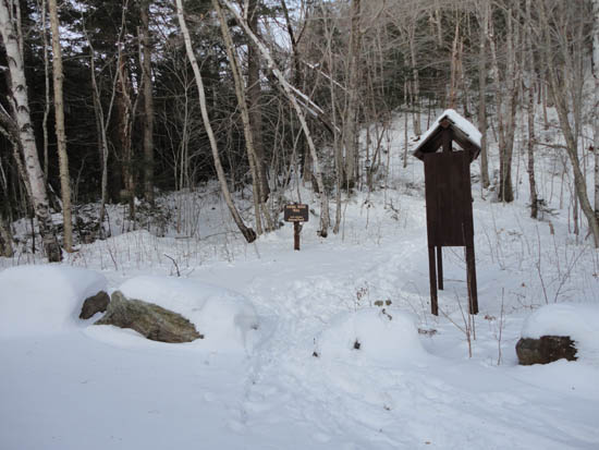
Signal Ridge Trail trailhead on Sawyer River Road
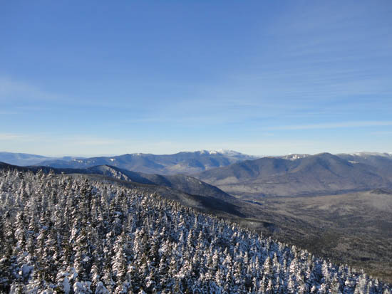
Looking at the Franconia Ridge from the Mt. Carrigain summit lookout tower

Directions to trailhead: Take Route 302 West from Bartlett to Sawyer River Road. In winter, there is a WMNF fee parking lot located to the left of the closed Sawyer River Road. The Signal Ridge Trail is 2 miles up Sawyer River Road, on the right.
Back to Mt. Carrigain Profile
|