Home
States
Colorado
Connecticut
Maine
Massachusetts
New Hampshire
New York
Rhode Island
Utah
Vermont
View All
Lists
NE 4,000 Footers
NE 100 Highest
NH 4,000 Footers
NH 100 Highest
NH 52 With A View
NH Belknap Range
NH Ossipee 10
Links
Trail Conditions
Trip Log
Sunrises
Sunsets
About
|
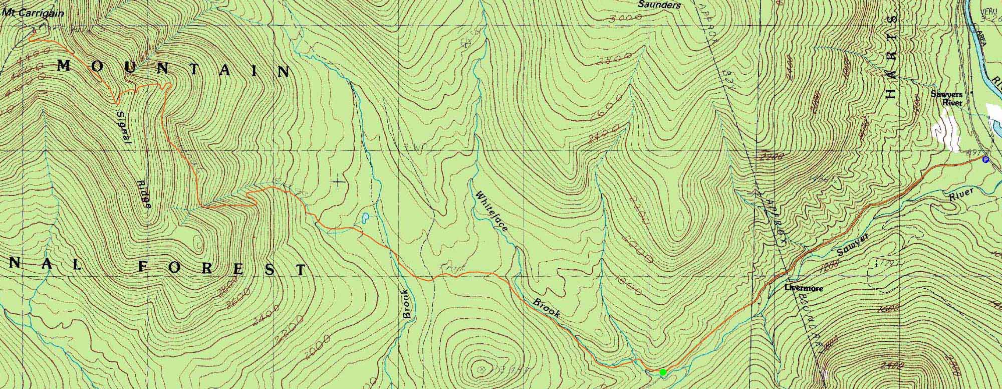
Mt. Carrigain
Livermore, NH
Trailheads, measurements, times, distances, and maps are all approximate and relative to the hike(s) as shown below.
The Signal Ridge Trail
Route: Sawyer River Road, Signal Ridge Trail, (Mt. Carrigain), Signal Ridge Trail, Sawyer River Road
At 10 miles roundtrip with significant vertical, Mt. Carrigain is enough of a task for Flags on the 48 (carrying a flag to the summit and flying it from 12 to 2 as a memorial for September 11th). After Hurricane Irene and the subsequent flooding, it became even more of a task, as Sawyer River Road was closed and portions of the roadwalk and trail involved getting around washouts.
There was one significant washout on Sawyer River Road, requiring a careful walk on a narrow dirt shelf. On the lower Signal Ridge Trail, the stepping stones on the water crossings were long gone. In addition, a section or two of the trail had washed into the brook.
Once on the actual ascent, the trail was in better shape (though perhaps rockier than before).
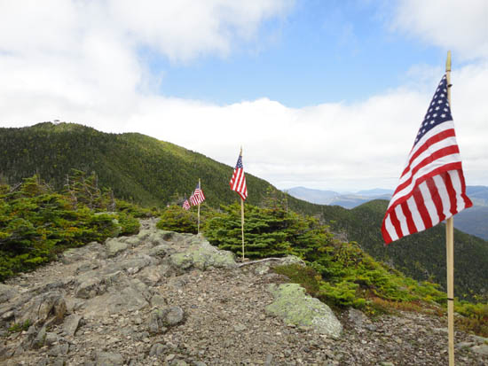
While the weather was overall good, the temperatures were chilly on top and the skies progressively cloudy. Nonetheless, we were able to fly the flag in clear conditions.
| Hike Ratings |
|
Getting To Trailhead: |
Difficult |
| Destination: |
Mt. Carrigain |
|
Length: |
Difficult |
|
Steepness: |
Difficult |
|
Navigation: |
Easy |
|
Views: |
Excellent |
|
Crowds: |
Moderate |
|
| Hike Stats |
|
Date Hiked: |
Sunday, September 11, 2011 |
| Time to Trailhead: |
00:39 |
| Parking Elevation: |
900' |
| Destination: |
Mt. Carrigain |
| Time Elapsed: |
03:05 |
| Trailhead Elevation: |
1,370' |
| Summit Elevation: |
4,700' |
| Vertical Gain: |
3,440' |
|
|
| Hike Time Elapsed: |
10:23 |
| Hike Vertical Gain: |
4,040' |
|
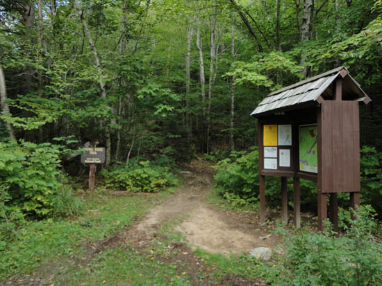
Signal Ridge Trail trailhead on Sawyer River Road
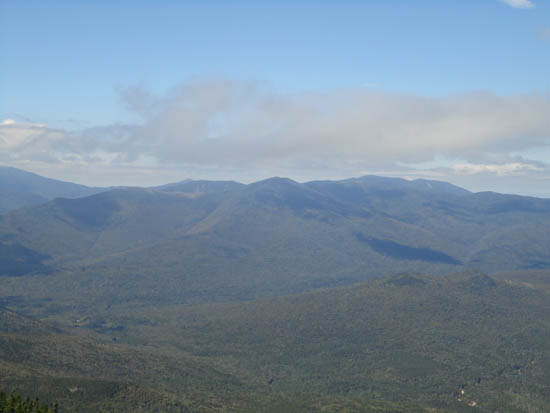
Looking at the Bonds from the Mt. Carrigain summit lookout tower
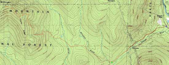

Directions to trailhead: Take Route 302 West from Bartlett to Sawyer River Road. In September 2011, Sawyer River Road was closed to vehicles due to a washout. There is a WMNF fee parking lot located to the left of the closed Sawyer River Road. The Signal Ridge Trail is 2 miles up Sawyer River Road, on the right.
Back to Mt. Carrigain Profile
|