Home
States
Colorado
Connecticut
Maine
Massachusetts
New Hampshire
New York
Rhode Island
Utah
Vermont
View All
Lists
NE 4,000 Footers
NE 100 Highest
NH 4,000 Footers
NH 100 Highest
NH 52 With A View
NH Belknap Range
NH Ossipee 10
Links
Trail Conditions
Trip Log
Sunrises
Sunsets
About
|
Mt. Crawford
Hart's Location, NH, Hadley's Purchase, NH
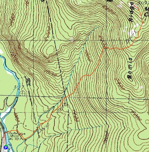
Trailheads, measurements, times, distances, and maps are all approximate and relative to the hike(s) as shown below.
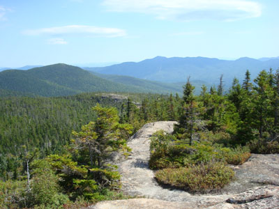
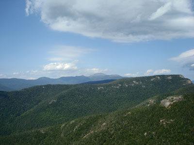
Looking down the spur trail near the Mt. Crawford summit
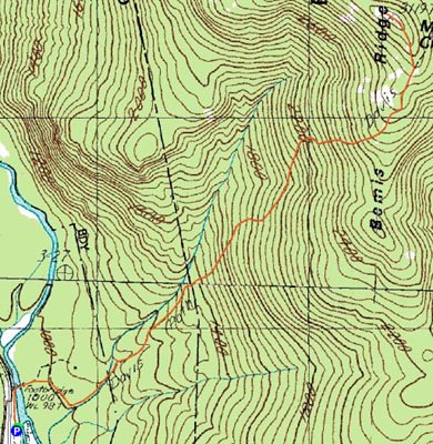
Route: Davis Path, unnamed Mt. Crawford spur trail, (Mt. Crawford), unnamed Mt. Crawford spur trail, Davis Path
After having hiked Mt. Adams, Mt. Madison, and Old Speck Mountain over the weekend, I was a bit tired. Nonetheless, looking out the window and seeing a really nice day, I decided to take a half day off from work and do a smaller hike. Having seen Mt. Crawford from Mt. Willey a few days earlier, I decided I wanted to give it a try.
Arriving at the Davis Path parking lot, I was shocked to see only a few vehicles - not quite what I expected for a really nice Labor Day.
The hike started off rather gently, before starting it's ascent at the wilderness boundary. From there it's a fairly steady ascent, including numerous rock stairways.
After going by a false summit of sorts, I was getting somewhat nervous about missing the spur trail to the Mt. Crawford summit. Sure enough, I looked up and saw a faded Mt. Crawford sign - not really in a direction that one can see when going uphill.
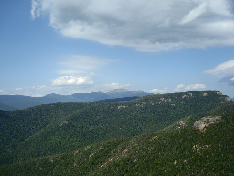
The spur trail was marked with yellow blazes/arrows on the numerous ledges. The views from the summit were excellent - strong in all directions. After taking in the views for a bit, I decided to call it a day.
On the way down I listened to Weezer's Blue and Talk Talk's Spirit of Eden. A nice afternoon for a hike.
| Hike Ratings |
|
Getting To Trailhead: |
Easy |
| Destination: |
Mt. Crawford |
|
Length: |
Moderate |
|
Steepness: |
Difficult |
|
Navigation: |
Easy |
|
Views: |
Excellent |
|
Crowds: |
Moderate |
|
| Hike Stats |
|
Date Hiked: |
Monday, September 3, 2007 |
| Hike Commenced: |
12:37 PM |
| Parking Elevation: |
995' |
| Destination: |
Mt. Crawford |
| Ascent Commenced: |
12:37 PM |
| Summit Reached: |
1:52 PM |
| Time Elapsed: |
01:15 |
| Trailhead Elevation: |
995' |
| Summit Elevation: |
3,119' |
| Distance: |
2.5 miles |
| Vertical Gain: |
2,144' |
|
|
| Hike Ended: |
3:27 PM |
| Hike Time Elapsed: |
02:50 |
| Hike Vertical Gain: |
2,164' |
|
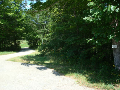
The Davis Path trailhead
Looking north-northeast at Mt. Washington from the Mt. Crawford summit

Directions to trailhead: Take Route 302 West from Bartlett. The Davis Path parking lot and trailhead will be on the right.
Back to Mt. Crawford Profile
|