Home
States
Colorado
Connecticut
Maine
Massachusetts
New Hampshire
New York
Rhode Island
Utah
Vermont
View All
Lists
NE 4,000 Footers
NE 100 Highest
NH 4,000 Footers
NH 100 Highest
NH 52 With A View
NH Belknap Range
NH Ossipee 10
Links
Trail Conditions
Trip Log
Sunrises
Sunsets
About
|
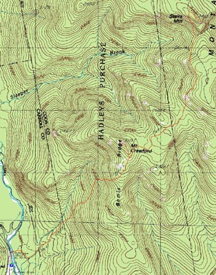
Mt. Crawford
Hart's Location, NH, Hadley's Purchase, NH, Sargent's Purchase, NH
Trailheads, measurements, times, distances, and maps are all approximate and relative to the hike(s) as shown below.
Looking up the Davis Path near Mt. Crawford
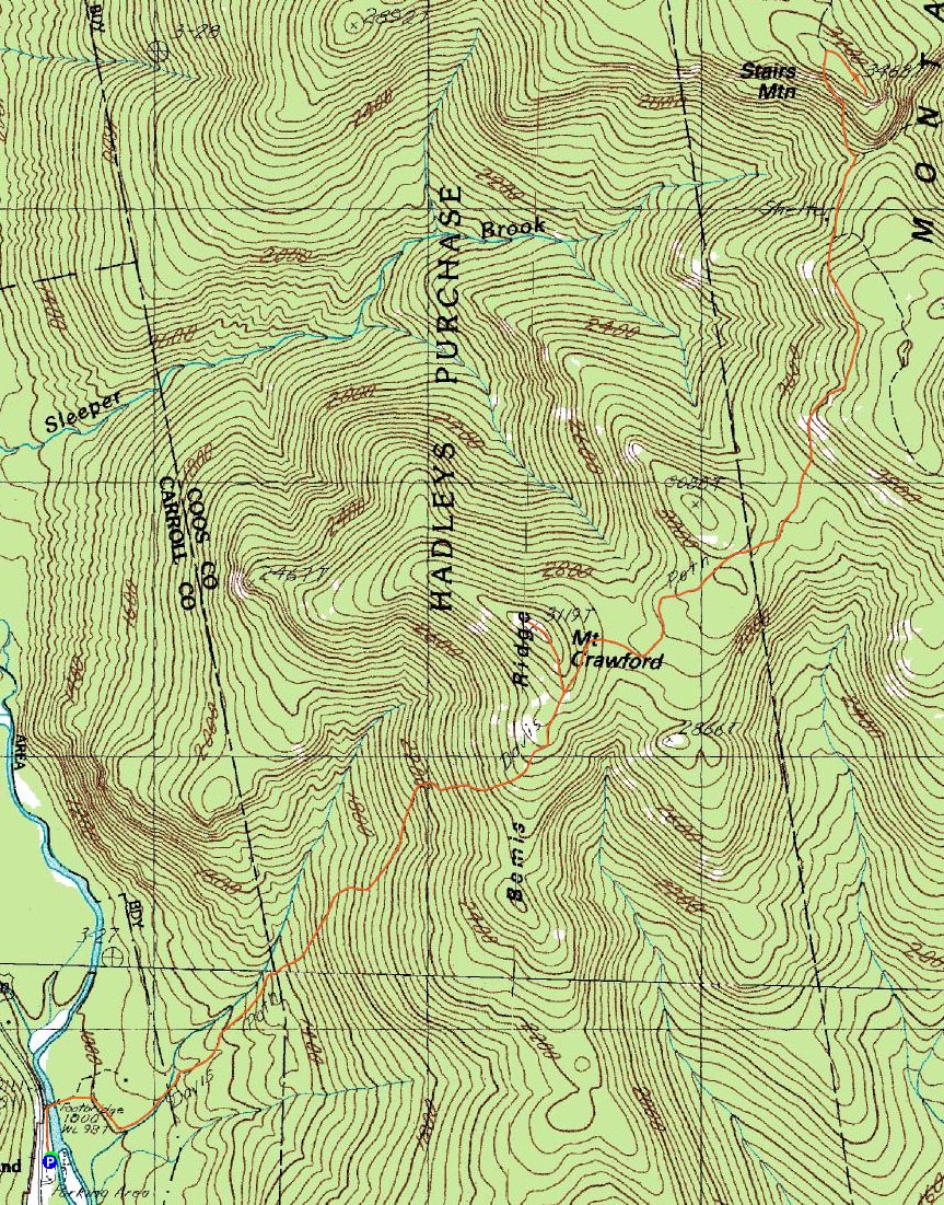
Route: Davis Path, Mt. Crawford spur trail, (Mt. Crawford), Mt. Crawford spur trail, Davis Path, Stairs Mountain spur trail, (Stairs Mountain), Stairs Mountain spur trail, Davis Path
While I had considered doing something in the Presidentials, the early wake up and possibility of below freezing temperatures persuaded me to do something a bit more tame. Since I had been considering Stairs Mountain for awhile, today seemed like a good day for it.
Arriving at an almost empty Davis Path parking lot, I set foot up the trail under clear skies. While the flats provide a nice warm up, the trail steepens up suddenly and continues at a relentless pace until reaching the ledgy areas below the Mt. Crawford spur path.
The views from the Mt. Crawford summit ledges were tremendous, though I did notice some clouds starting to move in high above.
After enjoying the views and a snack for a bit, I headed back to the Davis Path. The stretch of the Davis Path between Mt. Crawford's spur trail and the Resolution Shelter junction was awesome - good footing, neat terrain, and excellent views. Not long after the shelter, I was at the Stairs Col junction, and then on my way up the steep ascent to the Stairs Mountain spur path junction.
On the spur path, which had a few blowdowns, I took a detour along a vague herd path to what seemed to be a highpoint. I checked out a few other knobs on my way to the viewpoint, but I suspect the first one was the summit.
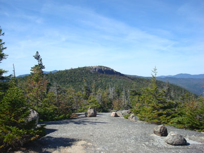
Though the sky was clouding up a bit, the views from the top of the Giant Stairs were tremendous. While it doesn't seem like you're on a stairway, the vista looks at points ranging from Thorn Mountain to the east to the numerous Pemi peaks to the south and west.
After having a long lunch break up on the ledge, I headed back on the Davis Path hiking highway. Until I reached the Mt. Crawford spur path junction, I saw very few people the entire day. Descending the last portion of the Davis Path on a nice Saturday afternoon, of course, resulted in some crowds. Nonetheless, it was still a somewhat peaceful end to the hike. I was surprised by the beauty of the area, as I had never been north of Mt. Crawford/Mt. Stanton and south of Mt. Isolation before. After this experience, I hope to get back and check out some of the other peaks nearby.
| Hike Ratings |
|
Getting To Trailhead: |
Easy |
| Destination: |
Mt. Crawford |
|
Length: |
Moderate |
|
Steepness: |
Difficult |
|
Navigation: |
Easy |
|
Views: |
Excellent |
|
Crowds: |
Minimal |
Stairs Mountain |
|
Length: |
Moderate |
|
Steepness: |
Difficult |
|
Navigation: |
Easy |
|
Views: |
Excellent |
|
Crowds: |
Minimal |
|
| Hike Stats |
|
Date Hiked: |
Saturday, September 20, 2008 |
| Hike Commenced: |
9:15 AM |
| Parking Elevation: |
995' |
| Destination: |
Mt. Crawford |
| Ascent Commenced: |
9:15 AM |
| Summit Reached: |
10:33 AM |
| Time Elapsed: |
01:18 |
| Trailhead Elevation: |
995' |
| Summit Elevation: |
3,119' |
| Distance: |
2.5 miles |
| Vertical Gain: |
2,144' |
| Destination: |
Stairs Mountain |
| Ascent Commenced: |
10:41 AM |
| Summit Reached: |
11:57 AM |
| Time Elapsed: |
01:16 |
| Trailhead Elevation: |
3,119' |
| Summit Elevation: |
3,463' |
| Distance: |
2.7 miles |
| Vertical Gain: |
1,083' |
|
|
| Hike Ended: |
2:46 PM |
| Hike Time Elapsed: |
05:31 |
| Hike Distance: |
9.8 miles |
| Hike Vertical Gain: |
3,900' |
|
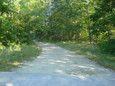
The Davis Path trailhead
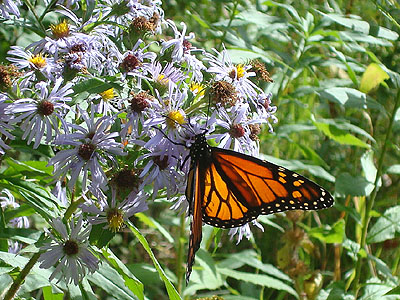
A butterfly enjoying some flowers near the Davis Path trailhead
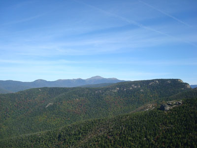
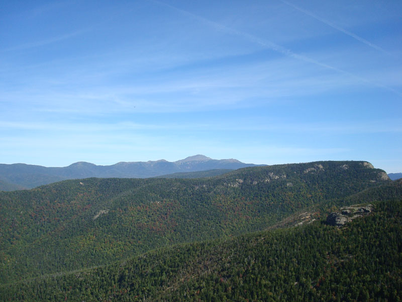
Looking north-northeast at Mt. Washington from the Mt. Crawford summit
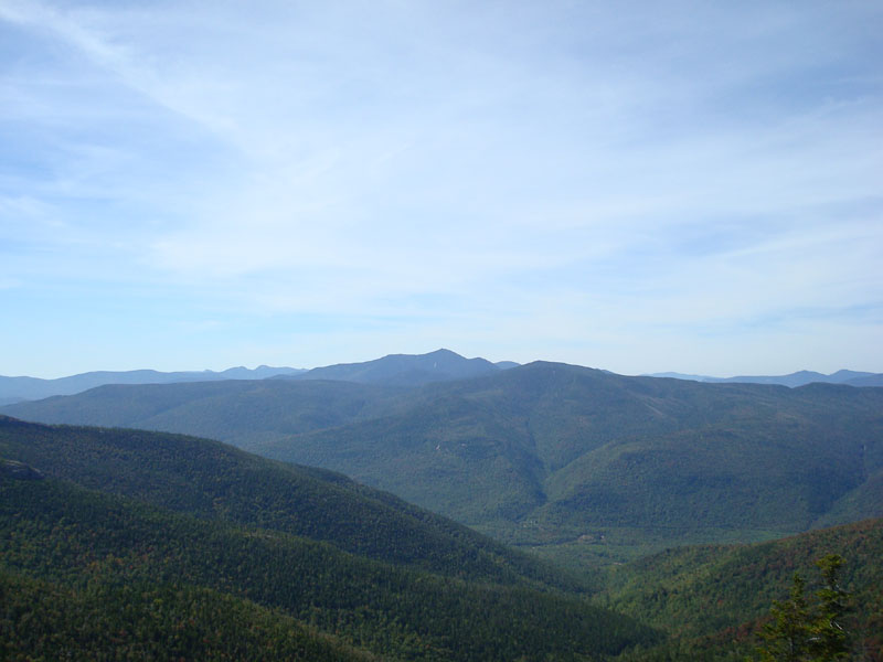
Looking down Davis Path between Mt. Crawford and Stairs Mountain
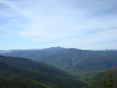
Looking at Mt. Carrigain from the Stairs Mountain viewpoint

Directions to trailhead: Take Route 302 West from Bartlett. The Davis Path parking lot and trailhead will be on the right.
Back to Mt. Crawford Profile
Back to Stairs Mountain Profile
|