Home
States
Colorado
Connecticut
Maine
Massachusetts
New Hampshire
New York
Rhode Island
Utah
Vermont
View All
Lists
NE 4,000 Footers
NE 100 Highest
NH 4,000 Footers
NH 100 Highest
NH 52 With A View
NH Belknap Range
NH Ossipee 10
Links
Trail Conditions
Trip Log
Sunrises
Sunsets
About
|
Mt. Dartmouth, Millen Hill
Crawfords Purchase, NH, Chandlers Purchase, NH, Thompson and Meserve Purchase, NH, Low and Burbanks Grant, NH
Trailheads, measurements, times, distances, and maps are all approximate and relative to the hike(s) as shown below.
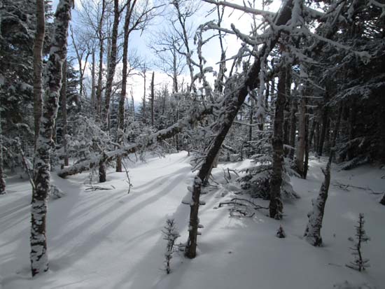
Bushwhacking to Mt. Dartmouth
Route: Jefferson Notch Road, bushwhack
Jefferson Notch Road was not gated and recently groomed for snowmobile traffic. Good snowshoeing to the height of land. One SUV drove up to the height of land (the only sign is that the road is not maintained for winter use). It looks like a vehicle went off the road a few days ago (by the looks of tracks, from nearly hitting a snowmobile) and had a heck of a time getting unstuck. Google suggests the road walk was 3.1 miles. Not nearly as long/monotonous as some others.
For Dartmouth, we slabbed along the northern shoulder, staying clear of the ridge until just about the highpoint. While the ridge has blowdown, the northern slope had nice open woods the whole way. I suspect the line we used could be done on skis due to the open woods and never overly steep grades.
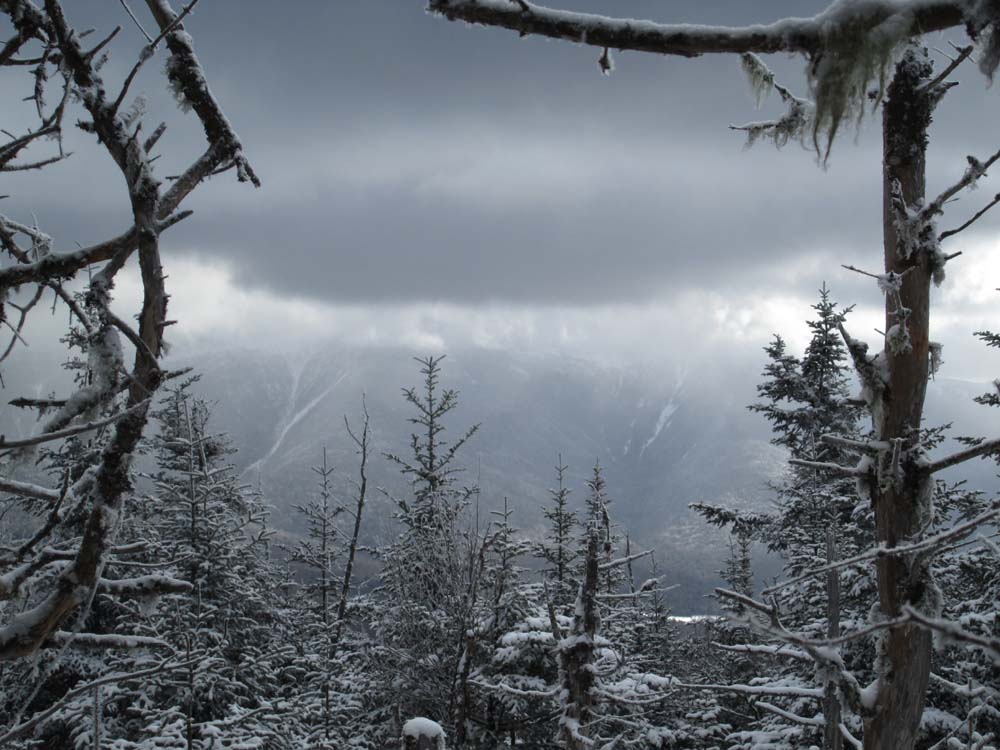
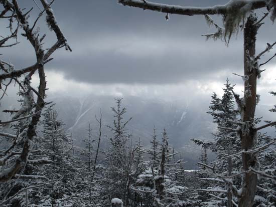
We then retraced our steps until we were north of Millen, then headed directly up the fall line, just west of the summit, to avoid more blowdown. Again, good woods. We also found a good viewpoint just south of the highpoint (perhaps enhanced by snowdrifts), ranging from the Presidentials to Bretton Woods.
Overall, there was maybe half a foot to a foot of snow down low and perhaps 8-20" in the upper elevations. The couple of times we ventured just over the south side of the ridge, the snowpack was much less in open areas. Overall today, the snowpack was pretty firm under an inch or two of powder, making for ideal snowshoe bushwhack conditions.
| Hike Ratings |
|
Getting To Trailhead: |
Difficult |
| Destination: |
Mt. Dartmouth |
|
Length: |
Moderate |
|
Steepness: |
Moderate |
|
Navigation: |
Difficult |
|
Views: |
Moderate |
|
Crowds: |
Minimal |
| Destination: |
Millen Hill |
|
Length: |
Moderate |
|
Steepness: |
Moderate |
|
Navigation: |
Difficult |
|
Views: |
Excellent |
|
Crowds: |
Minimal |
|
| Hike Stats |
|
Date Hiked: |
Saturday, January 10, 2015 |
| Parking Elevation: |
2,060' |
| Time to Trailhead: |
01:10 |
| Destination: |
Mt. Dartmouth |
| Time Elapsed: |
01:18 |
| Trailhead Elevation: |
3,009' |
| Summit Elevation: |
3,727' |
| Vertical Gain: |
762' |
| Destination: |
Millen Hill |
| Time Elapsed: |
01:13 |
| Trailhead Elevation: |
3,727' |
| Summit Elevation: |
3,355' |
| Vertical Gain: |
355' |
|
|
| Hike Time Elapsed: |
05:39 |
| Hike Vertical Gain: |
2,066' |
|
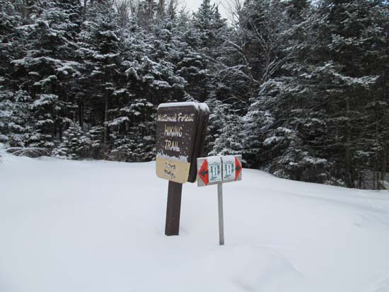
Entering the woods near the height of land on Jefferson Notch Road
Looking at the Presidentials from near the summit of Mt. Dartmouth
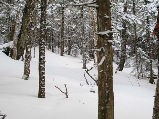
Bushwhacking to Millen Hill
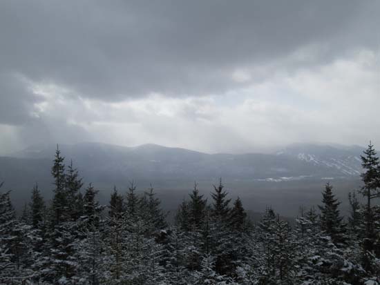
Looking at Mt. Tom and Bretton Woods from near the summit of Millen Hill
Directions to trailhead: From US 302 near Bretton Woods, turn onto the Cog Base Station Road. In winter, one may be able to park near the end of Mt. Clinton Road, adjacent to the beginning of Mt. Jefferson Road (neither are maintained for vehicular winter traffic).
Back to Mt. Dartmouth Profile
Back to Millen Hill Profile
|