Home
States
Colorado
Connecticut
Maine
Massachusetts
New Hampshire
New York
Rhode Island
Utah
Vermont
View All
Lists
NE 4,000 Footers
NE 100 Highest
NH 4,000 Footers
NH 100 Highest
NH 52 With A View
NH Belknap Range
NH Ossipee 10
Links
Trail Conditions
Trip Log
Sunrises
Sunsets
About
|
Mt. Eisenhower
Bean's Grant, NH, Chandler's Purchase, NH, Sargent's Purchase, NH
Trailheads, measurements, times, distances, and maps are all approximate and relative to the hike(s) as shown below.
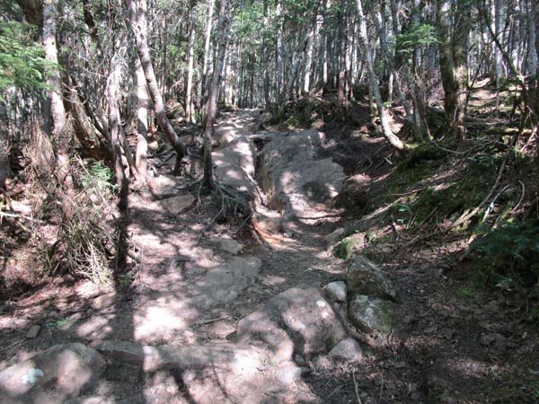
Heavy erosion and trail creep on the Edmands Path
Route: Edmands Path, Eisenhower Loop, (Mt. Eisenhower), Eisenhower Loop, Edmands Path
Trails were generally dry with some minor mud and a little bit of running water this afternoon/early evening.
Still some alpine flowers in bloom, including diapensia and lapland rosebay.
Sad to see the continued unmitigated erosion on this trail, folks leaving "rock art" on top of alpine vegetation (I removed it to save the vegetation), as well as the COVID mask litter near treeline.
| Hike Ratings |
|
Getting To Trailhead: |
Easy |
| Destination: |
Mt. Eisenhower |
|
Length: |
Moderate |
|
Steepness: |
Moderate |
|
Navigation: |
Easy |
|
Views: |
Excellent |
|
Crowds: |
Moderate |
|
| Hike Stats |
|
Date Hiked: |
Wednesday, June 17, 2020 |
| Parking Elevation: |
1,975' |
| Destination: |
Mt. Eisenhower |
| Time Elapsed: |
01:29 |
| Trailhead Elevation: |
1,980' |
| Summit Elevation: |
4,780' |
| Distance: |
3.3 miles |
| Vertical Gain: |
2,860' |
|
|
| Hike Time Elapsed: |
02:49 |
| Hike Distance: |
6.6 miles |
| Hike Vertical Gain: |
2,925' |
|
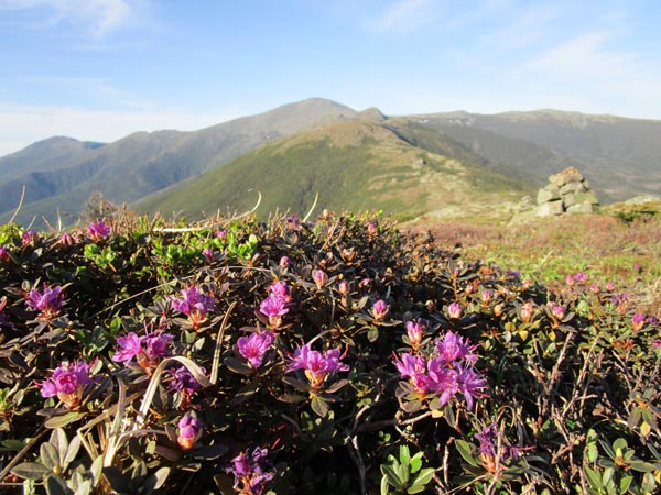
Looking north from Mt. Eisenhower
Directions to trailhead: Take Route 302 West from Bartlett into Carroll. Just after Saco Lake, take a right onto Mt. Clinton Road. Take this road for a few minutes. The Edmands Path trailhead and small WMNF fee parking area will be on the right.
Back to Mt. Eisenhower Profile
|

