Home
States
Colorado
Connecticut
Maine
Massachusetts
New Hampshire
New York
Rhode Island
Utah
Vermont
View All
Lists
NE 4,000 Footers
NE 100 Highest
NH 4,000 Footers
NH 100 Highest
NH 52 With A View
NH Belknap Range
NH Ossipee 10
Links
Trail Conditions
Trip Log
Sunrises
Sunsets
About
|
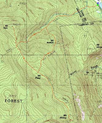
Mt. Field, Mt. Willey, Mt. Tom
Carroll, NH, Bethlehem, NH
Trailheads, measurements, times, distances, and maps are all approximate and relative to the hike(s) as shown below.
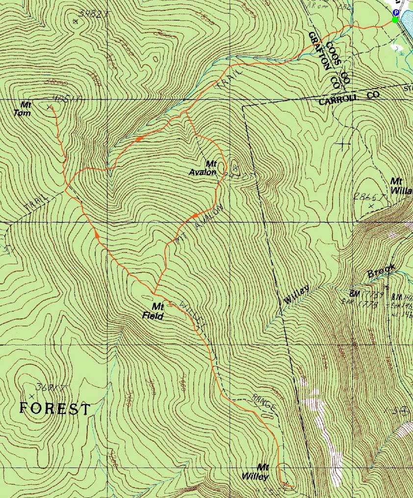
Looking up the Avalon Trail
Route: Avalon Trail, Willey Range Trail, (Mt. Field), Willey Range Trail, (Mt. Willey), Willey Range Trail, (Mt. Field), Willey Range Trail, A-Z Trail, Mt. Tom Spur Trail, (Mt. Tom), Mt. Tom Spur Trail, A-Z Trail, Avalon Trail
With a beautiful day, I had to get out and enjoy as much daylight as possible. Ascending the Avalon Trail, I skipped Mt. Avalon in the interest of minimizing headlamp using at the end of the hike. The Avalon Trail was in generally good shape - water crossings were easily done and mud was minimal.
The views from the Mt. Field viewpoint, though never comparatively stellar, were nonetheless pretty strong. Continuing on my way to Mt. Willey, I had much better views from that summit. It always seems like there's an additional up and down added to that portion of the hike.
Back at Mt. Field, I could tell that I might have a chance of getting a sunset view. Reaching Mt. Tom, I indeed could see the sun starting to set behind the blowdown field. Though not a 100% clear perspective, it was nonetheless a good sunset.
The headlamp went on as I descended the A-Z Trail. At one point, I saw eyes ahead of me on the trail. Just as my headlamp reached that area, whatever it was darted into the woods.
Reaching the railroad tracks, I looked up and was astonished by the clarity of the night's sky - an absolutely great display of stars.
| Hike Ratings |
|
Getting To Trailhead: |
Easy |
| Destination: |
Mt. Field |
|
Length: |
Moderate |
|
Steepness: |
Difficult |
|
Navigation: |
Easy |
|
Views: |
Excellent |
|
Crowds: |
Minimal |
| Destination: |
Mt. Willey |
|
Length: |
Moderate |
|
Steepness: |
Difficult |
|
Navigation: |
Easy |
|
Views: |
Excellent |
|
Crowds: |
Minimal |
| Destination: |
Mt. Field |
|
Length: |
Moderate |
|
Steepness: |
Difficult |
|
Navigation: |
Easy |
|
Views: |
Excellent |
|
Crowds: |
Minimal |
| Destination: |
Mt. Tom |
|
Length: |
Moderate |
|
Steepness: |
Difficult |
|
Navigation: |
Easy |
|
Views: |
Excellent |
|
Crowds: |
Minimal |
|
| Hike Stats |
|
Date Hiked: |
Wednesday, September 9, 2009 |
| Hike Commenced: |
3:43 PM |
| Parking Elevation: |
1,900' |
| Destination: |
Mt. Field |
| Ascent Commenced: |
3:45 PM |
| Summit Reached: |
5:01 PM |
| Time Elapsed: |
01:16 |
| Trailhead Elevation: |
1,900' |
| Summit Elevation: |
4,340' |
| Distance: |
2.8 miles |
| Vertical Gain: |
2,542' |
| Destination: |
Mt. Willey |
| Ascent Commenced: |
5:03 PM |
| Summit Reached: |
5:40 PM |
| Time Elapsed: |
00:37 |
| Trailhead Elevation: |
4,340' |
| Summit Elevation: |
4,285' |
| Distance: |
1.4 miles |
| Vertical Gain: |
465' |
| Destination: |
Mt. Field |
| Ascent Commenced: |
5:44 PM |
| Summit Reached: |
6:24 PM |
| Time Elapsed: |
00:40 |
| Trailhead Elevation: |
4,285' |
| Summit Elevation: |
4,340' |
| Distance: |
1.4 miles |
| Vertical Gain: |
520' |
| Destination: |
Mt. Tom |
| Ascent Commenced: |
6:24 PM |
| Summit Reached: |
7:01 PM |
| Time Elapsed: |
00:39 |
| Trailhead Elevation: |
4,340' |
| Summit Elevation: |
4,051' |
| Distance: |
1.5 miles |
| Vertical Gain: |
411' |
|
|
| Hike Ended: |
8:33 PM |
| Hike Time Elapsed: |
04:50 |
| Hike Distance: |
9.8 miles |
| Hike Vertical Gain: |
3,978' |
|
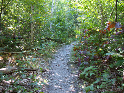
The Avalon Trail trailhead next to the train station
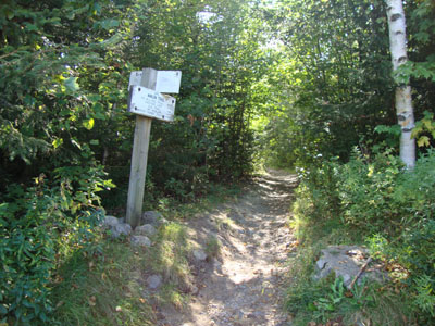
Mt. Tom and Mt. Martha as seen from the Mt. Field viewpoint

The Willey Range Trail to Mt. Willey

Looking at Mt. Washington from one of the Mt. Willey viewpoints

The Willey Range Trail

Looking at Mt. Washington from near the summit of Mt. Tom

The sunset as seen from the Mt. Tom summit

Directions to trailhead: Take Route 302 west from Bartlett, NH. There is day parking next to the railroad station. Trailhead is across the tracks.
Back to Mt. Field Profile
Back to Mt. Willey Profile
Back to Mt. Tom Profile
|