Home
States
Colorado
Connecticut
Maine
Massachusetts
New Hampshire
New York
Rhode Island
Utah
Vermont
View All
Lists
NE 4,000 Footers
NE 100 Highest
NH 4,000 Footers
NH 100 Highest
NH 52 With A View
NH Belknap Range
NH Ossipee 10
Links
Trail Conditions
Trip Log
Sunrises
Sunsets
About
|
Mt. Field, Mt. Willey
Carroll, NH, Bethlehem, NH
Trailheads, measurements, times, distances, and maps are all approximate and relative to the hike(s) as shown below.
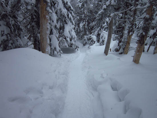
Looking up the Avalon Trail
Route: Avalon Trail, Willey Range Trail, (Mt. Field), Willey Range Trail, (Mt. Willey), Willey Range Trail, (Mt. Field), Willey Range Trail, Avalon Trail
Sub zero temperatures. Broken out trails, minimal views..
| Hike Ratings |
|
Getting To Trailhead: |
Easy |
| Destination: |
Mt. Field |
|
Length: |
Moderate |
|
Steepness: |
Difficult |
|
Navigation: |
Easy |
|
Views: |
Minimal (due to weather) |
|
Crowds: |
Minimal |
| Destination: |
Mt. Willey |
|
Length: |
Moderate |
|
Steepness: |
Difficult |
|
Navigation: |
Difficult |
|
Views: |
Minimal (due to weather) |
|
Crowds: |
Moderate |
| Destination: |
Mt. Field |
|
Length: |
Moderate |
|
Steepness: |
Difficult |
|
Navigation: |
Easy |
|
Views: |
Moderate (due to weather) |
|
Crowds: |
Moderate |
|
| Hike Stats |
|
Date Hiked: |
Sunday, January 12, 2012 |
| Parking Elevation: |
1,900' |
| Destination: |
Mt. Field |
| Time Elapsed: |
02:13 |
| Trailhead Elevation: |
1,900' |
| Summit Elevation: |
4,340' |
| Distance: |
2.8 miles |
| Vertical Gain: |
2,542' |
| Destination: |
Mt. Willey |
| Time Elapsed: |
00:59 |
| Trailhead Elevation: |
4,340' |
| Summit Elevation: |
4,285' |
| Distance: |
1.4 miles |
| Vertical Gain: |
465' |
| Destination: |
Mt. Field |
| Time Elapsed: |
01:16 |
| Trailhead Elevation: |
4,285' |
| Summit Elevation: |
4,340' |
| Distance: |
1.4 miles |
| Vertical Gain: |
520' |
|
|
| Hike Time Elapsed: |
06:11 |
| Hike Vertical Gain: |
3,627' |
|
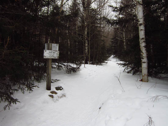
The Avalon Trail trailhead next to the train station
Mt. Tom (left) as seen from the Mt. Field viewpoint

The Willey Range Trail to Mt. Willey

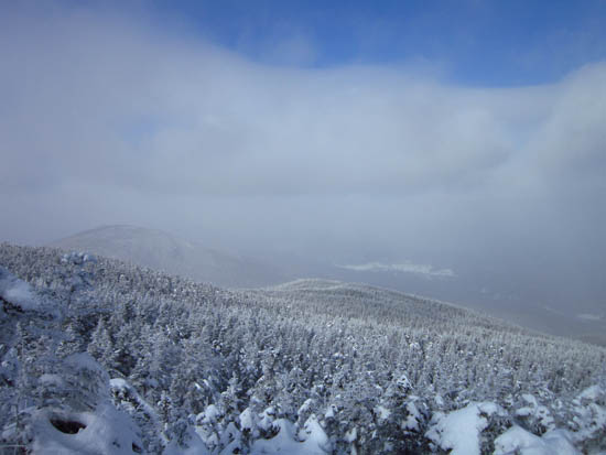
Slight views from Mt. Willey
Directions to trailhead: Take Route 302 west from Bartlett, NH. In the winter, there is plowed parking available at the Highland Center. Trailhead is across the tracks, next to the Crawford Depot.
Back to Mt. Field Profile
Back to Mt. Willey Profile
|


