Home
States
Colorado
Connecticut
Maine
Massachusetts
New Hampshire
New York
Rhode Island
Utah
Vermont
View All
Lists
NE 4,000 Footers
NE 100 Highest
NH 4,000 Footers
NH 100 Highest
NH 52 With A View
NH Belknap Range
NH Ossipee 10
Links
Trail Conditions
Trip Log
Sunrises
Sunsets
About
|
Mt. Field, Mt. Willey, Mt. Tom
Carroll, NH, Bethlehem, NH
Trailheads, measurements, times, distances, and maps are all approximate and relative to the hike(s) as shown below.

Looking up the heavily eroded Avalon Trail
Route: Avalon Trail, Willey Range Trail, (Mt. Field), Willey Range Trail, (Mt. Willey), Willey Range Trail, (Mt. Field), Willey Range Trail, A-Z Trail, Mt. Tom Spur Trail, (Mt. Tom), Mt. Tom Spur Trail, A-Z Trail, Avalon Trail
Trails were mostly dry this afternoon with occasional minor mud and a few areas of wet ledge exposed by the rampant erosion. Still some wildflowers in bloom, including pink and white lady slipper, blue bead, and bunch berry. Rain held off, but it started coming down at a good rate on on the drive back.
| Hike Ratings |
|
Getting To Trailhead: |
Easy |
| Destination: |
Mt. Field |
|
Length: |
Moderate |
|
Steepness: |
Difficult |
|
Navigation: |
Easy |
|
Views: |
Excellent |
|
Crowds: |
Heavy |
| Destination: |
Mt. Willey |
|
Length: |
Moderate |
|
Steepness: |
Difficult |
|
Navigation: |
Difficult |
|
Views: |
Excellent |
|
Crowds: |
Moderate |
| Destination: |
Mt. Field |
|
Length: |
Moderate |
|
Steepness: |
Difficult |
|
Navigation: |
Easy |
|
Views: |
Excellent |
|
Crowds: |
Minimal |
| Destination: |
Mt. Tom |
|
Length: |
Moderate |
|
Steepness: |
Difficult |
|
Navigation: |
Moderate |
|
Views: |
Excellent |
|
Crowds: |
Minimal |
|
| Hike Stats |
|
Date Hiked: |
Wednesday, June 27, 2018 |
| Parking Elevation: |
1,900' |
| Destination: |
Mt. Field |
| Time Elapsed: |
01:07 |
| Trailhead Elevation: |
1,900' |
| Summit Elevation: |
4,340' |
| Distance: |
2.8 miles |
| Vertical Gain: |
2,542' |
| Destination: |
Mt. Willey |
| Time Elapsed: |
00:29 |
| Trailhead Elevation: |
4,340' |
| Summit Elevation: |
4,285' |
| Distance: |
1.4 miles |
| Vertical Gain: |
465' |
| Destination: |
Mt. Field |
| Time Elapsed: |
00:31 |
| Trailhead Elevation: |
4,285' |
| Summit Elevation: |
4,340' |
| Distance: |
1.4 miles |
| Vertical Gain: |
520' |
| Destination: |
Mt. Tom |
| Time Elapsed: |
00:31 |
| Trailhead Elevation: |
4,340' |
| Summit Elevation: |
4,051' |
| Distance: |
1.5 miles |
| Vertical Gain: |
411' |
|
|
| Hike Time Elapsed: |
03:50 |
| Hike Distance: |
9.8 miles |
| Hike Vertical Gain: |
3,978' |
|

The Avalon Trail trailhead next to the train station

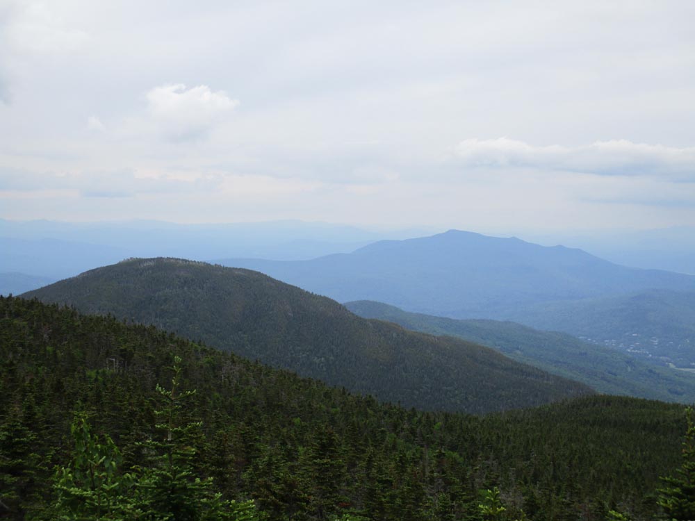
The Mt. Tom as seen from the Mt. Field viewpoint

The heavily eroded Willey Range Trail to Mt. Willey

Crawford Notch as seen from Mt. Willey

The eroded Willey Range Trail on the way to Mt. Tom

The Bonds and Twins as seen from near the summit of Mt. Tom
Directions to trailhead: Take Route 302 west from Bartlett, NH. In the winter, there is plowed parking available at the Highland Center. Trailhead is across the tracks, next to the Crawford Depot.
Back to Mt. Field Profile
Back to Mt. Willey Profile
Back to Mt. Tom Profile
|