Home
States
Colorado
Connecticut
Maine
Massachusetts
New Hampshire
New York
Rhode Island
Utah
Vermont
View All
Lists
NE 4,000 Footers
NE 100 Highest
NH 4,000 Footers
NH 100 Highest
NH 52 With A View
NH Belknap Range
NH Ossipee 10
Links
Trail Conditions
Trip Log
Sunrises
Sunsets
About
|
Mt. Flume, Mt. Liberty
Lincoln, NH
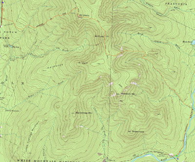
Trailheads, measurements, times, distances, and maps are all approximate and relative to the hike(s) as shown below.
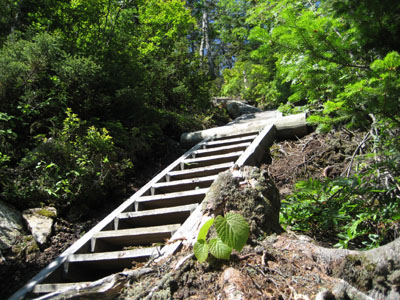
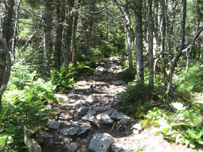
Stairs up the Osseo Trail to Mt. Flume
Route: Lincoln Woods Trail, Osseo Trail, Franconia Ridge Trail, (Mt. Flume summit), Franconia Ridge Trail, (Mt. Liberty summit), Fraconia Ridge Trail, Liberty Spring Trail, bushwack, bike trail
Originally, after first hand experience with the weather forecasts on Friday, I had written off the weekend as basically a loss. Things changed, though, as the forecast improved and a last minute hike was scheduled on VFTT.
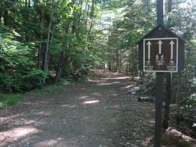
We started at around 7:15, spotting a vehicle at the Basin, then started from Lincoln Woods. We were on our way around 7:45 on the flat Lincoln Woods trail (an old railroad grade that still has railroad ties in some parts).
Though there was over a mile of this flat trail, we were seemingly soon at the Osseo Trail junction (this trail has been dramatically relocated since the Terraserver topos were originally printed).
For a few miles, the Osseo Trail is very gradual, responding to any steep terrain with numerous switchbacks. Things don't steepen until rather late in the hike, when a series of wooden stairways completes the main part of the ascent.
We continued our Sunday pace on the flats and passed the Flume Slide junction shortly thereafter. The trail then gets rather interesting, as it goes up a somewhat steep rocky area before ending up at the top of the slides on Mt. Flume.
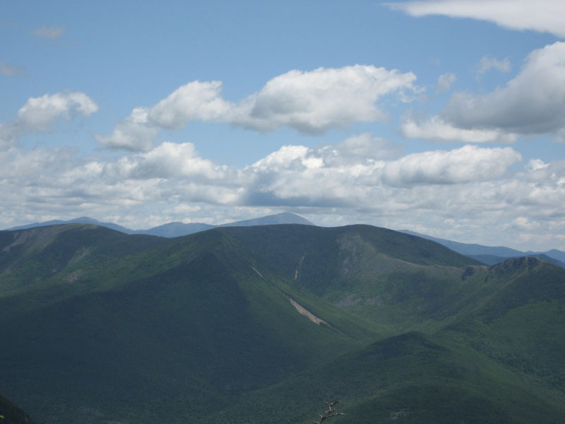
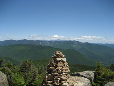
The views from Mt. Flume were excellent - great visibility in all directions, especially the east.
Since a group of people was gathering, we decided to continue on. The Franconia Ridge Trail connects Mt. Flume and Mt. Liberty with a moderate but humbling elevational gain. Looking at it, Mt. Liberty seems to be far away, however it is reached relatively quickly.
The views from Mt. Liberty were even stronger, thanks in part to the additional elevation. There was also a small crowd here, with conversational topics ranging from the Red Sox to AMC sponsored Gary Coleman barbeques.
After a leisurely lunch, we continued down the Fraconia Ridge Trail to the Liberty Spring Trail. In comparison to the long Osseo Trail, the Liberty Spring Trail seems to go by rather quickly.
Shortly after the Liberty Spring - Flume Slide junction, we went straight at a sharp turn and bushwacked down to the bike trail via an old logging road, saving a bit of time in getting back to the Basin.
What a sharp contrast this was to a hail-filled morning on Mt. Field just a few days earlier!
| Hike Ratings |
|
Getting To Trailhead: |
Easy |
| Destination: |
Mt. Flume |
|
Length: |
Moderate |
|
Steepness: |
Difficult |
|
Navigation: |
Easy |
|
Views: |
Excellent |
|
Crowds: |
Moderate |
| Destination: |
Mt. Liberty |
|
Length: |
Moderate |
|
Steepness: |
Difficult |
|
Navigation: |
Easy |
|
Views: |
Excellent |
|
Crowds: |
Moderate |
|
| Hike Stats |
|
Date Hiked: |
Sunday, June 24, 2007 |
| Hike Commenced: |
7:36 AM |
| Parking Elevation: |
1,170' |
| Destination: |
Mt. Flume |
| Ascent Commenced: |
7:40 AM |
| Summit Reached: |
11:15 AM |
| Time Elapsed: |
03:35 |
| Trailhead Elevation: |
1,170' |
| Summit Elevation: |
4,328' |
| Distance: |
5.6 miles |
| Vertical Gain: |
3,323' |
| Destination: |
Mt. Liberty |
| Ascent Commenced: |
11:24 AM |
| Summit Reached: |
12:20 PM |
| Time Elapsed: |
00:56 |
| Trailhead Elevation: |
4,328' |
| Summit Elevation: |
4,459' |
| Distance: |
1.1 miles |
| Vertical Gain: |
609' |
|
|
| Hike Ended: |
3:33 PM |
| Hike Time Elapsed: |
07:57 |
| Hike Vertical Gain: |
4,112' |
|
Lincoln Woods Trail trailhead, across the bridge from the parking lot

Looking northeast at the Bonds and Mt. Washington from the Mt. Flume summit
Fraconia Ridge Trail to Mt. Liberty
Looking northeast at the Bonds and Mt. Washington from the Mt. Liberty summit

Directions to trailhead: Take Route 112 East from I-93 past Loon to the Lincoln Woods WMNF fee parking area (left side of road). End of hike parking was at the Basin WMNF fee area, off I-93, a few exits north of the Route 112 exit.
Back to Mt. Flume Profile
Back to Mt. Liberty Profile
|