Home
States
Colorado
Connecticut
Maine
Massachusetts
New Hampshire
New York
Rhode Island
Utah
Vermont
View All
Lists
NE 4,000 Footers
NE 100 Highest
NH 4,000 Footers
NH 100 Highest
NH 52 With A View
NH Belknap Range
NH Ossipee 10
Links
Trail Conditions
Trip Log
Sunrises
Sunsets
About
|
Mt. Flume, Mt. Liberty, Owl's Head
Lincoln, NH, Franconia, NH
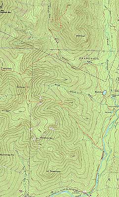
Trailheads, measurements, times, distances, and maps are all approximate and relative to the hike(s) as shown below.
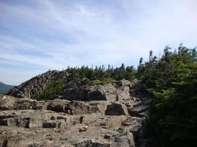
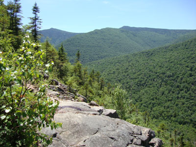
Looking up the Franconia Ridge Trail near the top of Mt. Flume
Route: Lincoln Woods Trail, Osseo Trail, Franconia Ridge Trail, (Mt. Flume), Franconia Ridge Trail, (Mt. Liberty), Franconia Ridge Trail, bushwhack, Lincoln Brook Trail, Owl's Head Path, (Owl's Head), Owl's Head Path, bushwhack, Lincoln Brook Trail, bushwhack, Black Pond Trail, Lincoln Woods Trail
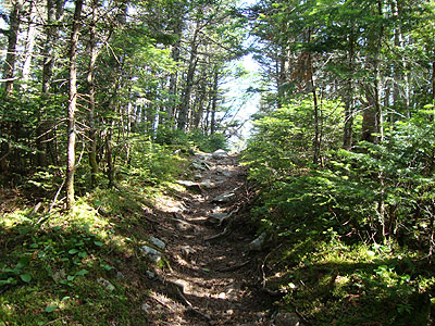
With the first day of the long weekend being the best weatherwise, I decided to attempt a potentially long and tricky day. Starting at Lincoln Woods in excellent temperatures (50s), I made decent time to the Osseo Trail junction. From there, I dialed it down a bit, not wanting to zap my energy or water supplies. After a seemingly endless (but nice, with decent footing) walk up to the ridge, I finally reached the Franconia Ridge Trail.
I had excellent views from the summit. While it was tempting to hang out for awhile, I continued on to Mt. Liberty, keeping my eye open for potential good places to enter the woods later.
Reaching Mt. Liberty, I once again had great views. Feeling a bit worn out, I opted to hang out a bit, as I wanted to fuel up for a potentially tough hike. In addition, I took some more time to review my map and the terrain in front of me, looking for hardwood canopy.
Once down in the col of the Franconia Ridge Trail, nearest the beginning of the climb to Mt. Flume, I jumped into the woods and worked my way through (at first) generally good going. About ten minutes later, I hit thicker woods, along with much steeper terrain. Pushing myself toward the northeast, I had about half an hour of junk - steep and somewhat thick, with tricky (rocks under thin soil) footing. Eventually, the grades lessened and I reached nice, open hardwoods and the brook proper.
As I worked my way east, I found some old logging roads which made things a bit smoother. As I neared the Lincoln Brook Trail, I found what I believe to be an old railbed cut (I ended up going above this, as it was quite muddy), which led me right to the Lincoln Brook Trail, about 2-3 miles north of the first water crossing after the Black Pond bushwhack exit.
While the bushwhack had increased my adrenaline a bit, I found myself zapped on the Owl's Head slide, as the mid day sun was beating down on me. After reaching the summit and taking a break, I opted to stay in the trees for the descent, taking the Brutus Bushwhack around the slide area. Back on the Lincoln Woods Trail, I worked my way to the entrance of the Black Pond bushwhack, then pushed my way to the pond proper, where I took a final break and enjoyed the views.
After that, it was a typical slog back out to Lincoln Woods.
| Hike Ratings |
|
Getting To Trailhead: |
Easy |
| Destination: |
Mt. Flume |
|
Length: |
Moderate |
|
Steepness: |
Difficult |
|
Navigation: |
Easy |
|
Views: |
Excellent |
|
Crowds: |
Minimal |
| Destination: |
Mt. Liberty |
|
Length: |
Moderate |
|
Steepness: |
Difficult |
|
Navigation: |
Easy |
|
Views: |
Excellent |
|
Crowds: |
Minimal |
| Destination: |
Owl's Head |
|
Length: |
Very Difficult |
|
Steepness: |
Very Difficult |
|
Navigation: |
Difficult |
|
Views: |
Minimal |
|
Crowds: |
Moderate |
|
| Hike Stats |
|
Date Hiked: |
Saturday, July 3, 2010 |
| Hike Commenced: |
7:00 AM |
| Parking Elevation: |
1,170' |
| Destination: |
Mt. Flume |
| Ascent Commenced: |
7:02 AM |
| Summit Reached: |
9:26 AM |
| Time Elapsed: |
02:24 |
| Trailhead Elevation: |
1,170' |
| Summit Elevation: |
4,328' |
| Distance: |
5.6 miles |
| Vertical Gain: |
3,323' |
| Destination: |
Mt. Liberty |
| Ascent Commenced: |
9:28 AM |
| Summit Reached: |
10:10 AM |
| Time Elapsed: |
00:42 |
| Trailhead Elevation: |
4,328' |
| Summit Elevation: |
4,459' |
| Distance: |
1.1 miles |
| Vertical Gain: |
609' |
| Destination: |
Owl's Head |
| Ascent Commenced: |
10:22 AM |
| Summit Reached: |
1:53 PM |
| Time Elapsed: |
03:31 |
| Trailhead Elevation: |
4,459' |
| Summit Elevation: |
4,025' |
| Distance: |
.4 mile |
| Vertical Gain: |
1,985' |
|
|
| Hike Ended: |
5:54 PM |
| Hike Time Elapsed: |
10:54 |
| Hike Vertical Gain: |
6,172' |
|
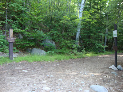
The Lincoln Woods Trail trailhead
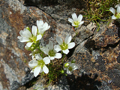
Alpine flowers on Mt. Flume
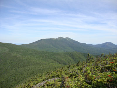
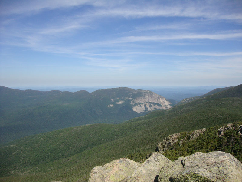
Looking north from Mt. Flume
The Franconia Ridge Trail on the way to Mt. Liberty

Looking at Cannon Mountain from Mt. Liberty
Bushwhacking to the Lincoln Brook Trail from the Franconia Ridge
Looking back at Flume and Liberty while climbing the Owl's Head slide
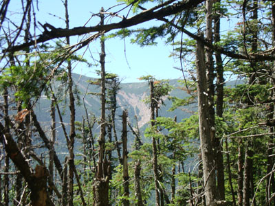
Slight views of the Franconia Ridge from near the summit of Owl's Head
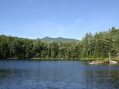
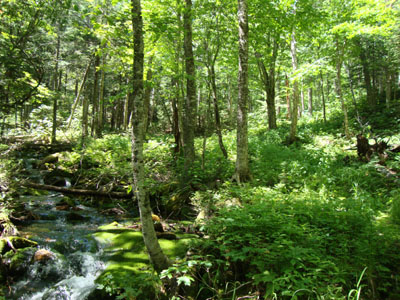
Black Pond at the end of a long day

Directions to trailhead: Take Route 112 East from I-93 past Loon to the Lincoln Woods WMNF fee parking area (left side of road).
Back to Mt. Flume Profile
Back to Mt. Liberty Profile
Back to Owls Head Profile
|