Home
States
Colorado
Connecticut
Maine
Massachusetts
New Hampshire
New York
Rhode Island
Utah
Vermont
View All
Lists
NE 4,000 Footers
NE 100 Highest
NH 4,000 Footers
NH 100 Highest
NH 52 With A View
NH Belknap Range
NH Ossipee 10
Links
Trail Conditions
Trip Log
Sunrises
Sunsets
About
|
Mt. Garfield
Bethlehem, NH, Franconia, NH
Trailheads, measurements, times, distances, and maps are all approximate and relative to the hike(s) as shown below.

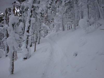
Looking up the Garfield Trail
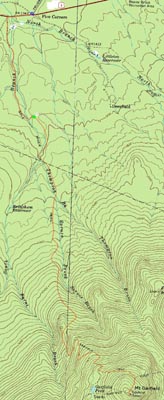
Route: Garfield Trail, Garfield Ridge Trail, (Mt. Garfield), Garfield Ridge Trail, Garfield
After over year, I decided it was time to hike Mt. Garfield again. While I knew it would involve a roadwalk with three bridges out, I figured I'd find a way to the trailhead.
Parking at the end of Trudeau Road, I took a leisurely stroll west on US 2 and then down Gale River Road (not plowed). While the first three bridges I encounted were messed up, they appeared to be structurally sound (abutments bad washed out, but otherwise okay). Since each of the water crossings were completely snowbridged, I decided to opt for the easy way around the bridges, rather than try to pull some sort of MacGuyver stunt with my snowshoes.
Finally at the trailhead, I was quickly on my way up the Mt. Garfield Trail. As I remembered from my previous hike, it was a long, fairly flat, and rather dull ascent.
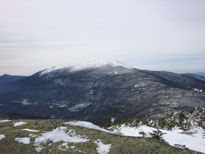
Arriving at the Garfield Ridge Trail junction, there were some powerful wind gusts. While it had been about 1 degree when I started the hike, temperatures had climbed dramatically, likely reaching the mid 20s at this point. Thus, I was able to continue my ascent in just a long sleeve shirt. Reaching the top of Garfield after the short, steep section of the Garfield Ridge Trail, I was greeted with decent views and strong wind gusts. Too lazy to take off my snowshoes, I somehow scrambled up the bare ledges to the highpoint.
After taking some photos, I was ready to call it a day. Doing my best to zone out, I essentially went nonestop (as I had while ascending) back to the trailhead and then parking area. Not a bad day to be out on the trails!
| Hike Ratings |
|
Getting To Trailhead: |
Difficult |
| Destination: |
Mt. Garfield |
|
Length: |
Difficult |
|
Steepness: |
Difficult |
|
Navigation: |
Easy |
|
Views: |
Excellent |
|
Crowds: |
Minimal |
|
| Hike Stats |
|
Date Hiked: |
Saturday, February 7, 2009 |
| Hike Commenced: |
8:09 AM |
| Parking Elevation: |
1,343' |
| Destination: |
Mt. Garfield |
| Ascent Commenced: |
8:42 AM |
| Summit Reached: |
10:54 AM |
| Time Elapsed: |
02:12 |
| Trailhead Elevation: |
1,535' |
| Summit Elevation: |
4,500' |
| Distance: |
5 miles |
| Vertical Gain: |
3,055' |
|
|
| Hike Ended: |
1:16 PM |
| Hike Time Elapsed: |
05:07 |
| Hike Vertical Gain: |
3,462' |
|

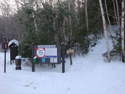
The Garfield Trail trailhead

Looking at Mt. Lafayette from the Mt. Garfield summit


Directions to trailhead: Take US 3 South from US 302. In winter 2008-09, one could park (on the right heading southbound) at the Trudeau Road-US 3 junction, then walk southbound on US 3, taking a left onto Gale River Road. The Garfield Trail is 1.2 miles up Gale River Road, on the right shortly after the forth bridge.
Back to Mt. Garfield Profile
|