Home
States
Colorado
Connecticut
Maine
Massachusetts
New Hampshire
New York
Rhode Island
Utah
Vermont
View All
Lists
NE 4,000 Footers
NE 100 Highest
NH 4,000 Footers
NH 100 Highest
NH 52 With A View
NH Belknap Range
NH Ossipee 10
Links
Trail Conditions
Trip Log
Sunrises
Sunsets
About
|
Mt. Garfield
Bethlehem, NH, Franconia, NH
Trailheads, measurements, times, distances, and maps are all approximate and relative to the hike(s) as shown below.
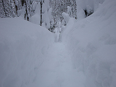
Looking down the Garfield Trail
Route: Garfield Trail, Garfield Ridge Trail, (Mt. Garfield), Garfield Ridge Trail, Garfield
Despite being in the middle of a snowstorm, I decided to head up and do something gradual and fairly protected from the wind.
After parking at Five Corners, I walked west on US 3 to the west branch of Gale River Road. After stepping over the snowbank, I was a bit surprised to find myself standing in 2 feet of fresh powder - after only receiving an inch or two overnight in the southern Whites.
After breaking out Gale River Road, I starting breaking out the Garfield Trail. Fortunately, after about 2 miles of solo breaking, a strong group caught up and we rotated duties. As we climbed, the light powder depth increased to about 3 feet - and, nearing the Garfield Ridge Trail junction, drifted to about 5 feet.
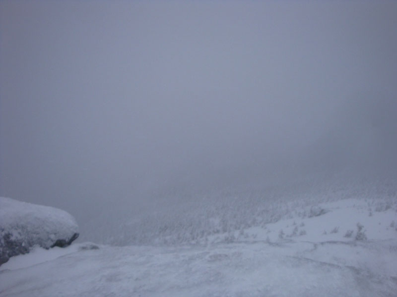
The summit was a cloudy, cold, windy place - thus, we didn't linger long at all.
Back on the Garfield Trail, the wind and continuing snow had resulted in the need to do some additional minor trailbreaking. Nonetheless, we were able to make it back to Five Corners before needing headlamps.
| Hike Ratings |
|
Getting To Trailhead: |
Difficult |
| Destination: |
Mt. Garfield |
|
Length: |
Difficult |
|
Steepness: |
Difficult |
|
Navigation: |
Easy |
|
Views: |
Minimal (due to weather) |
|
Crowds: |
Minimal |
|
| Hike Stats |
|
Date Hiked: |
Sunday, January 3, 2010 |
| Hike Commenced: |
9:54 AM |
| Parking Elevation: |
1,343' |
| Destination: |
Mt. Garfield |
| Ascent Commenced: |
10:34 AM |
| Summit Reached: |
2:07 PM |
| Time Elapsed: |
03:33 |
| Trailhead Elevation: |
1,535' |
| Summit Elevation: |
4,500' |
| Distance: |
5 miles |
| Vertical Gain: |
3,055' |
|
|
| Hike Ended: |
4:36 PM |
| Hike Time Elapsed: |
06:42 |
| Hike Vertical Gain: |
3,462' |
|
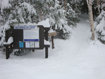
The Garfield Trail trailhead
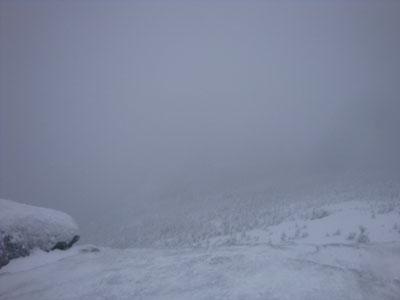
Looking into the clouds from the Mt. Garfield summit
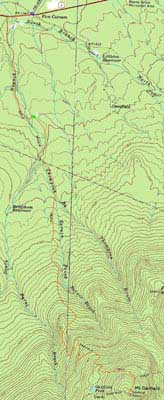

Directions to trailhead: Take US 3 South from US 302. In winter 2009-10, one could park (on the right heading southbound) at the Trudeau Road-US 3 junction, then walk southbound on US 3, taking a left onto Gale River Road. The Garfield Trail is 1.2 miles up Gale River Road, on the right shortly after the forth bridge.
Back to Mt. Garfield Profile
|