Home
States
Colorado
Connecticut
Maine
Massachusetts
New Hampshire
New York
Rhode Island
Utah
Vermont
View All
Lists
NE 4,000 Footers
NE 100 Highest
NH 4,000 Footers
NH 100 Highest
NH 52 With A View
NH Belknap Range
NH Ossipee 10
Links
Trail Conditions
Trip Log
Sunrises
Sunsets
About
|
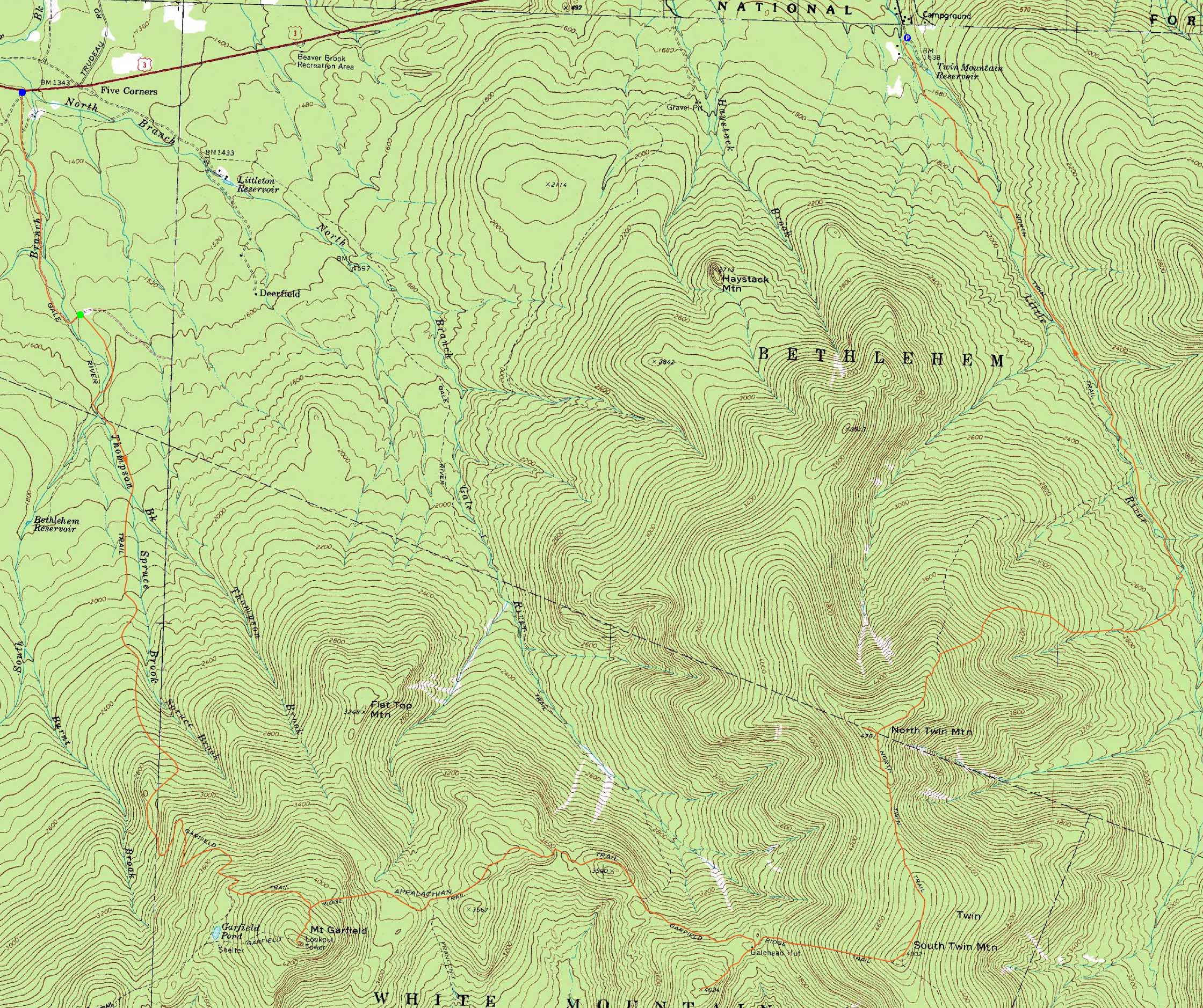
Mt. Garfield, Galehead Mountain, South Twin Mountain, North Twin Mountain
Bethlehem, NH, Franconia, NH
Trailheads, measurements, times, distances, and maps are all approximate and relative to the hike(s) as shown below.
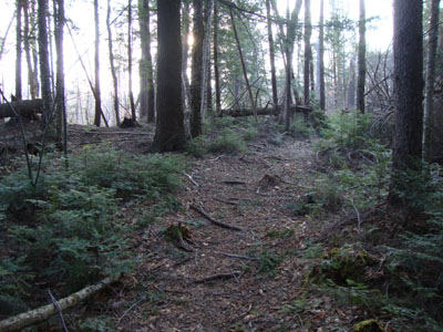
The bare lower portion of the Garfield Trail
Route: Gale River Road, Garfield Trail, Garfield Ridge Trail, (Mt. Garfield), Garfield Ridge Trail, Frost Trail, (Galehead Mountain), Frost Trail, Twinway, (South Twin Mountain), North Twin Spur, bushwhack, (North Twin Mountain), North Twin Trail, bushwhack, North Twin Trail, herd path, North Twin Trail, herd path
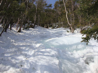
After spotting a vehicle at Little River Road, we started at west Gale River Road, which was completely snowfree. While the first washed out bridge had been repaired, the second and third were still out. The second was passable via a crude ladder, however the third required a brook crossing.
The Garfield Trail was fairly bare for the first mile or so. The water crossings were running a bit high, but nonetheless doable. Above there, we donned snowshoes for the balance of the spring-snow-covered trail to Mt. Garfield, where we had good, though hazy, views.
The Garfield Ridge Trail was in better shape than we had hoped - the steeps below the campsite were fortunately mostly snowcovered, though the ice bulges were lurking underneath. From there, we had to go over the many ups and downs on the way to the Galehead Hut.
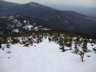
After lunch, we headed up to Galehead, where we had strong views from the normally wooded summit. Back at the hut, we fueled up for the climb to South Twin. By this point in the day, the skies had clouded over and the winds had picked up a little bit.
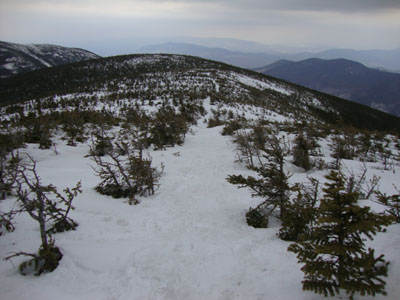
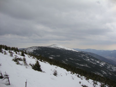
The trek from South Twin to North Twin was tricky - the previous tracks meandered off the trail in many places, some for good reason due to blowdowns. Nearing North Twin, the trees were just barely sticking out of the snow, resulting in views in all directions.
After descending to the north viewpoint, the packed route bushwhacked in a direct route, eventually rejoining the trail proper on a switchback. Now down in the lower elevations, many of the water crossings were snowbridged with the type of bridges that collapse as you cross. Finally down below the final crossing, the North Twin had some extended sections of flowing water. Despite these conditions, we were able to still make it to the road by sunset.
| Hike Ratings |
|
Getting To Trailhead: |
Difficult |
| Destination: |
Mt. Garfield |
|
Length: |
Moderate |
|
Steepness: |
Difficult |
|
Navigation: |
Easy |
|
Views: |
Excellent |
|
Crowds: |
Minimal |
| Destination: |
Galehead Mountain |
|
Length: |
Difficult |
|
Steepness: |
Very Difficult |
|
Navigation: |
Moderate |
|
Views: |
Excellent |
|
Crowds: |
Minimal |
| Destination: |
South Twin Mountain |
|
Length: |
Very Difficult |
|
Steepness: |
Difficult |
|
Navigation: |
Moderate |
|
Views: |
Excellent |
|
Crowds: |
Minimal |
| Destination: |
North Twin Mountain |
|
Length: |
Very Difficult |
|
Steepness: |
Difficult |
|
Navigation: |
Difficult |
|
Views: |
Excellent |
|
Crowds: |
Minimal |
|
| Hike Stats |
|
Date Hiked: |
Saturday, March 20, 2010 |
| Hike Commenced: |
7:39 AM |
| Parking Elevation: |
1,320' |
| Destination: |
Mt. Garfield |
| Ascent Commenced: |
8:07 AM |
| Summit Reached: |
11:13 AM |
| Time Elapsed: |
03:06 |
| Trailhead Elevation: |
1,535' |
| Summit Elevation: |
4,500' |
| Distance: |
5 miles |
| Vertical Gain: |
3,055' |
| Destination: |
Galehead Mountain |
| Ascent Commenced: |
11:17 AM |
| Summit Reached: |
1:58 PM |
| Time Elapsed: |
02:41 |
| Trailhead Elevation: |
4,500' |
| Summit Elevation: |
4,024' |
| Vertical Gain: |
769' |
| Destination: |
South Twin Mountain |
| Ascent Commenced: |
2:00 PM |
| Summit Reached: |
3:07 PM |
| Time Elapsed: |
01:07 |
| Trailhead Elevation: |
4,024' |
| Summit Elevation: |
4,902' |
| Vertical Gain: |
1,187' |
| Destination: |
North Twin Mountain |
| Ascent Commenced: |
3:14 PM |
| Summit Reached: |
4:04 PM |
| Time Elapsed: |
00:50 |
| Trailhead Elevation: |
4,902' |
| Summit Elevation: |
4,761' |
| Vertical Gain: |
321' |
|
|
| Hike Ended: |
6:46 PM |
| Hike Time Elapsed: |
11:07 |
| Hike Vertical Gain: |
5,727' |
|
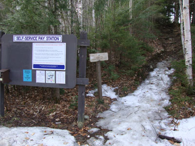
The Garfield Trail trailhead
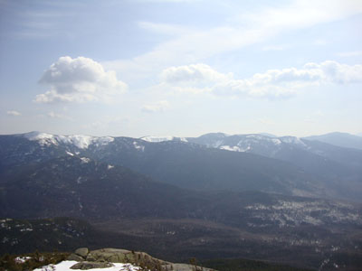
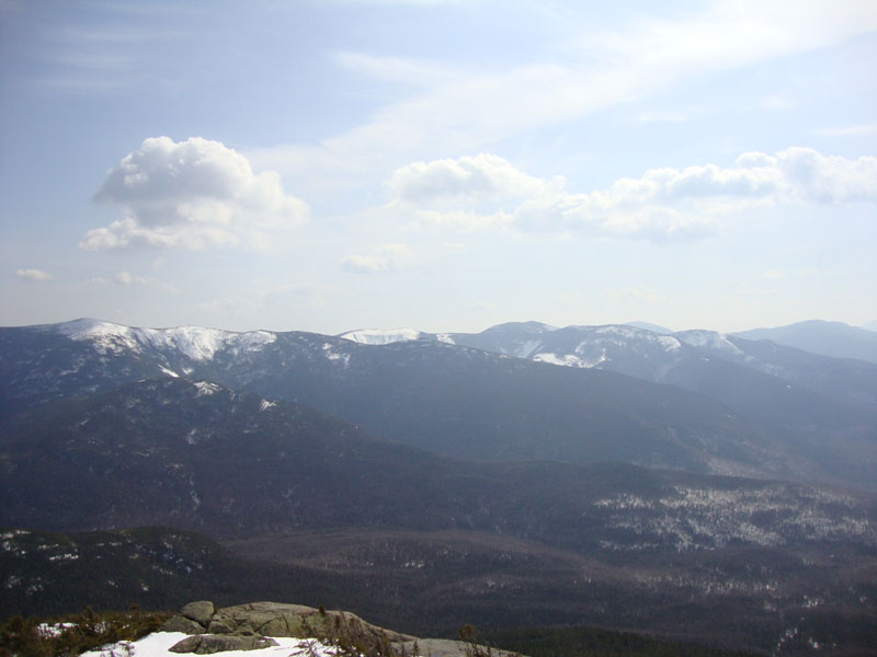
Looking at South Twin, Guyot, and the Bonds from Mt. Garfield
Looking up the Garfield Ridge Trail on the way to Galehead Mountain

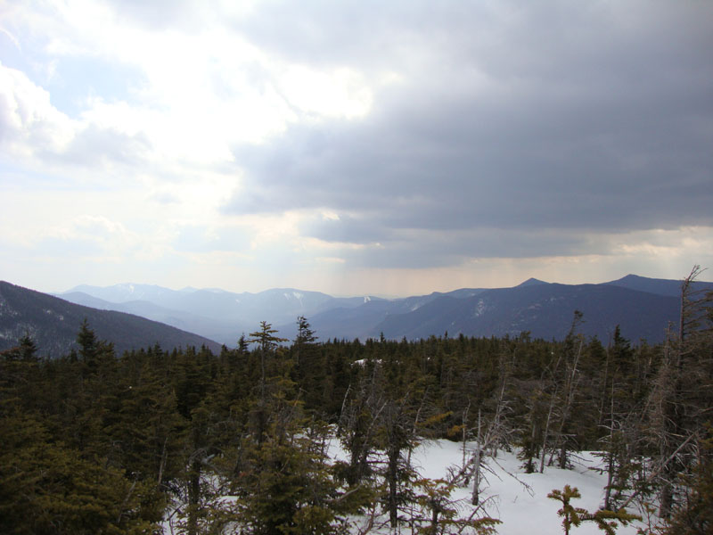
Looking at the Osceolas, Scar Ridge, Owl's Head, and Southern Franconias from Galehead
Looking down the Twinway on the way to South Twin

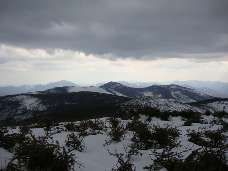
Looking at Carrigain, Guyot, and the Bonds from South Twin
Looking down the North Twin Spur on the way to North Twin
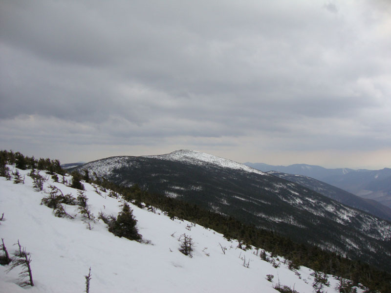
Looking at South Twin from near the summit of North Twin
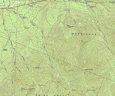

Directions to trailhead: From Route 302, take Route 3 South. In late winter 2010, one could park at the end of Little River Road, as well as at the end of the west end of Gale River Road. The Garfield Trail trailhead is a bit over a mile beyond the gated west end of the Gale River Road.
Back to Mt. Garfield Profile
Back to Galehead Mountain Profile
Back to North Twin Mountain Profile
Back to South Twin Mountain Profile
|