Home
States
Colorado
Connecticut
Maine
Massachusetts
New Hampshire
New York
Rhode Island
Utah
Vermont
View All
Lists
NE 4,000 Footers
NE 100 Highest
NH 4,000 Footers
NH 100 Highest
NH 52 With A View
NH Belknap Range
NH Ossipee 10
Links
Trail Conditions
Trip Log
Sunrises
Sunsets
About
|
Mt. Garfield
Bethlehem, NH, Franconia, NH
Trailheads, measurements, times, distances, and maps are all approximate and relative to the hike(s) as shown below.
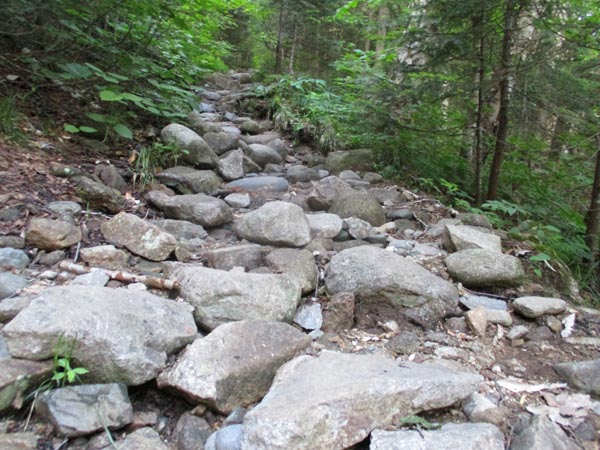
The heavily eroded Garfield Trail
Route: Garfield Trail, Garfield Ridge Trail, (Mt. Garfield), Garfield Ridge Trail, Garfield
Really sad to see how quickly and severely this once-smooth trail is eroding. Lots of mud and extended stretches of trail with water running down it. Quite a few herd paths resulting in trail creep. Lots of brook-bed-esque rocky stretches. Lots of gullying (where the trail is now multiple feet lower than the adjacent terrain with no where for the water to drain). There is still time to save this trail with a decent amount of work, but the pendulum is swinging.
Great morning weather with air much nicer than yesterday. Had the summit to myself briefly with good views and a gentle breeze. Looks like the Garfield Ridge tent site must have been packed last night.
| Hike Ratings |
|
Getting To Trailhead: |
Easy |
| Destination: |
Mt. Garfield |
|
Length: |
Moderate |
|
Steepness: |
Difficult |
|
Navigation: |
Easy |
|
Views: |
Excellent |
|
Crowds: |
Heavy |
|
| Hike Stats |
|
Date Hiked: |
Sunday, July 5, 2020 |
| Parking Elevation: |
1,540' |
| Destination: |
Mt. Garfield |
| Time Elapsed: |
01:53 |
| Trailhead Elevation: |
1,535' |
| Summit Elevation: |
4,500' |
| Distance: |
5 miles |
| Vertical Gain: |
3,055' |
|
|
| Hike Time Elapsed: |
03:48 |
| Hike Vertical Gain: |
3,150' |
|
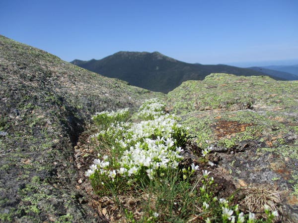
Looking at the Franconia Ridge from Mt. Garfield
Directions to trailhead: Take Route 3 South from US 302. Due to bridges being out on the west end of Gale River Road, take a left onto Gale River Road at the Five Corners junction. Bear left at the first fork, then take a right at the second fork, passing the Gale River Trail parking area. A few minutes later, the Garfield Trail WMNF fee hiker parking area is on the left, just before the Garfield Trail trailhead.
Back to Mt. Garfield Profile
|

