Home
States
Colorado
Connecticut
Maine
Massachusetts
New Hampshire
New York
Rhode Island
Utah
Vermont
View All
Lists
NE 4,000 Footers
NE 100 Highest
NH 4,000 Footers
NH 100 Highest
NH 52 With A View
NH Belknap Range
NH Ossipee 10
Links
Trail Conditions
Trip Log
Sunrises
Sunsets
About
|
Mt. Hale
Bethlehem, NH
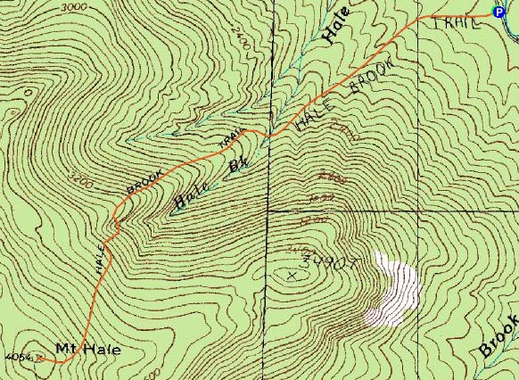
Trailheads, measurements, times, distances, and maps are all approximate and relative to the hike(s) as shown below.
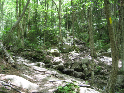
Looking up the Hale Brook Trail at the first brook crossing
Route: Hale Brook Trail
After small three pain free hikes, it was time to step it up a notch. With an invite to do a longer hike this coming weekend, I decided to skip over a few gradual hikes and instead do a tame 4,000 footer to see if I was up to it.
For quite a few days, the forecast said 'mostly sunny.' Then, the night before, it changed to partly sunny. When I awoke, it was raining. No need to fear - the sun would be out by 11 AM. Bull ticky. Had this been a hike with a strong summit view, I would have postponed.
Upon arriving at the trailhead the skies to the north and west were starting to clear out - finally! The sun wouldn't actually hit the trail until descent.
The trail has been pretty well maintained - in fact, there were guys from the gov clearing blowdowns and waterbars on the trail. The brook crossings were easy and mud was minimal, despite the recent rain. Though many consider Tecumseh the easiest NH 4k peak, I found the ascent up Hale Brook to be easier - there are only a few isolated steeper sections whereas Tecumseh has a consistent pitch near the ski area.
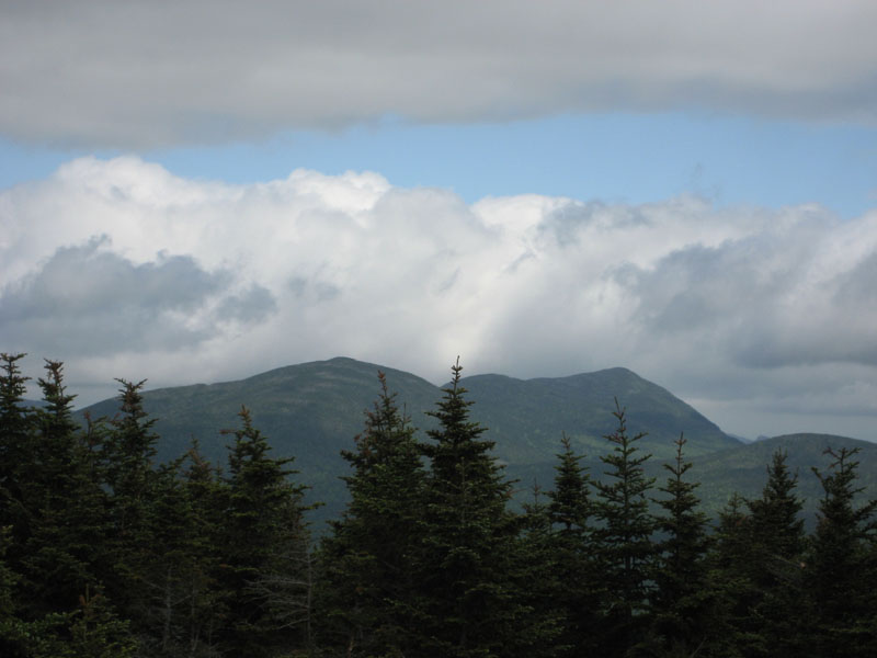
There aren't many views from this peak, as well documented. There are some views to the southeast near the top of the Hale Brook Trail, as well as some from the pile of rocks at the summit.
The ascent, though tough on my out of shape body, was fine on my knee. The descent was fine for about a mile or a mile and a half before the normal pain started to return. Taking breaks and massaging the area seemed to help at first, but by the time I was at the lower brook crossing, I was returning to previous pain levels. Surprisingly, though, possibly due in part to resting it, walking differently downhill, and not wrapping it, I was able to drive home without any pain, only a very long run on sentence in my future, with way too many commas. There is still some pain in it while walking, but not nearly as bad as it has been after previous hikes. Improvement? I hope so. Drop back to small hikes for awhile? Yes.
| Hike Ratings |
|
Getting To Trailhead: |
Easy |
| Destination: |
Mt. Hale |
|
Length: |
Moderate |
|
Steepness: |
Difficult |
|
Navigation: |
Easy |
|
Views: |
Moderate |
|
Crowds: |
Minimal |
|
| Hike Stats |
|
Date Hiked: |
Wednesday, June 13, 2007 |
| Hike Commenced: |
1:33 PM |
| Parking Elevation: |
1,770' |
| Destination: |
Mt. Hale |
| Ascent Commenced: |
1:33 PM |
| Summit Reached: |
2:38 PM |
| Time Elapsed: |
01:05 |
| Trailhead Elevation: |
1,770' |
| Summit Elevation: |
4,054' |
| Distance: |
2.3 miles |
| Vertical Gain: |
2,304' |
|
|
| Hike Ended: |
4:02 PM |
| Hike Time Elapsed: |
02:29 |
| Hike Distance: |
4.6 miles |
| Hike Vertical Gain: |
2,324' |
|
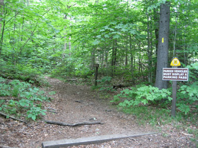
Hale Brook Trail trailhead from Zealand Road
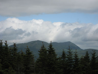
Looking southeast Mt. Field and Mt. Willey
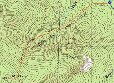

Directions to trailhead: Take US 302 west from Bartlett past Bretton Woods Ski Area. A few minutes after, take a left onto Zealand Road. Continue up this road (turns to dirt) to the Hale Brook trailhead/small WMNF fee parking area (right side of the road).
Back to Mt. Hale Profile
|