Home
States
Colorado
Connecticut
Maine
Massachusetts
New Hampshire
New York
Rhode Island
Utah
Vermont
View All
Lists
NE 4,000 Footers
NE 100 Highest
NH 4,000 Footers
NH 100 Highest
NH 52 With A View
NH Belknap Range
NH Ossipee 10
Links
Trail Conditions
Trip Log
Sunrises
Sunsets
About
|
Mt. Hale
Bethlehem, NH
Trailheads, measurements, times, distances, and maps are all approximate and relative to the hike(s) as shown below.
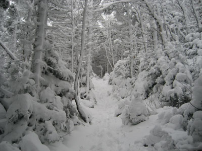
Looking up the Hale Brook Trail
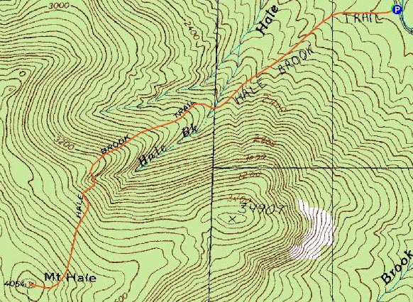
Route: Hale Brook Trail
With the forecast taking a dive from partly sunny to mostly cloudy, I decided to get some exercise and acclimation in by heading into the cold, snowy weather near Crawford Notch. While I knew there was some snow up there, I was surprised to see 3-4" on the roads - and even more surprised to see Zealand Road still open.
Since it was 16 degrees and windy at the base, I put on my gaitors and Microspikes inside my vehicle and quickly set foot up the trail. While there was "only" 3-4 inches down low, things quickly changed to 6-8" as I passed the water crossings.
I was surprised that, as I ascended, things didn't seem much colder. It was clear, however, that the weather had at some point been more brutal up high - evidenced by the snow built up on the sides of the trees and by upwards of a foot of snow on the trail.
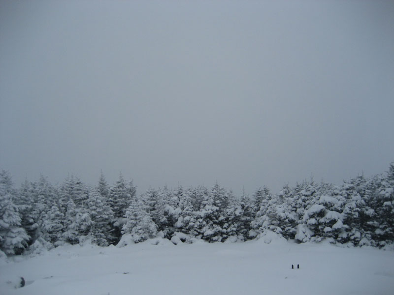
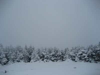
Surprisingly, there were no views from the summit, thanks to the storm in progress. After adding some layers, I headed back down the trail, pausing at one point to cut up a blowdown.
While it wasn't a spectacular hike by any means, the snow covered trees throughout the area were nonetheless stunning.
Isn't it still fall?
| Hike Ratings |
|
Getting To Trailhead: |
Easy |
| Destination: |
Mt. Hale |
|
Length: |
Moderate |
|
Steepness: |
Difficult |
|
Navigation: |
Easy |
|
Views: |
Minimal due to weather |
|
Crowds: |
Minimal |
|
| Hike Stats |
|
Date Hiked: |
Saturday, November 22, 2008 |
| Hike Commenced: |
11:29 AM |
| Parking Elevation: |
1,770' |
| Destination: |
Mt. Hale |
| Ascent Commenced: |
11:29 AM |
| Summit Reached: |
12:55 PM |
| Time Elapsed: |
01:26 |
| Trailhead Elevation: |
1,770' |
| Summit Elevation: |
4,054' |
| Distance: |
2.3 miles |
| Vertical Gain: |
2,304' |
|
|
| Hike Ended: |
2:11 PM |
| Hike Time Elapsed: |
02:42 |
| Hike Distance: |
4.6 miles |
| Hike Vertical Gain: |
2,324' |
|
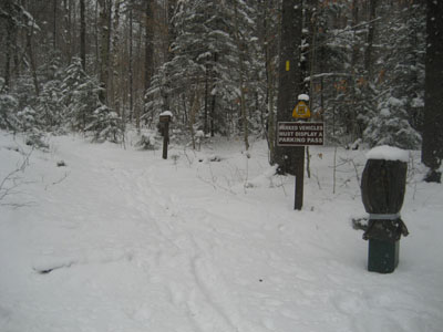
Hale Brook Trail trailhead
Looking at what normally would be a partial viewpoint at the summit of Mt. Hale
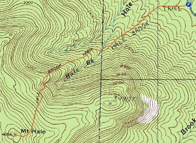

Directions to trailhead: Take US 302 west from Bartlett past Bretton Woods Ski Area. A few minutes after, take a left onto Zealand Road. Continue up this road (turns to dirt) to the Hale Brook trailhead/small WMNF fee parking area (right side of the road).
Back to Mt. Hale Profile
|