Home
States
Colorado
Connecticut
Maine
Massachusetts
New Hampshire
New York
Rhode Island
Utah
Vermont
View All
Lists
NE 4,000 Footers
NE 100 Highest
NH 4,000 Footers
NH 100 Highest
NH 52 With A View
NH Belknap Range
NH Ossipee 10
Links
Trail Conditions
Trip Log
Sunrises
Sunsets
About
|
Mt. Hale
Bethlehem, NH
Trailheads, measurements, times, distances, and maps are all approximate and relative to the hike(s) as shown below.
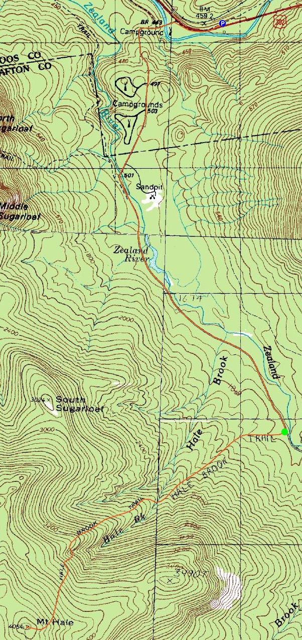
Looking up the Hale Brook Trail
Route: Snowmobile trail, Zealand Road, Hale Brook Trail, (Mt. Hale), Hale Brook Trail, Zealand Road, snowmobile trail
After a slow ride up in the bad weather, I hung out at the parking lot east of the Zealand Road entrance for awhile, wondering what kind of hike this would be. Though it was snowing, it looked like it was going to change to sleet and freezing rain as the day progressed.
We barebooted the snowmobile trail to Zealand Road and part way up Zealand Road (I barebooted all the way to the Hale Brook Trail trailhead). While supposed the road was supposed to be plowed for logging activity, there was only a single file packed trail up it.
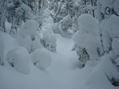
Arriving at the Hale Brook Trail trailhead, it looked like perhaps some skiers had broken out the trail after the recent trio of snowstorms - good deal! Unfortunately, this was too good to be true, as the tracks ended a few hundred feet up the trail. No one had been up this way since the snowfall, so it was trailbreaking the entire way up. While the powder generally was knee deep with snowshoes on, there were a few parts in which I sank up to my stomach. As a result, the ascent too me about three times as long as normal. Perhaps the trickiest part, though not overly technical, was the section of trail below the second sizable water crossing - the trail ascends with a steep slope on either side. While the snow was only knee deep on the downhill side of it, the uphill was hip deep for pretty much the entire duration of this part - losing one's footing could have resulted in a nasty, steep tumble.
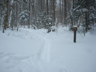
The views from the summit were zip, nada, zilch. Fortunately, other than some wind, things weren't overly cold, so there was ample time to switch into dry clothes for the descent.
While the descent down the trail went relatively quickly, I found the slog back out Zealand Road to be very taxing and dull. Blah. Nonetheless, it was nice to get some exercise despite the weather. While the sun never broke out, much of the Hale Brook Trail was still rather scenic and fairly worthwhile.
| Hike Ratings |
|
Getting To Trailhead: |
Difficult |
| Destination: |
Mt. Hale |
|
Length: |
Difficult |
|
Steepness: |
Difficult |
|
Navigation: |
Easy |
|
Views: |
Minimal due to weather |
|
Crowds: |
Minimal |
|
| Hike Stats |
|
Date Hiked: |
Wednesday, December 24, 2008 |
| Hike Commenced: |
8:25 AM |
| Parking Elevation: |
1,480' |
| Destination: |
Mt. Hale |
| Ascent Commenced: |
9:52 AM |
| Summit Reached: |
1:06 PM |
| Time Elapsed: |
03:14 |
| Trailhead Elevation: |
1,770' |
| Summit Elevation: |
4,054' |
| Distance: |
2.3 miles |
| Vertical Gain: |
2,304' |
|
|
| Hike Ended: |
3:38 PM |
| Hike Time Elapsed: |
07:13 |
| Hike Vertical Gain: |
2,714' |
|
Hale Brook Trail trailhead
Due to the clouds, this was about all there was to see around the summit area
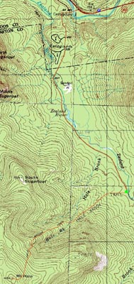

Directions to trailhead: Take US 302 west from Bartlett past Bretton Woods Ski Area. In winter, there is a plowed parking lot on the right, shortly after a bridge, just before the closed Zealand Road entrance appears on the left. In winter, to get to the trailhead from there, one can hike up Zealand Road.
Back to Mt. Hale Profile
|