Home
States
Colorado
Connecticut
Maine
Massachusetts
New Hampshire
New York
Rhode Island
Utah
Vermont
View All
Lists
NE 4,000 Footers
NE 100 Highest
NH 4,000 Footers
NH 100 Highest
NH 52 With A View
NH Belknap Range
NH Ossipee 10
Links
Trail Conditions
Trip Log
Sunrises
Sunsets
About
|
Mt. Hale
Bethlehem, NH
Trailheads, measurements, times, distances, and maps are all approximate and relative to the hike(s) as shown below.

Looking up the Hale Brook Trail
Route: Hale Brook Trail
After having essentially sat the balance of the week out due to my knee flaring up, I decided I'd try and get some exercise. Since the forecast wasn't looking great, I decided to do a somewhat bland hike - thus Mt. Hale via the Hale Brook Trail. Based upon a week old conditions report, it seemed like the snow line might have been higher up than other peaks.
Arriving at the trailhead (and amazed at how far I had snowshoed to get to this point in December), I did some extra stretching and soon set foot up the Hale Brook Trail. The lower portion of the trail was pleasant with blue skies overhead.
After leaping across the first water crossing, I continued on my way up the sidehill portion of the trail. After passing the second water crossing, I soon reached patches of snow - eek. As I climbed, the depths increased - I had a feeling the conditions report I read was a bit optimistic! Nonetheless, I continued my way up the snow monorail, eventually reaching the summit under cloudy skies.
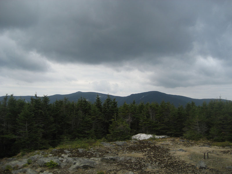
With only a small patch of the once-mighty summit snow tower remaining, I climbed up the cairn and checked out the now-mortal views. While the Willey Range and Twins were visible over the trees, I couldn't help but wonder how much nicer things would have been had the tower (fire or snow for that matter) still be standing.
The descent went slowly at first, as I tried to cautiously make my way down the flimsy snow monorail. Nearing the lower water crossing, my bad knee started to bark at me again, though not too much. Nonetheless, it was enough for me to slow down even more and show it some respect - it's certainly calling the shots right now!
| Hike Ratings |
|
Getting To Trailhead: |
Easy |
| Destination: |
Mt. Hale |
|
Length: |
Moderate |
|
Steepness: |
Difficult |
|
Navigation: |
Easy |
|
Views: |
Moderate |
|
Crowds: |
Minimal |
|
| Hike Stats |
|
Date Hiked: |
Saturday, May 9, 2009 |
| Hike Commenced: |
8:38 AM |
| Parking Elevation: |
1,770' |
| Destination: |
Mt. Hale |
| Ascent Commenced: |
8:38 AM |
| Summit Reached: |
9:54 AM |
| Time Elapsed: |
01:16 |
| Trailhead Elevation: |
1,770' |
| Summit Elevation: |
4,054' |
| Distance: |
2.3 miles |
| Vertical Gain: |
2,304' |
|
|
| Hike Ended: |
11:24 AM |
| Hike Time Elapsed: |
02:46 |
| Hike Distance: |
4.6 miles |
| Hike Vertical Gain: |
2,324' |
|
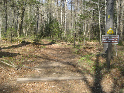
Hale Brook Trail trailhead
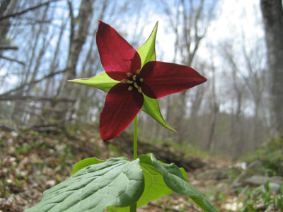
A purple trillium along Hale Brook Trail

Looking at the Twins from the summit of Mt. Hale
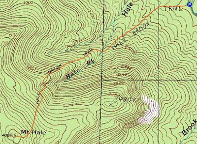

Directions to trailhead: Take US 302 west from Bartlett past Bretton Woods Ski Area. A few minutes after, take a left onto Zealand Road. Continue up this road (turns to dirt) to the Hale Brook trailhead/small WMNF fee parking area (right side of the road).
Back to Mt. Hale Profile
|