Home
States
Colorado
Connecticut
Maine
Massachusetts
New Hampshire
New York
Rhode Island
Utah
Vermont
View All
Lists
NE 4,000 Footers
NE 100 Highest
NH 4,000 Footers
NH 100 Highest
NH 52 With A View
NH Belknap Range
NH Ossipee 10
Links
Trail Conditions
Trip Log
Sunrises
Sunsets
About
|
Mt. Hale
Bethlehem, NH
Trailheads, measurements, times, distances, and maps are all approximate and relative to the hike(s) as shown below.

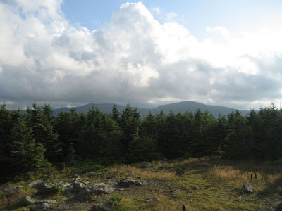
Looking up the Hale Brook Trail
Route: Hale Brook Trail
Halfway decent weather and a narrow window of time pulled me up to Mt. Hale for a quick hike. The Mt. Hale was in decent shape, though the rocks were wet due to the afternoon humidity. The water crossings and bugs were not an issue.
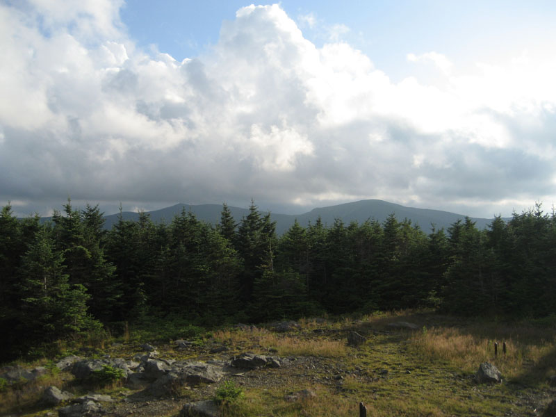
The views from the top, or what's left of them due to the encroaching treegrowth, were decent - the Twins and Willey Range were easily seen from the top of the cairn.
As the days get shorter once again, I was able to make it back to the trailhead just before sunset.
| Hike Ratings |
|
Getting To Trailhead: |
Easy |
| Destination: |
Mt. Hale |
|
Length: |
Moderate |
|
Steepness: |
Difficult |
|
Navigation: |
Easy |
|
Views: |
Moderate |
|
Crowds: |
Minimal |
|
| Hike Stats |
|
Date Hiked: |
Monday, August 10, 2009 |
| Hike Commenced: |
5:09 PM |
| Parking Elevation: |
1,770' |
| Destination: |
Mt. Hale |
| Ascent Commenced: |
5:09 PM |
| Summit Reached: |
6:14 PM |
| Time Elapsed: |
01:05 |
| Trailhead Elevation: |
1,770' |
| Summit Elevation: |
4,054' |
| Distance: |
2.3 miles |
| Vertical Gain: |
2,304' |
|
|
| Hike Ended: |
7:32 PM |
| Hike Time Elapsed: |
02:23 |
| Hike Distance: |
4.6 miles |
| Hike Vertical Gain: |
2,324' |
|
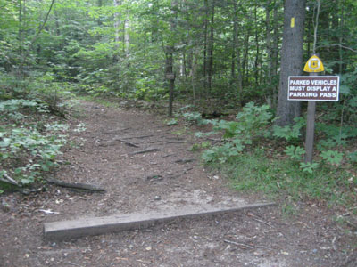
Hale Brook Trail trailhead

Wild flowers along Hale Brook Trail
Looking at the Twins from the summit of Mt. Hale
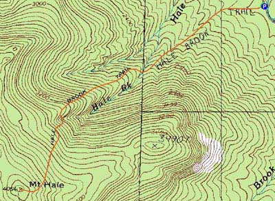

Directions to trailhead: Take US 302 west from Bartlett past Bretton Woods Ski Area. A few minutes after, take a left onto Zealand Road. Continue up this road (turns to dirt) to the Hale Brook trailhead/small WMNF fee parking area (right side of the road).
Back to Mt. Hale Profile
|