Home
States
Colorado
Connecticut
Maine
Massachusetts
New Hampshire
New York
Rhode Island
Utah
Vermont
View All
Lists
NE 4,000 Footers
NE 100 Highest
NH 4,000 Footers
NH 100 Highest
NH 52 With A View
NH Belknap Range
NH Ossipee 10
Links
Trail Conditions
Trip Log
Sunrises
Sunsets
About
|
Mt. Hale
Bethlehem, NH, Franconia, NH
Trailheads, measurements, times, distances, and maps are all approximate and relative to the hike(s) as shown below.
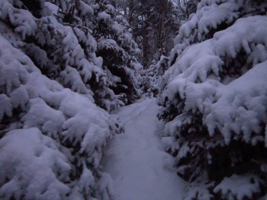
Looking up the upper Firewarden's Trail
Route: Herd path, Haystack Road, North Twin Trail, herd path, Firewarden's Trail, (Mt. Hale), Firewarden's Trail, herd path, North Twin Trail, Haystack Road, herd path
Afternoon/evening hike to Mt. Hale and back. Though there was 1-3" of new powder, the snowshoes never left the pack. The approach to the snowmobile bridge over the Little River had been washed out by Hurricane Irene, but was passable on foot.
| Hike Ratings |
|
Getting To Trailhead: |
Difficult |
| Destination: |
Mt. Hale |
|
Length: |
Moderate |
|
Steepness: |
Difficult |
|
Navigation: |
Difficult |
|
Views: |
Minimal (due to weather) |
|
Crowds: |
Minimal |
|
| Hike Stats |
|
Date Hiked: |
Friday, December 23, 2011 |
| Time to Trailhead: |
00:22 |
| Parking Elevation: |
1,620' |
| Destination: |
Mt. Hale |
| Time Elapsed: |
01:42 |
| Trailhead Elevation: |
1,800' |
| Summit Elevation: |
4,054' |
| Vertical Gain: |
2,324' |
|
|
| Hike Time Elapsed: |
03:43 |
| Hike Vertical Gain: |
2,604' |
|
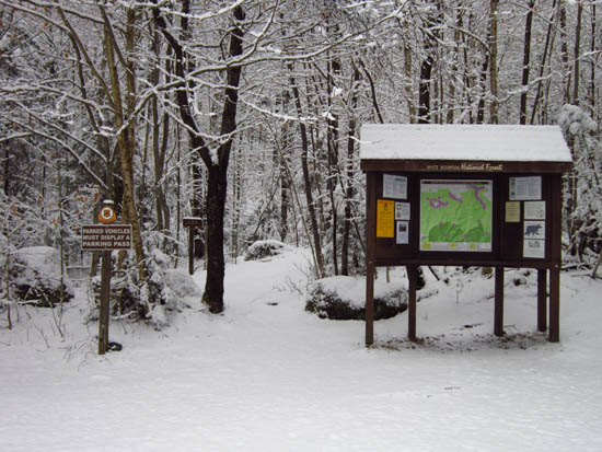
The North Twin Trail trailhead at the end of Haystack Road

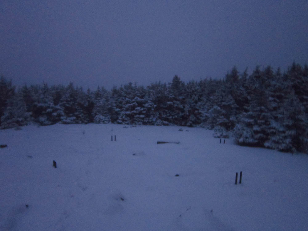
A lack of views from the Mt. Hale summit
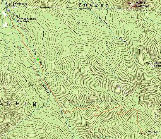

Directions to trailhead: In winter, from Route 302, take Route 3 South into Twin Mountain. Take a left onto Little River Road. As of winter 2009-2010, the end of the road had room for limited parking (no parking signs removed - 7 Dwarfs Motel offers alternative fee parking in winter), and the snowmobile bridge across the Little River had been rebuilt and reopened. After crossing this bridge, take an immediate sharp left turn onto a skier path, which then leads to Haystack Road, near the North Twin Trail trailhead.
Back to Mt. Hale Profile
|