Home
States
Colorado
Connecticut
Maine
Massachusetts
New Hampshire
New York
Rhode Island
Utah
Vermont
View All
Lists
NE 4,000 Footers
NE 100 Highest
NH 4,000 Footers
NH 100 Highest
NH 52 With A View
NH Belknap Range
NH Ossipee 10
Links
Trail Conditions
Trip Log
Sunrises
Sunsets
About
|
Mt. Hale, Mt. Hale (South Peak)
Bethlehem, NH, Franconia, NH
Trailheads, measurements, times, distances, and maps are all approximate and relative to the hike(s) as shown below.
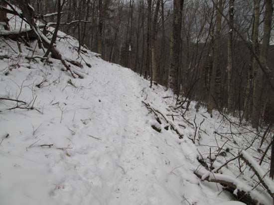
Looking up the Firewarden's Trail
Route: Herd path, Haystack Road, North Twin Trail, herd path, Firewarden's Trail, (Mt. Hale), Lend-A-Hand-Trail, bushwhack, (South Hale), bushwhack, herd path, North Twin Trail, Haystack Road, herd path
Very little snow in the lower elevations. The skier path (immediate left after crossing the snowmobile bridge) and North Twin Trail had minimal snow with some flat blue ice patches. Some wore Microspikes. I found it barebootable without much issue.
The Firewardens Trail is well packed out by boot traffic right now. A little bit of blue ice where the trail climbs above the birches. Snowpack suddenly increases to 6" adjacent to the false peak and saddle. Most wore Microspikes. I was able to bareboot it without much of an issue.
Lend-A-Hand Trail had some significant blue ice patches. Since we were descending, we could sort of pick and choose our way around them. If doing an out and back on this trail prior to more snowfall, some may be more comfortable with crampons.
We hopped off the trail at the marshy area in the saddle (frozen over). Snowpack was over a foot deep (mostly frozen granular with an inch or two of powder on top) on the ridge in places, while only a dusting in some wind exposed areas. We had generally good woods up to the South Hale cliffs (the ones you can see from Zealand Notch...only views of the day for us today, but very rewarding) and pretty good woods from there to the recognized summit.
We then backtracked to the small dip north of the summit, then tried to slab down the west side of the ridge. Initially we had mediocre at best woods with a lot of hidden rock crevaces. As we dropped down, there was also a lot of blue ice hidden under an inch or two of powder. Within a few hundred vertical of the summit, snowpack dropped to maybe 1-3 inches.
We eventually popped into birch glades, then slabbed down to the side of the Little River, working our way across a steep embankment until we hit the abandoned Little River Trail (old railgrade), which provided pretty smooth sailing back to the North Twin Trail.
Most were happy with Microspikes. I barebooted the whole thing and with careful footwork in a few descent areas, was okay. If we get more snow Sunday night, I'd be bringing snowshoes if I were to return.
| Hike Ratings |
|
Getting To Trailhead: |
Difficult |
| Destination: |
Mt. Hale |
|
Length: |
Moderate |
|
Steepness: |
Difficult |
|
Navigation: |
Moderate |
|
Views: |
Minimal (due to weather) |
|
Crowds: |
Minimal |
| Destination: |
South Hale |
|
Length: |
Difficult |
|
Steepness: |
Difficult |
|
Navigation: |
Difficult |
|
Views: |
Minimal |
|
Crowds: |
Minimal |
|
| Hike Stats |
|
Date Hiked: |
Saturday, December 28, 2013 |
| Time to Trailhead: |
00:22 |
| Parking Elevation: |
1,620' |
| Destination: |
Mt. Hale |
| Time Elapsed: |
02:06 |
| Trailhead Elevation: |
1,800' |
| Summit Elevation: |
4,054' |
| Vertical Gain: |
2,324' |
| Destination: |
South Hale |
| Time Elapsed: |
01:41 |
| Trailhead Elevation: |
4,054' |
| Summit Elevation: |
3,700' |
| Vertical Gain: |
350' |
|
|
| Hike Time Elapsed: |
07:37 |
| Hike Vertical Gain: |
3,004' |
|
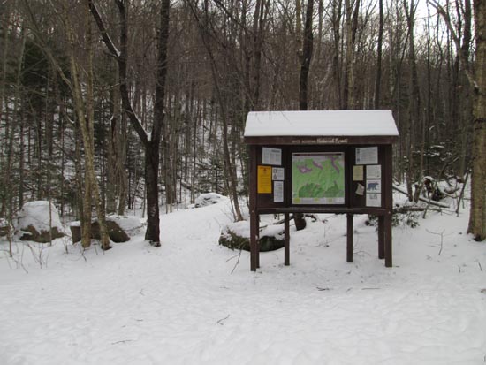
The North Twin Trail trailhead at the end of Haystack Road
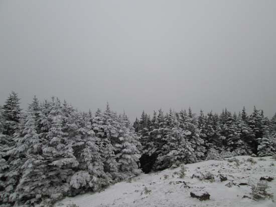
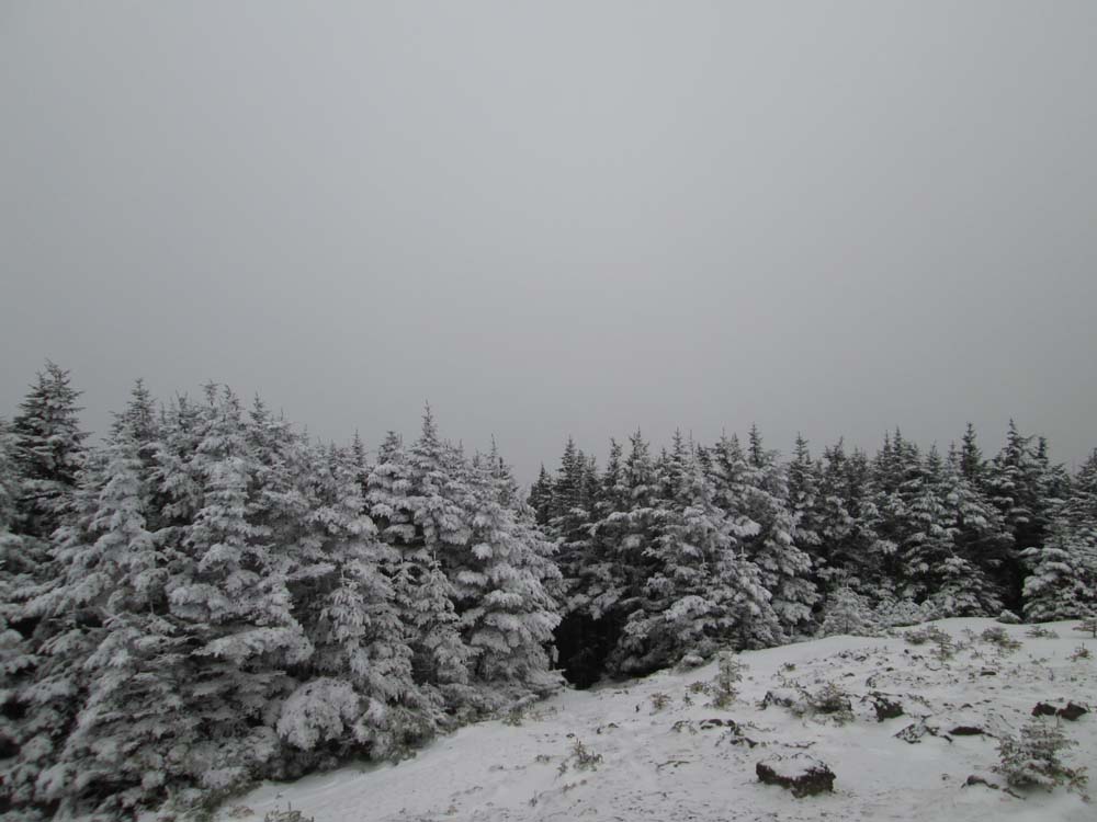
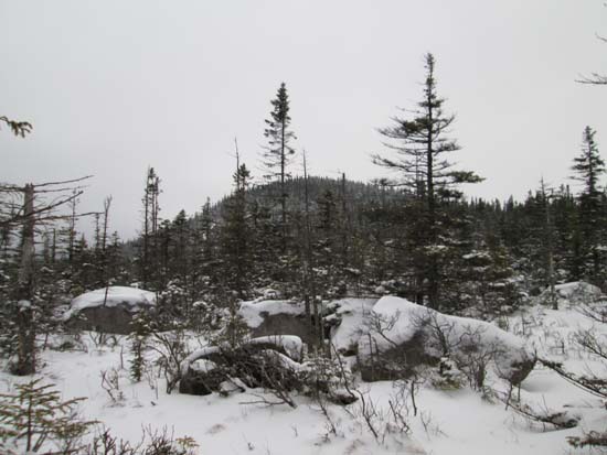
A lack of views from the Mt. Hale summit
Bushwhacking toward South Hale
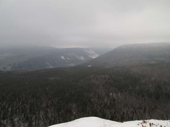
Looking at Zealand Notch from the South Hale cliffs
The abandoned Little River Trail
Directions to trailhead: In winter, from Route 302, take Route 3 South into Twin Mountain. Take a left onto Little River Road. As of winter 2012-2013, the end of the road had room for limited parking (no parking signs removed - 7 Dwarfs Motel offers alternative fee parking in winter), and the snowmobile bridge across the Little River had been rebuilt and reopened. After crossing this bridge, take an immediate sharp left turn onto a skier path, which then leads to Haystack Road, near the North Twin Trail trailhead.
Back to Mt. Hale Profile
Back to Mt. Hale (South Peak) Profile
|