Home
States
Colorado
Connecticut
Maine
Massachusetts
New Hampshire
New York
Rhode Island
Utah
Vermont
View All
Lists
NE 4,000 Footers
NE 100 Highest
NH 4,000 Footers
NH 100 Highest
NH 52 With A View
NH Belknap Range
NH Ossipee 10
Links
Trail Conditions
Trip Log
Sunrises
Sunsets
About
|
Mt. Hope
Harts Location, NH, Hadleys Purchase
Trailheads, measurements, times, distances, and maps are all approximate and relative to the hike(s) as shown below.
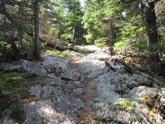
The path to Mt. Hope
Route: Davis Path, bushwhack, herd path
Short section of the Davis Path was dry and in good shape.
On the ascent, we didn't find the start of the old bootleg trail, so we bushwhacked along a contour and eventually found it. We were able to follow it back down to the Davis Path. It branches off after the wilderness boundary, soon after the first rock waterbar above the big gully brook crossing (dry at the moment). Soon after that waterbar, what looks to be an old logging road climbs steeply up to the right, which leads to the old bootleg trail.
The old trail has some old blazes of various colors (grey, yellow, green) and can be followed with care. If expecting to follow a maintained trail without navigational skills, it would be very easy to lose. If expecting to bushwhack, it's a pleasant surprise. Except for the yellow jackets nest I stepped on at perhaps 1,500 feet in elevation, which resulted in a bunch of stings. Ouch.
Once up on the ridge, the trail heads toward Mt. Hope. We didn't find any signs or canisters. The highpoint appeared to be adjacent to the view ledge (views of Carrigan, Willey/some of the Presidentials). There were a few bumps south of this, but they appeared to be 10 or more vertical feet lower by eye. The old trail appears to perhaps head further down the ridge from the ledge (not much sign of use), but we didn't investigate.
| Hike Ratings |
|
Getting To Trailhead: |
Easy |
| Destination: |
Mt. Hope |
|
Length: |
Moderate |
|
Steepness: |
Difficult |
|
Navigation: |
Difficult |
|
Views: |
Excellent |
|
Crowds: |
Minimal |
|
| Hike Stats |
|
Date Hiked: |
Sunday, August 10, 2014 |
| Parking Elevation: |
995' |
| Destination: |
Mt. Hope |
| Time Elapsed: |
01:25 |
| Trailhead Elevation: |
995' |
| Summit Elevation: |
2,505' |
| Vertical Gain: |
1,550' |
|
|
| Hike Time Elapsed: |
03:01 |
| Hike Vertical Gain: |
1,600' |
|
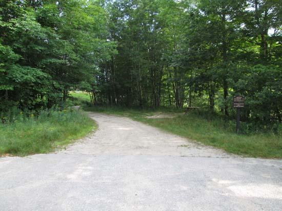
The Davis Path trailhead
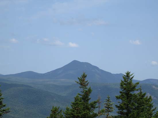
Mt. Willey as seen from near the summit of Mt. Hope
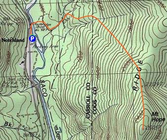

Directions to trailhead: Take Route 302 West from Bartlett. The Davis Path parking lot and trailhead will be on the right.
Back to Mt. Hope Profile
|

