Home
States
Colorado
Connecticut
Maine
Massachusetts
New Hampshire
New York
Rhode Island
Utah
Vermont
View All
Lists
NE 4,000 Footers
NE 100 Highest
NH 4,000 Footers
NH 100 Highest
NH 52 With A View
NH Belknap Range
NH Ossipee 10
Links
Trail Conditions
Trip Log
Sunrises
Sunsets
About
|
Mt. Isolation
Jackson, NH, Sargents Purchase, NH, Cutts Grant, NH
Trailheads, measurements, times, distances, and maps are all approximate and relative to the hike(s) as shown below.
The Davis Path
Route: Rocky Branch Trail, (Engine Hill bushwhack), Isolation Trail, Davis Path, Isolation Spur, (Mt. Isolation), Isolation Spur, Davis Path, Isolation Trail, (Engine Hill bushwhack), Rocky Branch Trail
With minimal snow on the ground, it seemed like a good day to head up to Isolation. Starting before sunset but without my headlamp on, I was quickly slowed by numerous branches and trees down on the trail from the prior week's storm. I reached patchy snow at around 2,000 feet and eventually ducked off the Rocky Branch Trail after the height of land.
Heading through the 'Engine Hill bushwhack,' I awoke a bull moose, who quickly sprinted off. Awhile later, I encountered a second bull - this one without a rack. He kindly posed as I took some photos.
I dropped onto the Isolation trail at the third water crossing - and subsequently bushwhacked to the fourth crossing, prior to actually crossing the Rocky Branch at crossing number five.
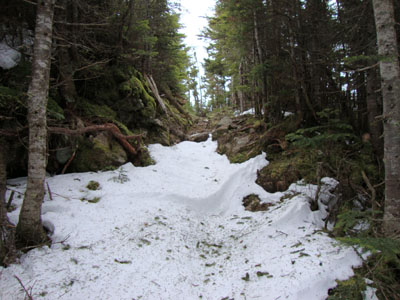
From there, the Isolation Trail was essentially a brook. There were some particularly bad blowdown patches in a few areas, which promise to be a pain once there's more snow on the ground.
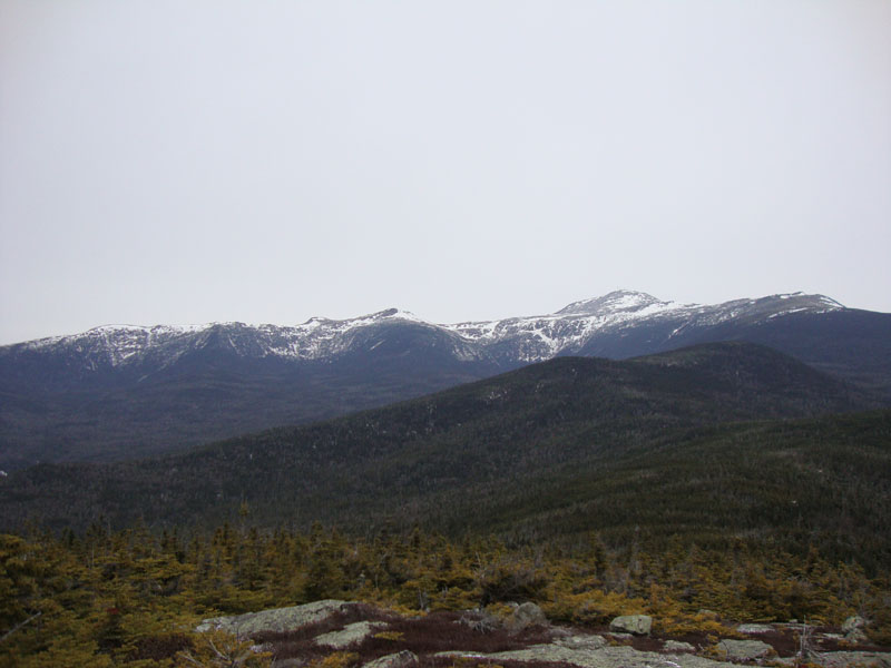
Reaching the Davis Path, I put on my snowshoes, though I could have just as easily barebooted. Taking them off at the spur junction, I reached the summit and had decent views, despite the high overcast. The temperatures and winds were also quite mild - I was comfortable in just a long sleeve shirt.
Back on the Davis Path, I was able to cut up all of the blowdowns encountered. I also removed some on the Isolation Trail, however some particularly nasty ones were out of the question. For the return bushwhack, I roughly followed my route, and soon emerged on the battered Rocky Branch Trail, where I cleaned up a few more blowdowns (in addition to the ones I removed in the morning). For the last few miles, the next storm moved in, resulting in increasing snow flurries.
| Hike Ratings |
|
Getting To Trailhead: |
Easy |
| Destination: |
Mt. Isolation |
|
Length: |
Difficult |
|
Steepness: |
Difficult |
|
Navigation: |
Difficult |
|
Views: |
Excellent |
|
Crowds: |
Minimal |
|
| Hike Stats |
|
Date Hiked: |
Saturday, December 5, 2009 |
| Hike Commenced: |
6:23 AM |
| Parking Elevation: |
1,260' |
| Destination: |
Mt. Isolation |
| Ascent Commenced: |
6:23 AM |
| Summit Reached: |
10:03 AM |
| Time Elapsed: |
03:40 |
| Trailhead Elevation: |
1,260' |
| Summit Elevation: |
4,004' |
| Vertical Gain: |
3,039' |
|
|
| Hike Ended: |
2:37 PM |
| Hike Time Elapsed: |
08:14 |
| Hike Vertical Gain: |
3,334' |
|
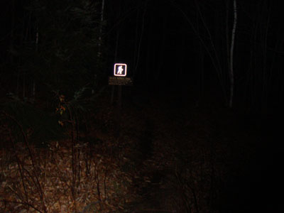
The Rocky Branch Trail trailhead
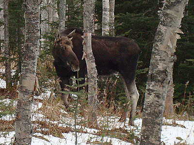
You never know who is watching you!
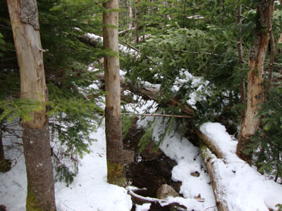
Nasty blowdown patches on the Isolation Trail
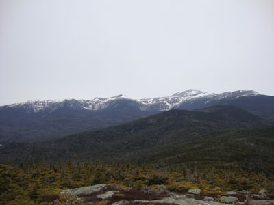
Looking at Mt. Monroe, Mt. Washington, and Boott Spur from Mt. Isolation

Directions to trailhead: Take Route 16 North from the Route 302-16 junction in Glen. A few minutes having passing Jackson and just before 16 starts to climb to Pinkham Notch, the Rocky Branch parking lot will be on the left. The Rocky Branch Trail trailhead is at the north side of the parking lot.
Back to Mt. Isolation Profile
|