Home
States
Colorado
Connecticut
Maine
Massachusetts
New Hampshire
New York
Rhode Island
Utah
Vermont
View All
Lists
NE 4,000 Footers
NE 100 Highest
NH 4,000 Footers
NH 100 Highest
NH 52 With A View
NH Belknap Range
NH Ossipee 10
Links
Trail Conditions
Trip Log
Sunrises
Sunsets
About
|
Mt. Isolation
Jackson, NH, Sargents Purchase, NH, Cutts Grant, NH
Trailheads, measurements, times, distances, and maps are all approximate and relative to the hike(s) as shown below.
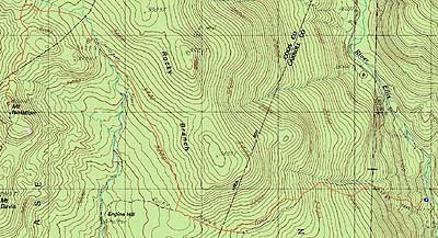
The birch glades around the Engine Hill bushwhack
Route: Rocky Branch Trail, (Engine Hill bushwhack), Isolation Trail, (bushwhack), Davis Path, Isolation Spur, (Mt. Isolation), Isolation Spur, Davis Path, (bushwhack), Isolation Trail, (Engine Hill bushwhack), Rocky Branch Trail
With very warm air moving in, we opted to try and get to Mt. Isolation before the Rocky Branch started to flow to rapidly. Starting at the trailhead, we barebooted up the bare first portion of the Rocky Branch Trail, before switching to snowshoes at the upper ski trail junction.
While there was no snow down low, there was still three feet or more upon reaching the height of land. Following old snow monorail through the first part of the Engine Hill bushwhack, we opted to take our own route for the second half, cutting off some of the Isolation Trail. After bushwhacking around what are normally the third and forth water crossings, we were able to make our way over the fifth water crossing with some careful leaps over the rushing current.
From there, we worked our way up the Isolation Trail, and then a bushwhack, to the Davis Path. Temperatures now balmy, we soon reached Isolation, where we had tremendous views in nearly all directions, thanks to the snowpack. While it was tempting to just lounge for hours in the nice weather, we left after a forty minute lunch break, as we were concerned about getting back over the rising water crossing. This fortunately was still doable, and we eventually made our way back down the Rocky Branch Trail - the snow-free line had risen about one hundred vertical feet in just a few hours!
| Hike Ratings |
|
Getting To Trailhead: |
Easy |
| Destination: |
Mt. Isolation |
|
Length: |
Difficult |
|
Steepness: |
Difficult |
|
Navigation: |
Difficult |
|
Views: |
Excellent |
|
Crowds: |
Minimal |
|
| Hike Stats |
|
Date Hiked: |
Friday, April 2, 2010 |
| Hike Commenced: |
7:13 AM |
| Parking Elevation: |
1,260' |
| Destination: |
Mt. Isolation |
| Ascent Commenced: |
7:13 AM |
| Summit Reached: |
10:58 AM |
| Time Elapsed: |
03:45 |
| Trailhead Elevation: |
1,260' |
| Summit Elevation: |
4,004' |
| Vertical Gain: |
3,034' |
|
|
| Hike Ended: |
2:54 PM |
| Hike Time Elapsed: |
07:41 |
| Hike Vertical Gain: |
3,324' |
|
The Rocky Branch Trail trailhead
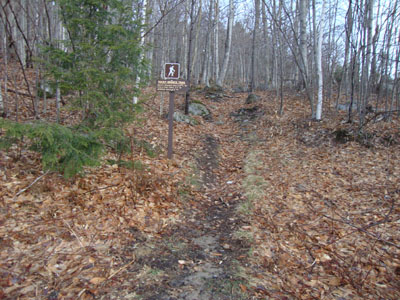
Looking down the Davis Path
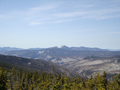
Looking at Mt. Carrigain from Mt. Isolation

Directions to trailhead: Take Route 16 North from the Route 302-16 junction in Glen. A few minutes having passing Jackson and just before 16 starts to climb to Pinkham Notch, the Rocky Branch parking lot will be on the left. The Rocky Branch Trail trailhead is at the north side of the parking lot.
Back to Mt. Isolation Profile
|