Home
States
Colorado
Connecticut
Maine
Massachusetts
New Hampshire
New York
Rhode Island
Utah
Vermont
View All
Lists
NE 4,000 Footers
NE 100 Highest
NH 4,000 Footers
NH 100 Highest
NH 52 With A View
NH Belknap Range
NH Ossipee 10
Links
Trail Conditions
Trip Log
Sunrises
Sunsets
About
|
Mt. Isolation
Jackson, NH, Sargents Purchase, NH, Cutts Grant, NH
Trailheads, measurements, times, distances, and maps are all approximate and relative to the hike(s) as shown below.
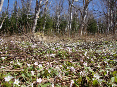
The flower covered birch glades
Route: Rocky Branch Trail, (Engine Hill bushwhack), Isolation Trail, Davis Path, Isolation Spur, (Mt. Isolation), Isolation Spur, Davis Path, Isolation Trail, (Engine Hill bushwhack), Rocky Branch Trail
With snow melting and water crossings dropping a bit, we decided it would be a decent time to attempt Mt. Isolation.
The Rocky Branch Trail to the height of land was snow free, though a but mucky for the last mile or so. Bushwhacking through the birch glades, we found things to be a bit soggy around 3,200 feet, so we climbed up to around 3,400 feet, reaching the Isolation Trail just before the top water crossing.
After making out way across the tricky crossing about 20 feet downstream, the Isolation Trail alternated between snow and running water. The Davis Path alternated between snow and bare ground, but was generally snow.
Reaching the windy summit of Mt. Isolation, we had strong views with very few clouds in the sky. Though a bit chilly, we opted to hang out for quite some time, before finally heading back. While we didn't use snowshoes on the way up, we almost put them on for the first part of the descent, as the snow was softening up (and still multiple feet deep). Nonetheless, it remained just firm enough to boot, perhaps thanks to the wind.
| Hike Ratings |
|
Getting To Trailhead: |
Easy |
| Destination: |
Mt. Isolation |
|
Length: |
Difficult |
|
Steepness: |
Difficult |
|
Navigation: |
Difficult |
|
Views: |
Excellent |
|
Crowds: |
Minimal |
|
| Hike Stats |
|
Date Hiked: |
Sunday, May 16, 2010 |
| Hike Commenced: |
8:19 AM |
| Parking Elevation: |
1,260' |
| Destination: |
Mt. Isolation |
| Ascent Commenced: |
8:19 AM |
| Summit Reached: |
12:58 PM |
| Time Elapsed: |
04:30 |
| Trailhead Elevation: |
1,260' |
| Summit Elevation: |
4,004' |
| Vertical Gain: |
3,039' |
|
|
| Hike Ended: |
6:00 PM |
| Hike Time Elapsed: |
09:41 |
| Hike Vertical Gain: |
3,334' |
|
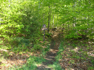
The Rocky Branch Trail trailhead
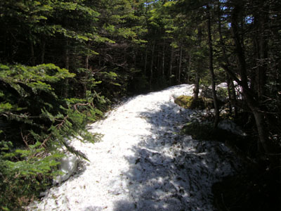
The Davis Path
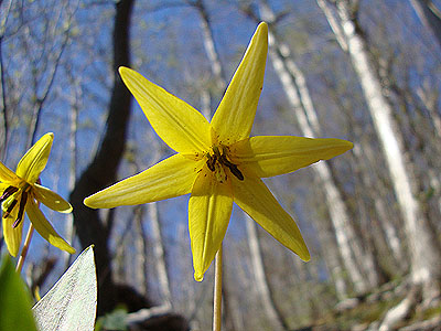
Trout lilly on the Rocky Branch Trail
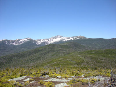
Looking at Mt. Washington from Mt. Isolation

Directions to trailhead: Take Route 16 North from the Route 302-16 junction in Glen. A few minutes having passing Jackson and just before 16 starts to climb to Pinkham Notch, the Rocky Branch parking lot will be on the left. The Rocky Branch Trail trailhead is at the north side of the parking lot.
Back to Mt. Isolation Profile
|