Home
States
Colorado
Connecticut
Maine
Massachusetts
New Hampshire
New York
Rhode Island
Utah
Vermont
View All
Lists
NE 4,000 Footers
NE 100 Highest
NH 4,000 Footers
NH 100 Highest
NH 52 With A View
NH Belknap Range
NH Ossipee 10
Links
Trail Conditions
Trip Log
Sunrises
Sunsets
About
|
Mt. Israel
Sandwich, NH
Trailheads, measurements, times, distances, and maps are all approximate and relative to the hike(s) as shown below.
Looking up the Wentworth Trail
Route: Wentworth Trail
Finally, it was time to hike Mt. Israel. I had intended to hike this back in April, but then winter decided to happen a bit late.
I almost was tricked by a sign on the road near the trailhead, claiming it was closed due to mud per order of selectmen. I didn't see any mud or selectmen, so after some consideration, I decided to proceed and quickly found the trailhead (and no mud).
The Wentworth Trail started off somewhat flat, before picking up a bit. This was not to be, however, as it quickly started traversing the mountain toward a brook, before finally starting a steeper ascent.
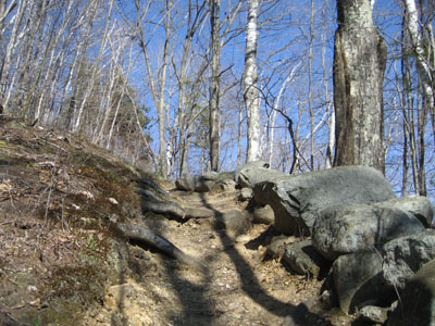
The trail started taking some turns as it climbed, making things a bit more interested as it climbed around a few rocks and small cliffs. Not too long after, I was at the top of the ridge and at the first false summit (nice ledge views of the Sandwich Dome). After a moment, I recalled the map and realized I was not there yet. I continued following the trail to a second false summit (the one I had expected), with views to the southeast. Shortly thereafter, I met the Mead Trail, and then finally the real summit, marked with a cairn.
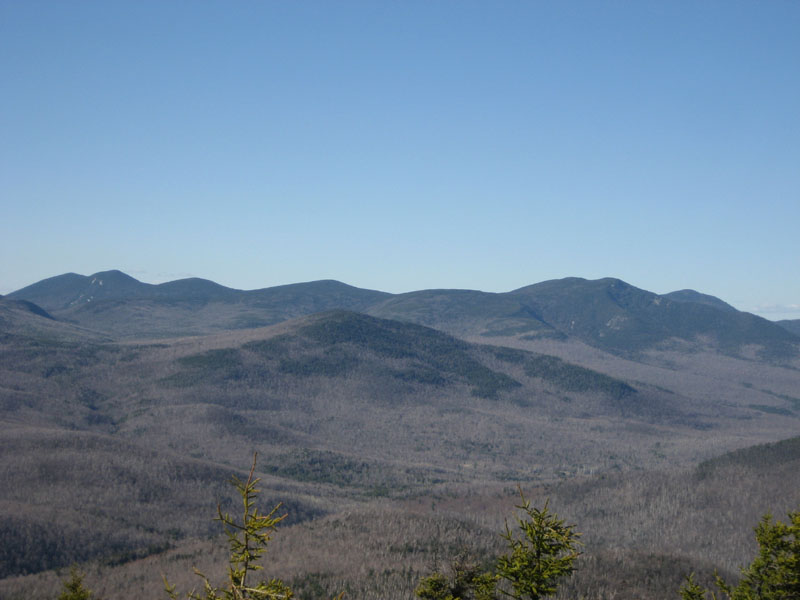
For a sub-3,000' mountain, the summit is a treat, as it offers views in some directions that show no signs of life. Overall, the views ranged from west south west to just about due east.
The trail itself was dry until reaching the ridge, at which point it alternated from being dry to being muddy to being icy to being snowy. Nothing tricky, though.
I took my time on the descent, clearing some blowdowns (four gone, one remaining).
| Hike Ratings |
|
Getting To Trailhead: |
Easy |
| Destination: |
Mt. Israel |
|
Length: |
Moderate |
|
Steepness: |
Moderate |
|
Navigation: |
Easy |
|
Views: |
Excellent |
|
Crowds: |
Minimal |
|
| Hike Stats |
|
Date Hiked: |
Friday, May 4, 2007 |
| Hike Commenced: |
4:08 PM |
| Parking Elevation: |
940' |
| Destination: |
Mt. Israel |
| Ascent Commenced: |
4:10 PM |
| Summit Reached: |
5:06 PM |
| Time Elapsed: |
00:54 |
| Trailhead Elevation: |
950' |
| Summit Elevation: |
2,630' |
| Distance: |
2.1 miles |
| Vertical Gain: |
1,780' |
|
|
| Hike Ended: |
6:26 PM |
| Hike Time Elapsed: |
02:18 |
| Hike Distance: |
4.2 miles |
| Hike Vertical Gain: |
1,890' |
|
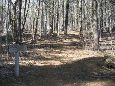
Wentworth Trail trailhead at the Mead Base Camp

Looking north-northeast at Mt. Tripyramid, Flat Mountain, and Mt. Whiteface from the Mt. Israel summit
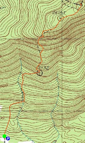

Directions to trailhead: Take Route 109 into Center Sandwich. Route 113 will enter on your right and bear left shortly thereafter. Go straight onto Grove Street instead, bear left onto Diamond Ledge Road. Parking at the Mead Camp.
Back to Mt. Israel Profile
|